I’ve left the rest of the family sleeping whilst I’ve hot up early to indulge my joint passions of walking and exploring. Next to where we’re staying is a remnant of the old Midland and Great Northern Railway (M&GNR) which closed to passenger in March 1959 and completely on the 1st January 1966. This section has been converted into a footpath known as the ‘Weaver’s Way’ so I’m off to explore.
I’ll post pictures and updates later…
10:00.
I’m now taking a break at North Walsham station after a beautiful walk. This is a fantastic time of year for rambling as the hedgerows are bursting with summer fruits. As I was starting from the middle of nowhere the initial part of the route was deathly quiet. I passed a couple of cyclists and thatcwas about it. The old line’s heavily overgrown in parts but still easily navigable. It makes a superb wildlife cortidor. There’s a mixture of cuttings and embankments so the line has a variety of structures (over and underbridges) plus the remains of the single platform station (complete with old building) at Framlingham. Here’s some initial pictures
Summer bounty…The road bridge near Pine Tree farm where I first accessed the old line.Mature trees have grown up along the line since it closed 66 years ago.The well preserved platform at the old Framlingham station, looking East towards North Walsham.Platform and former station building at Framlingham.
11:00.
I decided to flag the next train from North Walsham in order to look around and get some pictures. I must admit, it’s not the most exciting place and a bit of a disappointment. It’s run down compared to the other market towns we’ve visited. Still, it gave me chance of a break.
One of Greater Anglia’s excellent Stadler built 4-car bi-mode trains working to Cromer and Sheringham.
Right now I’m waiting for the return working of this unit which I’ll catch as far as Hoveton and Wroxton on the edge of the Norfolk broads where I’ll meet up with everyone else.
11:50.
Train time!
22:00.
The end of the day. There’s so much more I could write about our travels as we went on to explore the Norfolk broads but I’m meant to be on holiday! Instead, I’ll leave you with a final picture from Hoveton and Wroxham on the Bure Valley Railway as one of their services arrives at the end of the line – just as a freight train heading for North Walsham passes on the main line. If only one had been earlier and the other later…
I’ve a small favour to ask… If you enjoy reading this or any of the other blogs I’ve written, please click on an advert or two. You don’t have to buy anything you don’t want to of course – although if you did find something that tickled your fancy that would be fab! – but the revenue from them helps me to cover some of the cost of maintaining this site (which isn’t cheap and comes out of my own pocket). Remember, 99% of the pictures used in my blogs can be purchased as prints from my other website – https://paulbigland.zenfolio.com/
The pair of us are having a local but active day here at Bigland Towers. Dawn’s been busy baking, experimenting with some cake and cookie recipies whilst I’ve been occupied in the office. I had a phone call on Friday afternoon that’s completely changed my plans for next week as it involves some commissions and COP26 so trips to Scotland beckon. Meanwhile, I’ve some articles to pen before I do, which means the week ahead’s going to be hectic.
As if that wasn’t enough, I’ve been trying to keep up the momentum on scanning old slides, which leads to today’s little picture story.
The latest batch of slides were taken in 1994 when I was working as a Housing Officer in Bow, East London. Having left my previous housing job in nearby Poplar (where I lived) to spend a year travelling solo in SE Asia I applied for a job with Bow neighbourhood, was accepted and offered a position as Housing Officer on the Lefevre Estate. The name sounded far better than the reality. The Estate consisted of a series of brutalist 1970s deck access maisonettes linked together by walkways. Our office, located on the estate, wasn’t much better. Even so, I really enjoyed working there. When I accepted the job I’d been told that the estate was due to be transferred to a new Government quango called a Housing Action Trust (HAT), one of only 5 in the country. This would manage the complete redevelopment of the estate and 2 others adjacent. I had the option of staying with the council and being transferred to another housing job on another estate or being TUPE’d across to the HAT when it was established. Being adventurous and liking what the embryonic HAT Management team told me about what to expect and the opportunities to broaden my skills that would be on offer, I decided to sign up.
This meant that I stayed on the HAT estates for the rest of my housing career. A decision I never regretted although I’d no idea at that time what my future career looked like. I could write a book about those times, but that’s not the purpose of this blog. Instead, I’m going to talk about something else – one of the railways of that part of the East End and the changing face of London.
Our office on Lefevre Walk backed onto what had been a scrapyard, but before that it had been a railway. The North London Railway. It had been a Southerly branch from what’s still the North London Line (now the Overground) running through Old Ford, Poplar and Bow down to the London docks. I moved to East London in 1986 so never knew this line when it was open as it had closed a couple of years before. In those last days it had been a freight only line although I could still see the remains of some of the old stations like Bow Rd which had all closed in 1944 due to enemy action.
Sadly, I never researched the route by getting any books on the NLR. Nowadays it’s so easy just to look stuff up on the internet, but not in 1994. So, whilst I knew that the old scrapyard outside my office window (known as Yallop’s Yard) had been an old railway goods yard I never knew at the time there’d been an old railway station on part of the site. In some ways that’s not too surprising. The area looked completely different as in the 1970s an urban motorway (the A102M) had cut a swathe through the old factories and homes in the Lea Valley. Here’s some of the pictures I took in 1994, then I’ll link to something that shows you how it used to look even earlier. To say you wouldn’t recognise it now is an understatement. I don’t recognise the 1950s photos. Today, if you visited the area, you wouldn’t recognise it from my 1994 pictures either!
The Lefevre walk estate in April 1994 with my old office in the centre. The old railway yard is behind with the A102M beyond. After that is the canal with the London Borough of Newham beyond. When the estate was built no-one even tried to give the blocks pretty names, they just had letters. So some people lived in H Block. Nice! Sadly, time has dimmed the memory, so I can’t remember which blocks you can see here. Everything you see is gone now – apart from the urban motorway! The area to the right beyond looks very different now – that’s because it became the 2012 Olympic park. Who would have thought back then…Looking South from the corner of the block you can see in the previous picture. My old office is in the bottom right and the route of the North London Railway and Old Ford goods yard can be seen to the left. The Tower blocks beyond are in Poplar and were built on old NLR railway land. The edifice in the middle is the old Bryant and May match works which was then being converted into apartments. Just behind it is the Great Eastern Main Line with Stratford to your left. The match factory has an important part in social history due to the match girls strike. The goods yard and the route of the NLR are now buried under new homes. The road you see going off into the horizon to the right of the match works is Fairfield Rd. It used to take me 15 minutes to walk to work along it. Happy days!
Here’s a zoom shot showing the course of the North London Railway heading South. The first bridge is where the Great Eastern main line crosses. The second is the link from the GEML at Bow junction to the former London Tilbury and Southend line to Fenchurch St at Gas Factory Junction. The NLR route had been converted into a linear park several years previously (at considerable expense) but was now being taken for housing as London’s population – which had been shrinking since World War 2 was suddenly expanding again. See the red roofed building below the tower blocks? If you look to the right you can just make out the platforms of Bow Rd DLR station.
Here’s a view of the Old Ford Goods yard and station site taken in October 1994 when the contaminated soil had been removed – hence the lakes! The former railway station was situated on the extreme right of the picture with the lines running along the base of the concrete wall. Behind is the wall of maisonettes that made up part of the Lefevre Walk estate. This next shot was taken in September 1994 from the top floor of one of the blocks you see above. A footbridge has replaced the original old Ford Road. The hoarding underneath it is the site of Old Ford Station. The remains of the North London Line trackbed can be seen as the green strip along the edge of the A102M.
Nowadays, with the advent of the internet, it’s easy to research images of what they area used to look like. The excellent ‘Disused stations’ website has the history of the railway and also some old pictures of the station and area. Even I was surprised by how the place used to look! Here’s a link to a look at a long-vanished part of London’s East End.
I’ve a favour to ask… If you enjoy reading this blog, please click on an advert or two. You don’t have to buy anything you don’t want to of course (although if you did find something that tickled your fancy that would be fab!), but the revenue from them helps to cover some of the cost of maintaining this site – and right now (because of Covid), us freelances appreciate all the help that we can get to aid us in bouncing back from lockdowns. Remember, 99% of the pictures used in my blogs can be purchased as prints from my other website – https://paulbigland.zenfolio.com/
I’m having another rare day at home catching up on chores and a spot of picture editing, mostly of images that don’t fit the main gallery categories on my website and need a bit of research first. Some of these were taken earlier in the week around Mirfield in West Yorkshire. Like many people involved in railways I have a curiosity about the many lines that closed during my childhood or even before I was born. Yorkshire’s rich in such lines and Mirfield has quite a few remains. One I spotted was what’s left of the Spen valley line which lasted a little over 50 years, opening in 1900 and closing in November 1966 although it lost its passenger services as early as 1953. Built by the LNWR it ran from Heaton Lodge Junction through Heckmondwike and Cleckheaton to Farnley Junction and on into Leeds City station. You can find out more about it on this very good website, ‘Mirfield memories’. Here’s what I found.
The site of Battyeford station which was built straddling the Huddersfield Rd. This is the North side. The view looking in the opposite direction to the first picture. Part of the viaduct remains as many of the arches are occupied by commercial premises. The opposite end of the viaduct where the railway crossed the River Calder on a steel bridge. Behind me is the line from Huddersfield to Dewsbury which is still operational. The Spen valley line came off to the left just on front of this Class 185 which is approaching Heaton Lodge Junction.
If you’re interested in abandoned or disused railways there’s a gallery dedicated to them on my Zenfolio website. You can find it by following this link.
I’d love to have more time to spend to explore West Yorkshire’s railway heritage, but there’s little time for that as most of my time’s taken up with the modern, growing railway rather than the remains of a contracting one. That said, Dawn and I are hoping to get out on the bikes to explore several that are close to us which have been converted into some excellent cycle-paths. I first got to know about several of them when I explored them by bike for an article in RAIL magazine. One of their writers and I were given a guided tour on Brompton bikes by a couple of Sustrans officers and I’ve always meant to revisit the places and infrastructure we saw. Some of the viaducts, tunnels and cuttings were really impressive, especially around Heckmondwike, Dewsbury and Queensbury. But as the year is rapidly moving on, that may have to wait until next year!
Today’s been very much governed by the rain which has put the mockers on a lot of things, including any walking and also the change to get any decent scenic pictures of what’s a beautiful bit of Ireland. To be honest, the day started slowly anyway as poor Dawn went down with a migraine yesterday evening, which left her feeling woozy, so she had an early night and a late morning start. At first, the weather looked promising, so we stuck to our plan of driving over to pretty Kinsale on the River Brandon. But then we pushed our luck and ventured further West. Our first stop was at Courtmacsherry which is an attractive little village that’s spread out along a single long street on the southern shore of Courtmacsherry Bay. We stopped for coffee and cake (a rare holiday treat) at the Travara Lodge, a B&B with a lovely café on the ground floor and a garden on the banks of the Bay. You have to admit, the cakes do look tempting and the Pecan pie was gorgeous.
Like many places in Ireland, Courtmacsherry once had a railway station. The Timoleague and Courtmacsherry Railway finally closed in 1960 after many years when it was only used for summer excursions and freight. Part of it remains as a footpath which is marked by an old semaphore signal arm on a makeshift post.
Looking towards Courtmacsherry
The old station building in Courtmacsherry survives as a residential property.
The village also contains a memorial to the sinking of the liner Lusitania which was torpedoed in May 1915 and sank in 20 minutes, with the loss of 1,198 lives. The ship went down not far off the coast from the village.
Taking a gamble and really sticking our necks out we ventured further West through Clonakilty and Skibereen as far as Baltimore, a village with a harbour that serves as the ferry terminal for boats to Cape Clear, Sherkin and Hare Islands, as well as trips around the famous Fastnet lighthouse. The area’s popular with boaters so the harbour’s busy with yachts and other small craft. In the right weather it must be an absolutely stunning bit of coastline. Today was not that day! As usual, we arrived the same time as the rain which cut visibility to a few hundred metres. We cut our losses by taking up refuge in the local pub which had been recommended by a friend. Bushe’s Bar overlooks the harbour and contains a vast array of nautical memorabilia including lifebelts from some of the ships wrecked in the area over the years. The place is popular with both locals and visitors and serves food as well as a good selection of drinks. It’s certainly worth a visit. On a sunny day the barrel tables outside are especially popular.
We hung around for a couple of drinks, hoping the weather would clear, but it wasn’t to be, so we gave up and headed back to Kinsale to eat at another recommendation, Fishy Fishy is (as the name suggests) a seafood restaurant just back from the River Bandon that specialises in locally caught fish. The menu isn’t huge, but what you get is delicious. I went for this, pan cooked Hake.
Suitably stuffed, we’re now lounging at our Airbnb before exploring Cork and Cobh tomorrow – and praying for better weather!
The weather here in Limerick has been (to use the local vernacular) ‘shoite’ It’s been chucking it down overnight and the forecast remains mixed for the rest of the day although the sun is breaking through to defy predictions. Undeterred, we’re embarking on a bit of a tour today, taking in some of the historical, cultural and railway sites as well as the scenery on a roundabout trip that will eventually see us end of in Cork where we’ll base ourselves for the next few nights. Keep popping in through the day and see what we get up to. For now, here’s a shot from Limerick showing the 13th century King John’s castle.
As you can see from the fullness of the river Shannon, there’s been plenty of rain recently!
11:10.
We left Limerick just as the heavens opened, treating us to a torrential rainstorm that’s left roads and pavements awash and us warm and dry in the car as we head for out first stop of the day: Foynes.
15:10.
The Gods have smiled upon us and the weather’s brightened up, making our visit to the Flying Boat museum in Foynes much more pleasurable. This is an excellent museum that documents when the River Shannon played a pivotal role as a base for the air-bridge across the Atlantic to America when flying boats dominated the trade before the war and subsequent advances in aviation technology killed it off in 1945. As well as a fascinating mixture of memorabilia there’s also the full size recreation of the fuselage and interior layout of the largest of the flying boats, the ‘American Clipper’. If you’re in the area I’d recommend a visit. The museum also hosts a section on the Irish-American film star Maureen O’ Hara (who was married to a pilot who flew flying boats in and out of Foynes during the war), the origins of Irish Coffee and also a look at the history of Foynes harbour. Here’s a few pictures from our visit.
Memento’s, trinkets and even the remains of a crashed flying boat in one of the museum galleries.
The replica of one of the luxurious Boeing B314 flying boats used by both American and British companies on the Atlantic crossings.
Interior of the B314 replica
The spacious flight deck of the B314 which could accommodate seven people.
Fold-out beds in the cabins of the B314.
16:00.
Moving on from Foynes to Listowel we visited another museum, but to a very different era and very different technology. This one was a dead end – the Lartigue monorail system that was used on the 10 mile long Listowel and Ballybunion railway between its opening in 1888 until its closure in 1924. The museum was opened in 2008 on the site of the former broad gauge railway adjacent to the original route of the L&B. It has a 500 metre demonstration track complete with the unique turntable switches used on the monorail, along with a replica of one of the engines and some carriages. The replica engine is actually a diesel hydraulic as building (and maintaining) a steam replica would be prohibitively expensive. In the former goods shed is a museum to the line which has some excellent quality old photographs of the line, plus a superb old newsreel which was filmed on the route back in 1916. The whole site is run by volunteers who give you a warm welcome and an informative tour. Here’s some of what we saw.
Yes, the headlamp really was that big!
One of the switches in action. They’re curved as that way they can connect with lines closer to each other than if the track on them was straight, but you can’t turn locomotives on them. That’s only done on straight turntables.
The museum inside the former board-gauge goods shed has some really excellent quality old pictures of the L&B as well as a selection of railway memorabilia.
22:13.
After leaving Listowel we essentially ran out of time to explore. Instead we drove down to Tralee for a late lunch, then headed on Down to Cork where we’ve booked 3 nights in a lovely Airbnb, which is where we’re relaxing now. Tomorrow we’re up early and heading out to explore the coast as the weather forecast’s looking promising, so expect another rolling blog.
Every so often, an article appears in ‘The Spectator’ where the sole intention is to knock HS2. Don’t be fooled into thinking the ‘speccie’ is somehow a magazine of independent mind. It’s the house journal and propaganda sheet for the far-right of the Tory party. It’s also famous for producing fiction masquerading as fact. It has a long history of getting it wrong on events around HS2. In fact, if you believed everything you ever read in the rag, HS2 should have been stillborn.
The latest mountain of rubbish comes from one Ross Clark, a man who’s clearly a stranger to knowing anything about the subject, or even bothering to do the slightest research on it. He’s come up with this nonsensical piece called “There is a far better option than HS2, and it already exists.
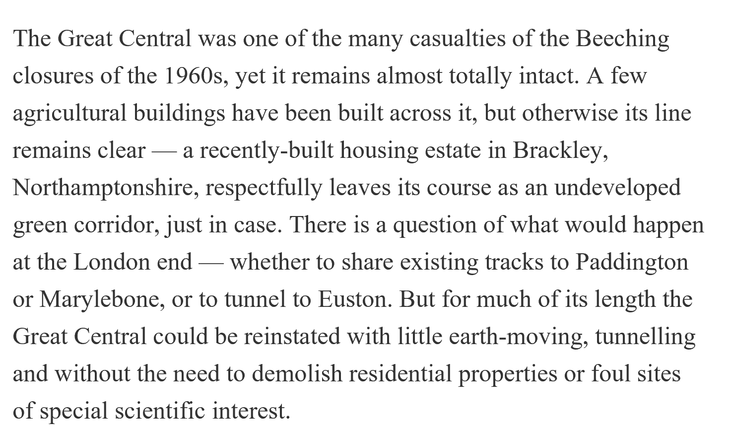
Yes, you’ve guessed it, he’s blathering on about re-opening the Great Central railway! For some reason, the Great Central is one of those totemic issues to people of a certain age, not all of them are railway enthusiasts, although many of them are. It’s symptomatic of England being stuck in the past rather than looking positively to the future, ‘cos for a ‘bright’ future, all we have to do is bring back the past, obviously! You can see this bonkers thinking in the whole Brexit shambles. Anyway, I digress. Let’s have a look at some of Clark’s claims.
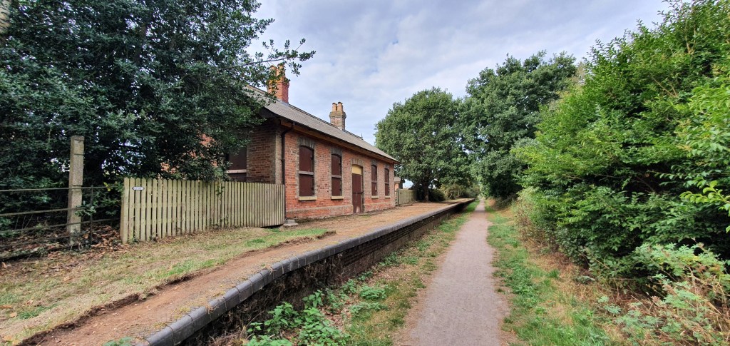
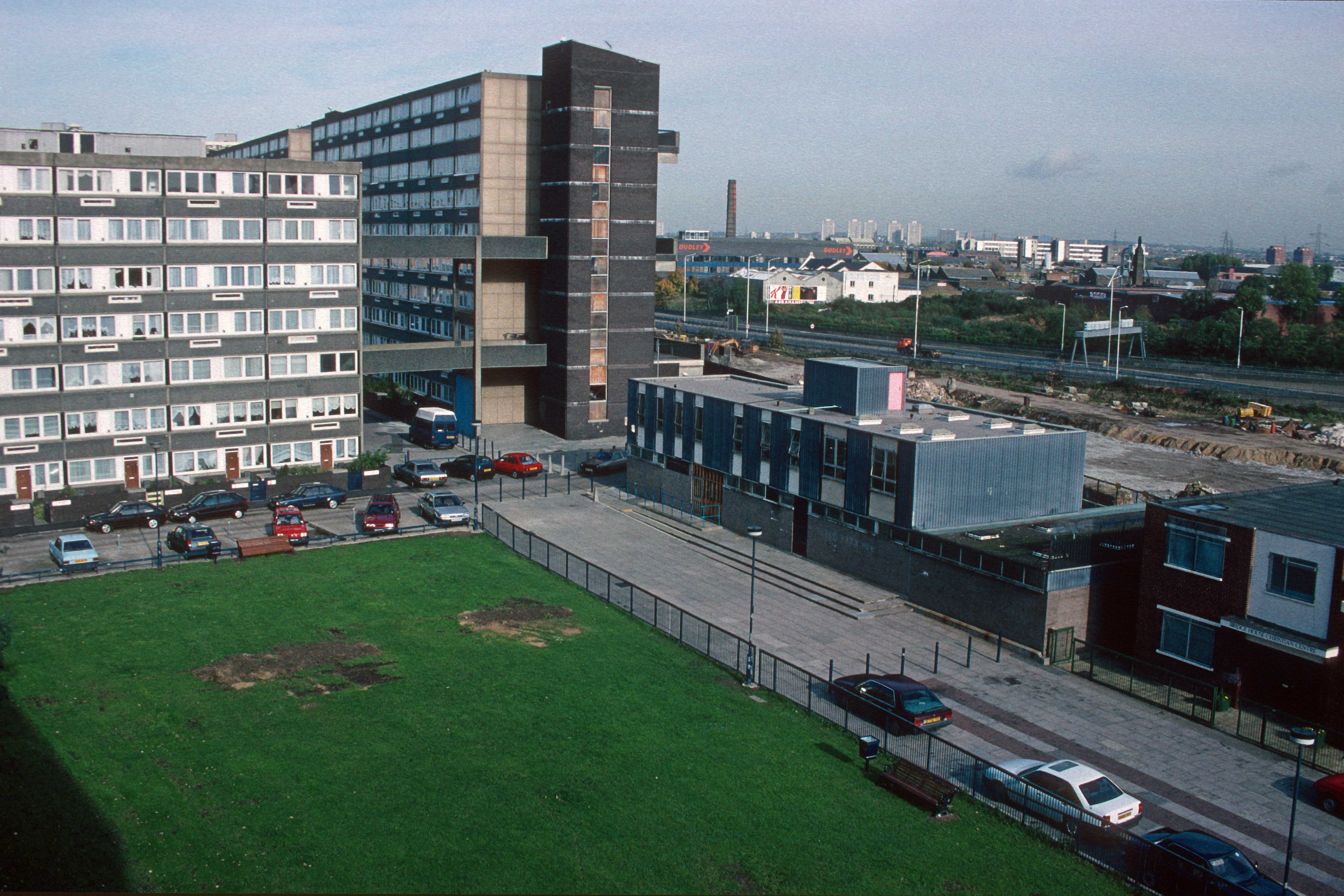
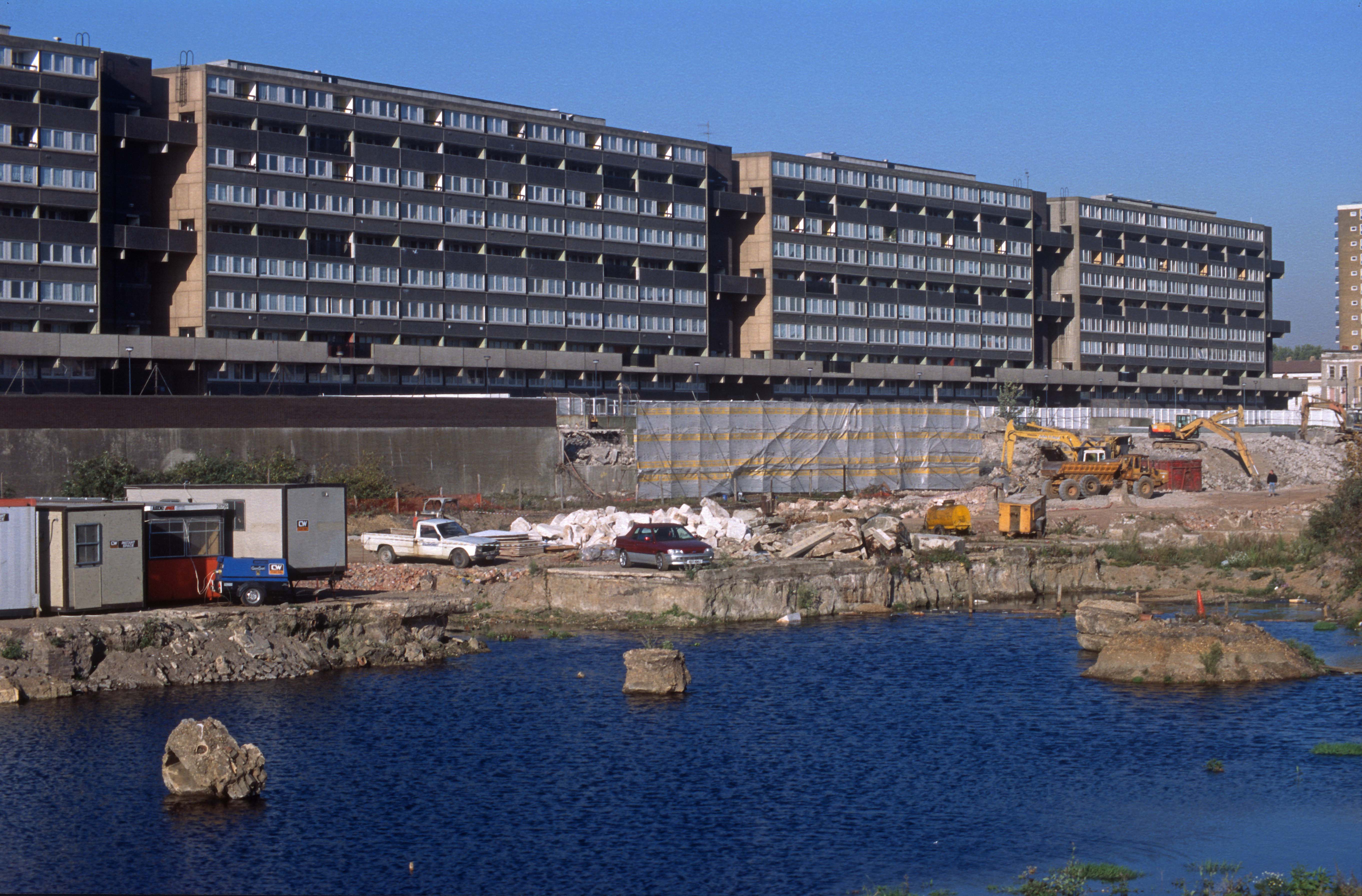
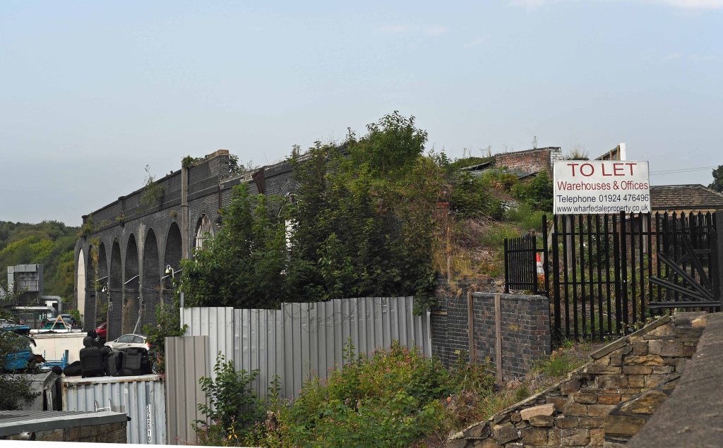
I’m struggling to find a single factual statement in this. Where to start? It takes the same route as HS2? No, it doesn’t. The nearest to Birmingham the GC went was Rugby, after which it headed North to go to Leicester, Nottingham and Sheffield. There’s a clue in its name! Its viaducts and bridges are ‘unused’? Well, ignoring the fact many of them have been demolished, that would be news to the good citizens of Nottingham, as much of the city centre formation of the GC has been incorporated into the new tramway, and the site of Nottingham Victoria is now a shopping centre. Here’s an illustration of the scale of changes in Nottingham.
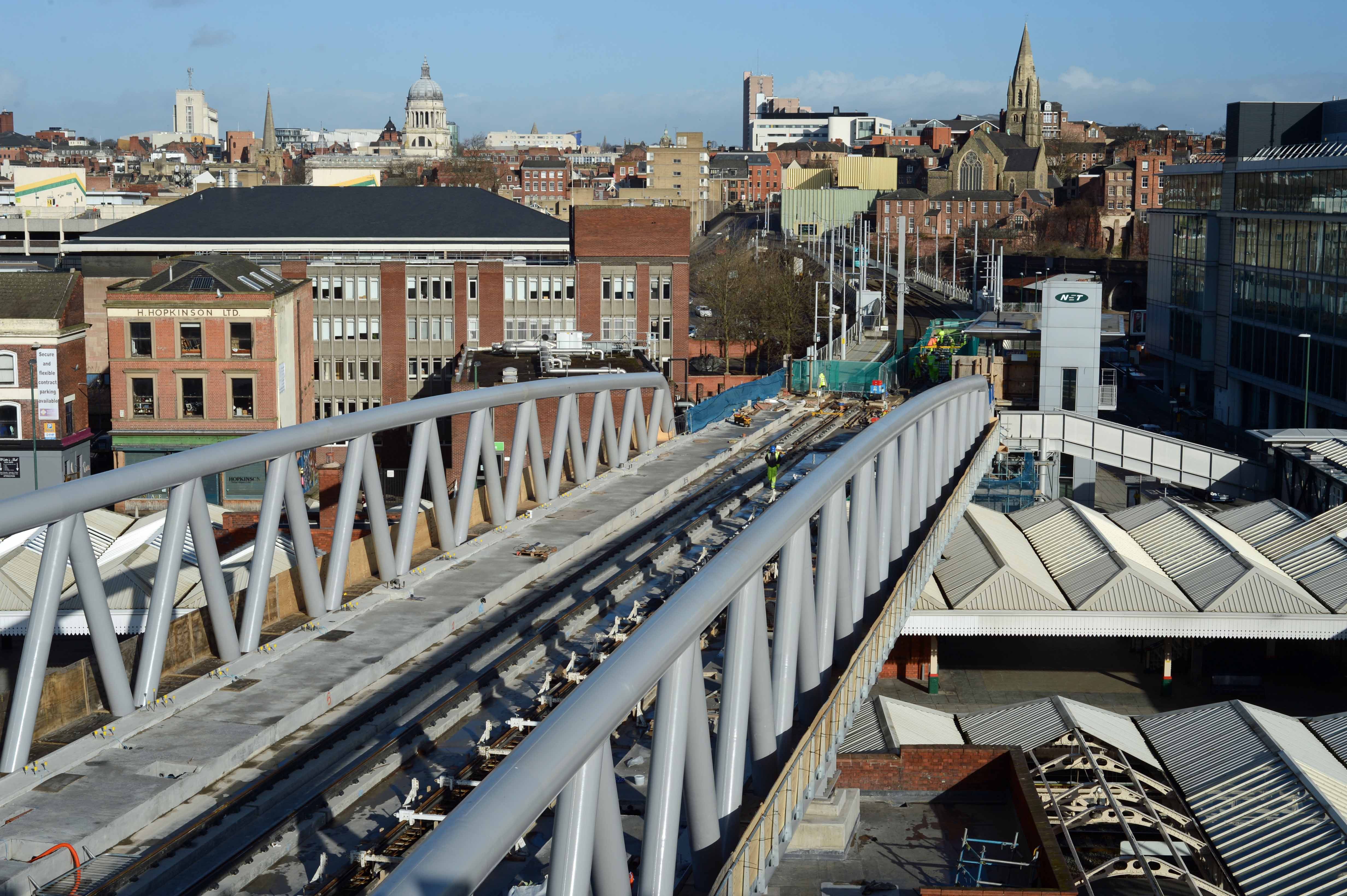
This shot was taken in 2014. It shows the new tram route crossing over the centre of the remaining Nottingham station. It’s built on the course of the Great Central, which crossed the station in exactly the same spot, only that was demolished years ago. This bridge now links the two separate sections of the NET tramway. Remove this and you cut the new tram network in half. Not only that, but the remaining formation of the GC is used by NET in the background. The GC’s ‘almost totally intact’? Pfft!
This website has a great selection of pictures documenting the demolition of the Great Central around Nottingham.
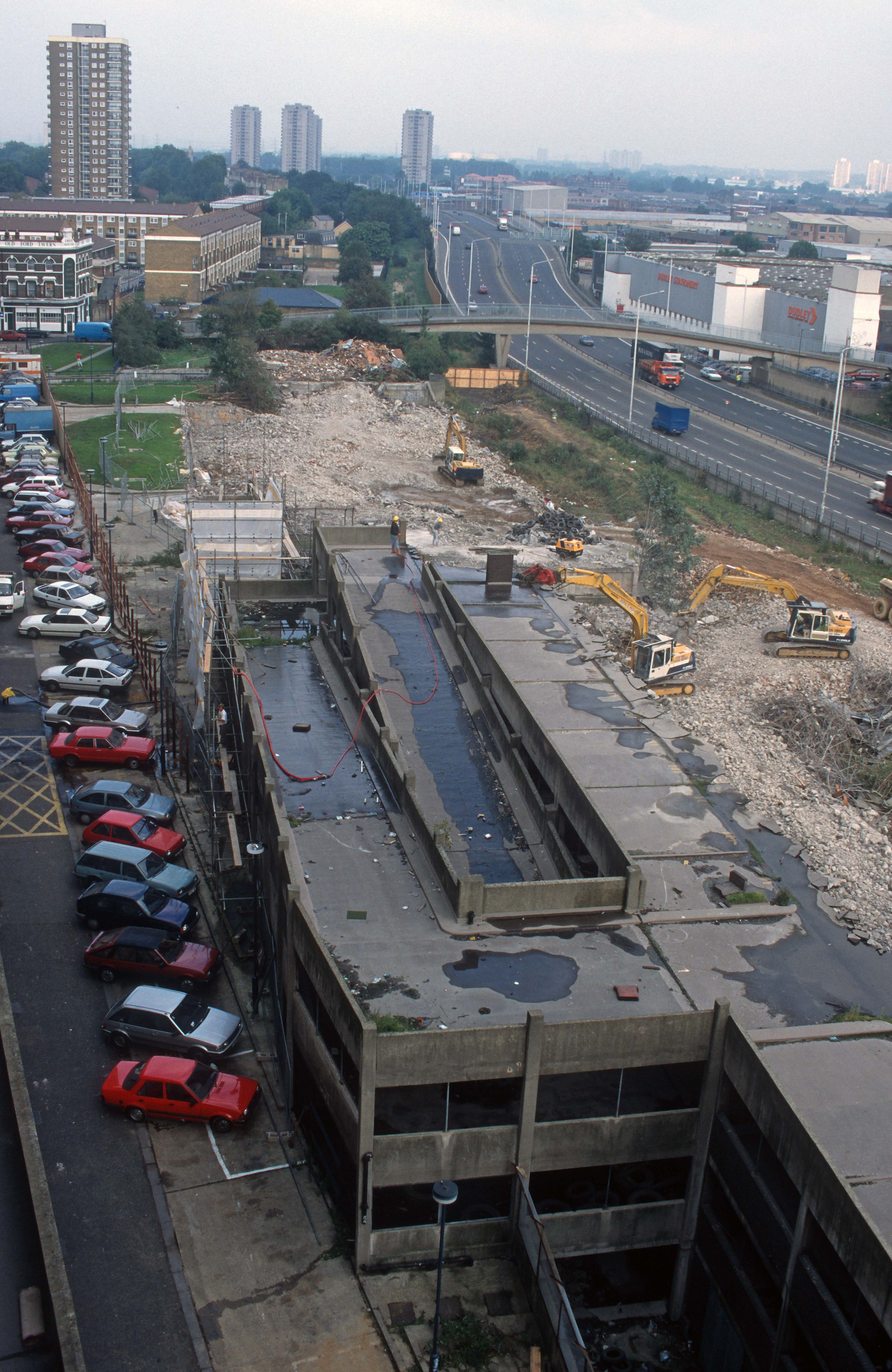
As you can see, the idea that the tracks were ripped up 53 years ago, leaving the formation untouched until the present day is just a load of cobblers, frankly. For example, much of the GC’s route through Leicester was demolished by the beginning of the 1980s whilst the famous bowstring bridge was dismantled in 2009. Here’s a fascinating website that documents the demolition of the Great Central’s infrastructure around Leicester. It blows Clark’s claims out of the water.
At Rugby, the huge ‘birdcage’ bridge that used to carry the GC over the West Coast Main line was demolished in 2006. There’s also a large industrial estate to the north now. It’s the same with the 223m long viaduct at Brackley, which was demolished in 1978. There’s also the small matter that a couple of chunks of the GC around Loughborough are now part of the preserved Great Central railway. They had to reinstate the bridge over the Midland Main Line at great expense and any battle to reclaim the route from them would be rather expensive I imagine! Oh, talking of Blackley, William Barter’s sent me this link, which proves Clark couldn’t even get the bit about reopening the GC not affecting any SSSI’s right. Part of the GC route IS an SSSI!
The GC had ‘the fastest expresses in the country’? That’s a new one I’ve never heard before and I notice he offers no evidence for that claim. The GC had no ‘racing’ stretches like the LNER did on the East Coast main line, or the Great Western had on Brunel’s ‘billiard table’, it just had few stations on the London extension.
Then we get the age-old nonsense that the GC’s London Extension was built to ‘continental loading gauge’. No. It wasn’t. The most common guff you hear is that it was built to ‘Berne gauge’ – only Berne gauge wasn’t established as a standard until a 1912 conference (yes, you’ve guessed it – in Berne!) and wasn’t adopted until 1914, long after the GC London extension was opened. Yes, it does have a slightly more generous loading gauge than many other UK railways built earlier (but only on the London extension), but that’s not equal to any of the standards accepted in Europe and it certainly isn’t the same as the UIC standards trans-European railways like HS1 are built to. It’s also worth noting that many EU railways like Belgium, Germany and the Scandanavian countries use a loading gauge that’s far bigger than Berne.
Another howler is the claim that the GC London extension built as a high speed railway. Firstly, define ‘high-speed’? In the era the GC was built, 75mph was ‘high-speed’, it’s not now. The idea that to can just reinstate a few bridges, relay the track and whizz trains up and down it at 140mph as Clark asserts is just another fantasy. Of course, there’s a subtle irony about these high-speed claims. The London extension was high-speed because it was built as straight as possible through open country and had few intermediate stations so that expresses weren’t slowed down. All these are things opponents of Hs2 object to!
Here’s some more guff from Clark.
Right, we’ve already exposed the “almost totally intact” nonsense, but let’s really put that one to bed. The line remains ‘clear’ at Brackley? I’ve already mentioned the demolished viaduct there, but here’s a screengrab from Google maps showing the town itself. I’ve marked the old GC route in red.
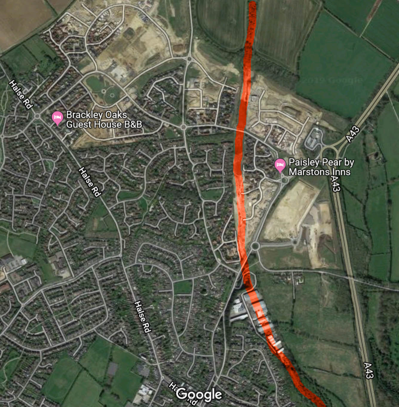
If the line’s ‘clear’ at Brackley, what’s that big industrial estate towards the bottom of the picture then? I could produce map after map showing how little is actually left of the GC route on the ground, rather than in Clark’s imagination. Plus, does Clark seriously think that the residents of the new housing estate would welcome the idea of the place being cut in two by re-opening the GC? Nimbyism would be rife along the route, just as it has been with HS2, where plans to reuse part of the GC formation in Bucks met with opposition from Nimbys!
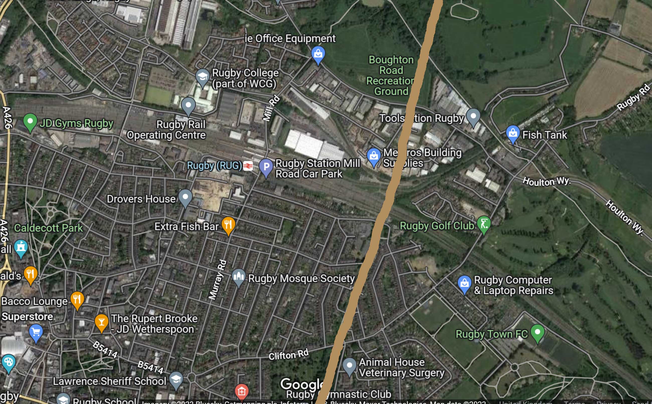
Now lets look at Rugby. There was never a connection between the Great Central and the LNWR at Rugby that faced towards Birmingham. THE GC passed over the LNWR on the famous ‘birdcage bridge’. To build any such connection now you would have to demolish a large part of the town! It’s utterly bonkers but then these people never let facts get in the way of their flights of fancy. Can you imagine the uproar in Rugby if anyone seriously suggested this? Here’s a map to illustrate the issue. I’ve drawn on the old route of the GC so you can see the problem.
Now let’s address the ‘question’ of the London end, which Clark poses but glibly ignores answering. Run into Marylebone? You’re having a laugh! Since the 1966 closure of the GC Marylebone’s fortunes have changed completely, once proposed for closure itself its now a very busy station run by Chiltern trains who added two more platforms in 2006 to cope with all the extra trains they run. There’s simply no spare capacity there, nor on the Metropolitan line tracks the route shares with London Underground heading up through Rickmansworth to Amersham. As for running into Paddington. that’s just as laughable, it’s yet another London terminus with no spare capacity. In the 50 years since the GC closed rail services have grown massively, a point totally ignored by Clark. He also mentions Euston but neglects to mention the fact HS2 is having to build a lot of new platforms there to cope. Here you see the beauty of being a writer who’s untroubled by reality, you can airly solve these problem with a few taps on your keyboard. In the real world however…
It’s time that we finally put to bed this fiction that re-opening the Grand Central is either possible, or desireable. We need to stop indulging in these flights of fancy into the past and start dealing with the reality of the future. One last point. The weather. Unless you’ve had your head buried in the sand these past couple of weeks you can’t have failed to notice that the weather is getting more extreme. Our Victorian rail network was built for an age when Climate Change wasn’t even considered. Now we know the truth. HS2 has been designed and will be built to cope with those ‘once in a century’ events that are now happening almost every year. We cannot rely on Victorian infrastructure forever.
I’ve a favour to ask… If you enjoy reading this blog, please click on an advert or two. You don’t have to buy anything you don’t want to of course (although if you did find something that tickled your fancy would be fab!), but the revenue from them helps to cover some of the cost of maintaining this site – and right now (because of Covid), us locked-down freelances need all the help that we can get…
I had a commission in rural Leicestershire on Monday so my partner, Dawn and I decided to use it as an opportunity to explore the area. We booked a couple of nights at the Sysonby Knoll hotel on the outskirts of Melton Mowbray. The hotel’s part of the Best Western group & displays all the quirkiness & individuality that many of their properties do. It’s set in an attractive garden that’s bordered by the meandering River Eye. Our gorgeous first floor room looked out across the river & meadow beyond to the embankments of an old railway. As we had fabulous sunshine blessing our visit we both decided to go for an early morning walk along the footpath that’s replaced the rail tracks*. What could possibly go wrong?
Lazy & ignorant dog owners, that’s what!
We noticed the first pile of poo within minutes of stepping off the pavement. After 100 yards it became obvious the area was heavily used by dog walkers. It was like walking through a faecal minefield – and some of these dogs were clearly a damned sight bigger than Chihuahua’s! What should have been a pleasant walk & chance to explore was marred by inconsiderate dog-owners who (metaphorically & literally) didn’t give a shit.
The condition of the River Eye wasn’t much to write home about either. Perhaps I’ve been spoilt living on the clear Calder with its abundant wildlife & pristine waters. In contrast the Eye is a murky mess that bares the hallmarks of pollution from phosphate run-off from farmers’ fields along its banks.
What a shame. People remember Melton Mowbray for its pork pies & cheese. Sadly, Dawn & I will always associate it with dogshit.
* For anyone interested in old railways & who’s foolhardy enough to run the dogshit gauntlet here’s a link to the line’s history (and a selection of fine old photographs) run by local enthusiast Peter Smith; http://www.meltonmowbrayrailways.info/
After an all too brief break I’m back on the road & back to London to do a couple of jobs for Network Rail. This one will see me atop the roof at Liverpool St station apparently…
Whilst I’ve not been blogging you’ll find that a lot of new pictures have appeared on my website – with more to come. The beautiful weather we enjoyed in the Pennines yesterday encouraged me to eschew picture editing for picture taking. A leisurely stroll around the Calder Valley allowed me to document a pair of magnificent railway viaducts – although, sadly – one hasn’t seen a train in decades. Nowadays it carries cyclists & pedestrians in lofty isolation on 13 arches spanning 230 yards across West Vale near Greetland. It’s one of a pair of viaducts on the short Holywell Green branch. Despite the L&Y increasing the service & cuttings costs by using their railmotors, the line succumbed to competition from a growing tram network on the 23rd September 1929 (although it still carried freight until September 1959). With the hue & cry over the Beeching era it’s easy to forget that the era between the wars saw quite a few lines lose their passenger services. There’s another even closer to me, the line between Sowerby Bridge & Rishworth. Like the Holywell Green branch this was run by the Lancashire & Yorkshire railway & it closed to passengers on the 8th July 1929. It remained open for freight until 1953 when the line was cut back to Ripponden. The whole route finally closed on September 1st 1958. I’ve walked both routes & you’ll find a selection of pictures on my website. You can see the latest ones in this gallery:
There’s something ineffably sad about walking old railways. The sense of lost opportunity is quite palpable on some. Yet, at the time the pendulum had swung away from rail in favour of roads. Now, half a century later, it’s swung back again. Many lines that were closed in the Beeching era would be extremely valuable today. Of course, some (like East-West rail & the Borders railway) are returning – but others will remain lost forever – like these two…
Here’s a taster of the pictures. Firstly, West Vale viaduct.
I have a whole gallery of abandoned railway pictures that includes several on the Rishworth branch. Here’s a sample.