I’ve returned to Parbold today to get more shots of the work now that things have progressed. I had the same trouble getting out here as yesterday. The ‘direct’ bus is a figment of Northern’s imagination. I still had to change at Burscough Bridge to the same timetable as yesterday. This time I sat on the station to wait and ended up directing several rail passengers to the bus stop. There’s no posters on the station telling them were it is, only one saying the the line’s closed and buses are running instead. I’m amazed at the number of people who don’t know there’s a blockade on this week and still turn up expecting a train.
Anways, here’s a few pictures from today.
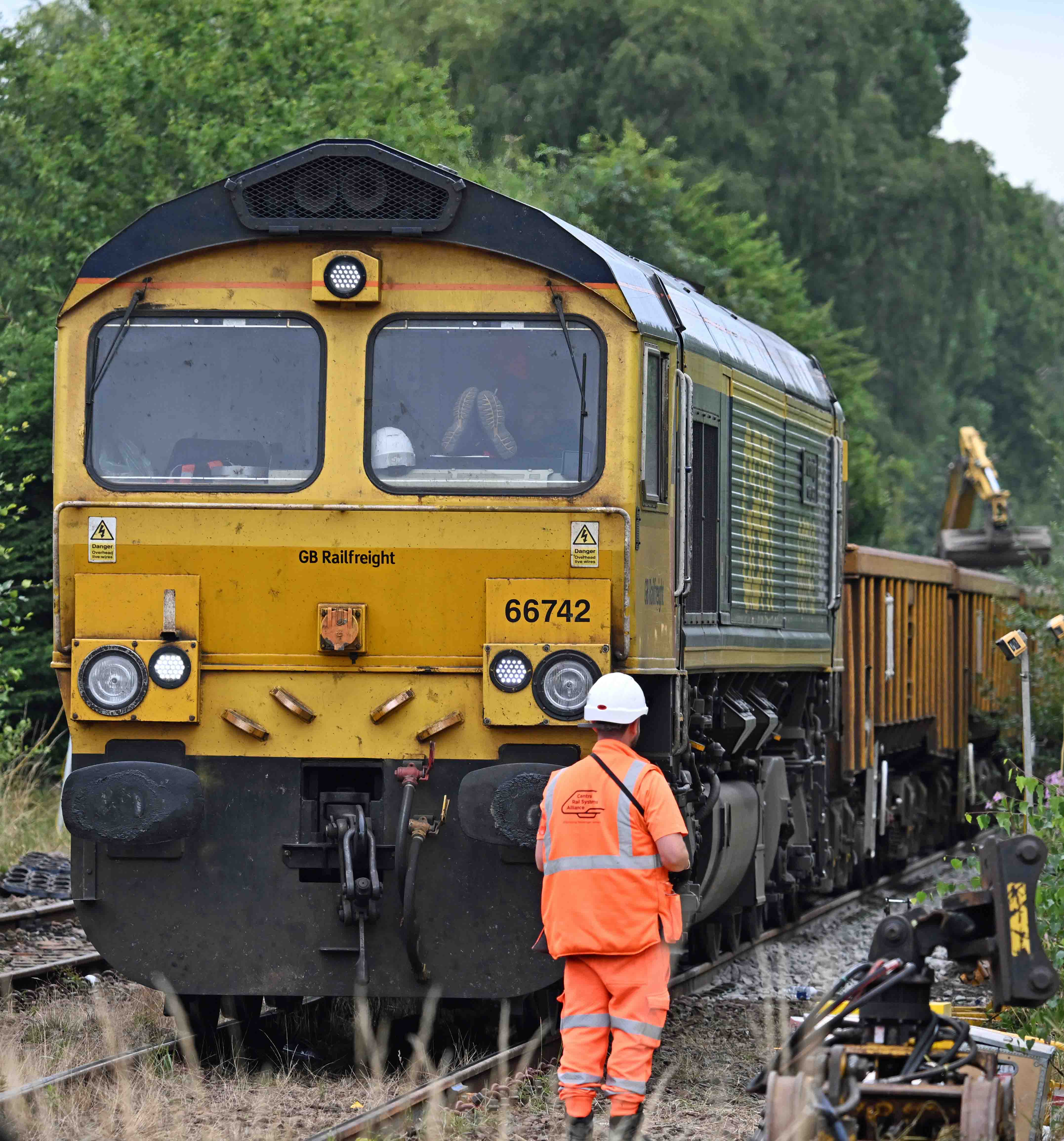
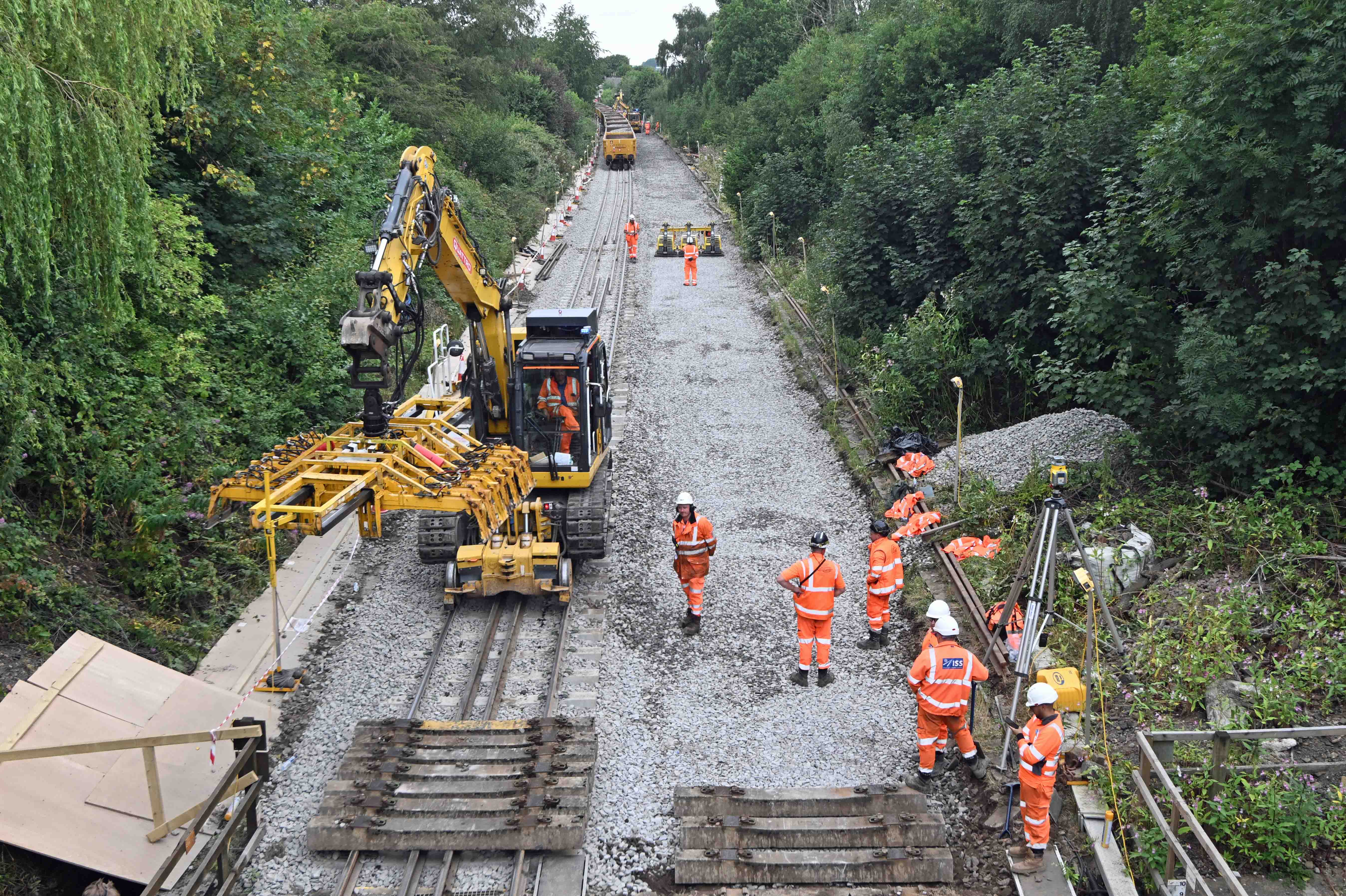
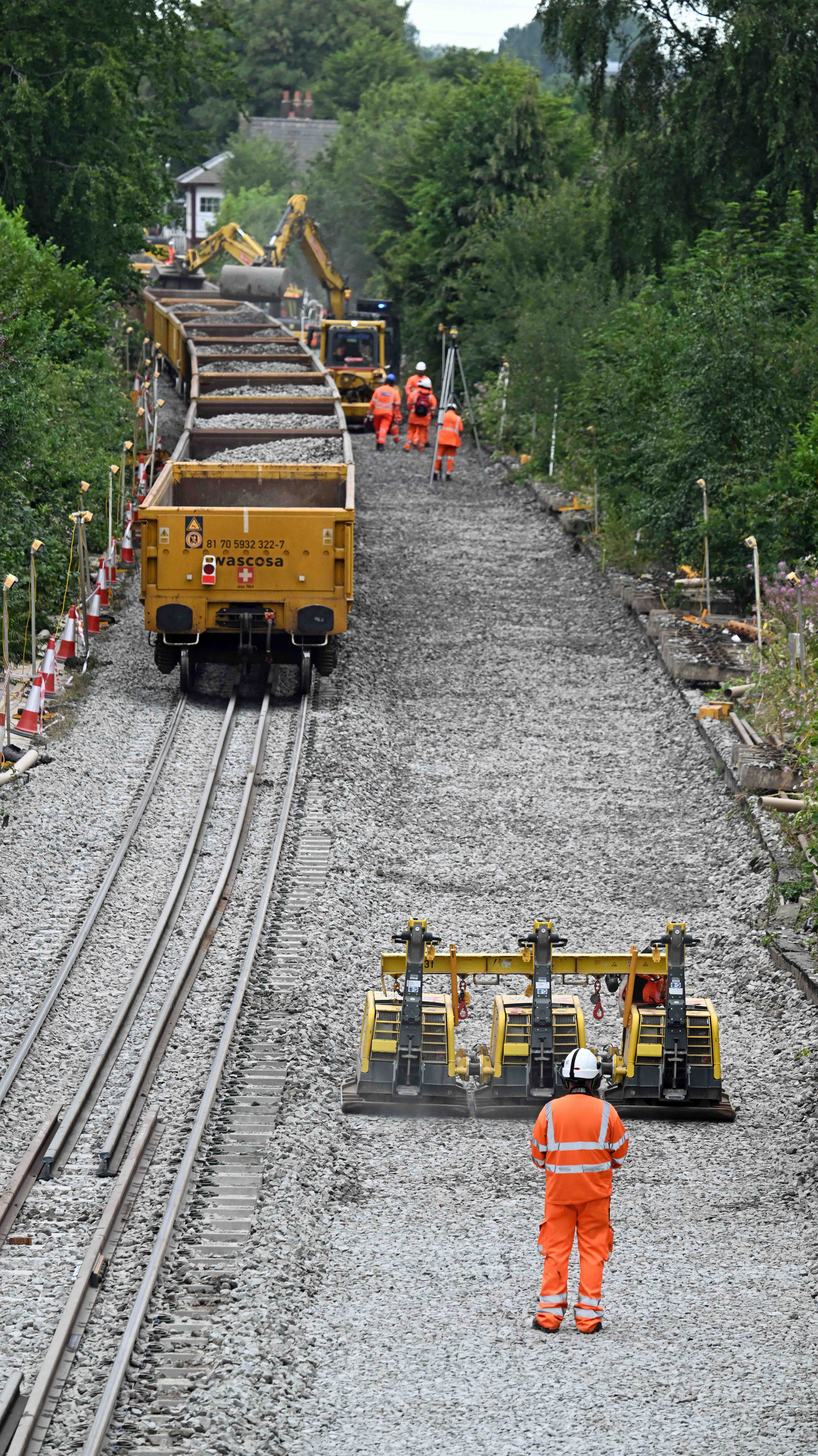
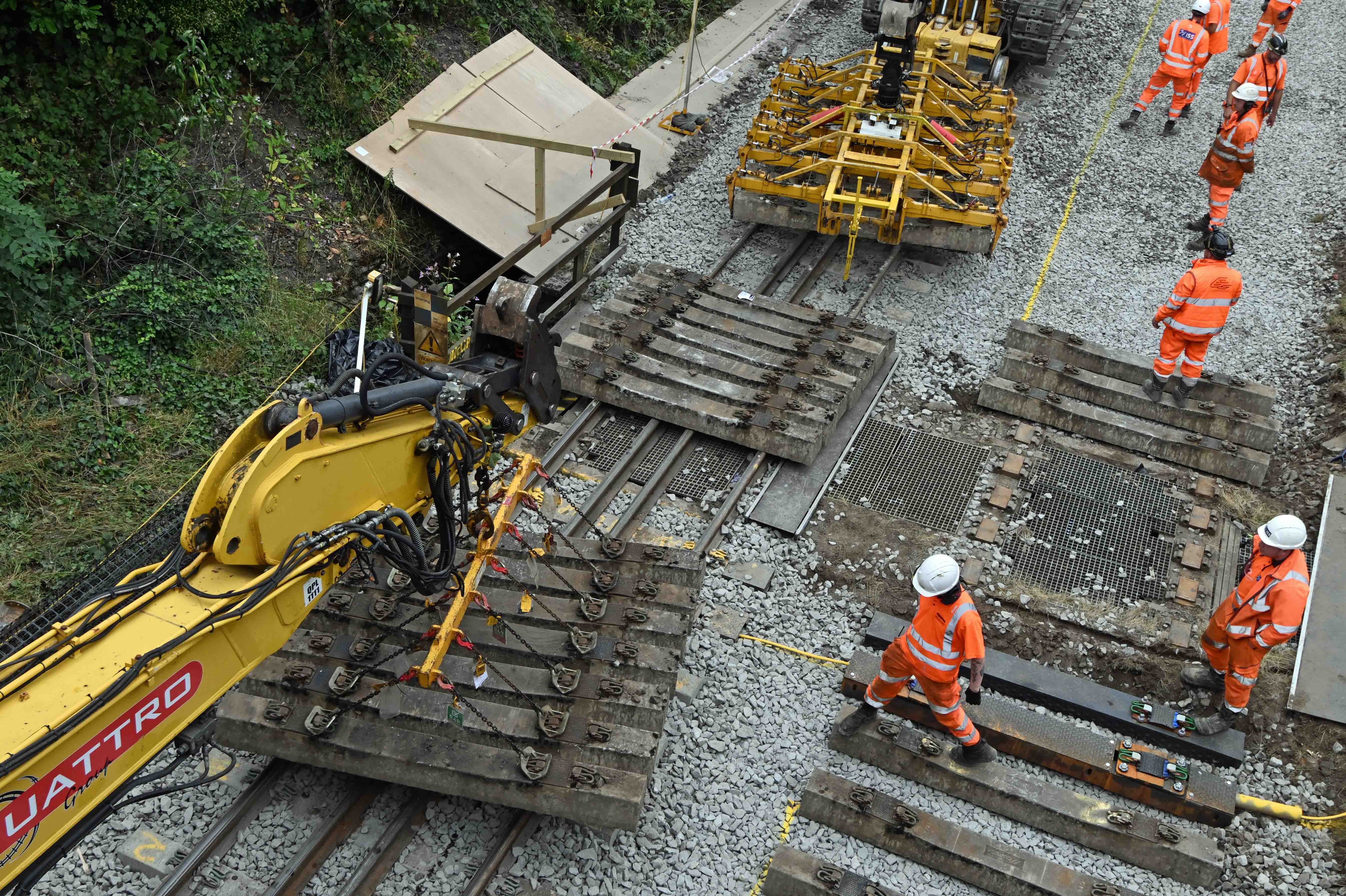
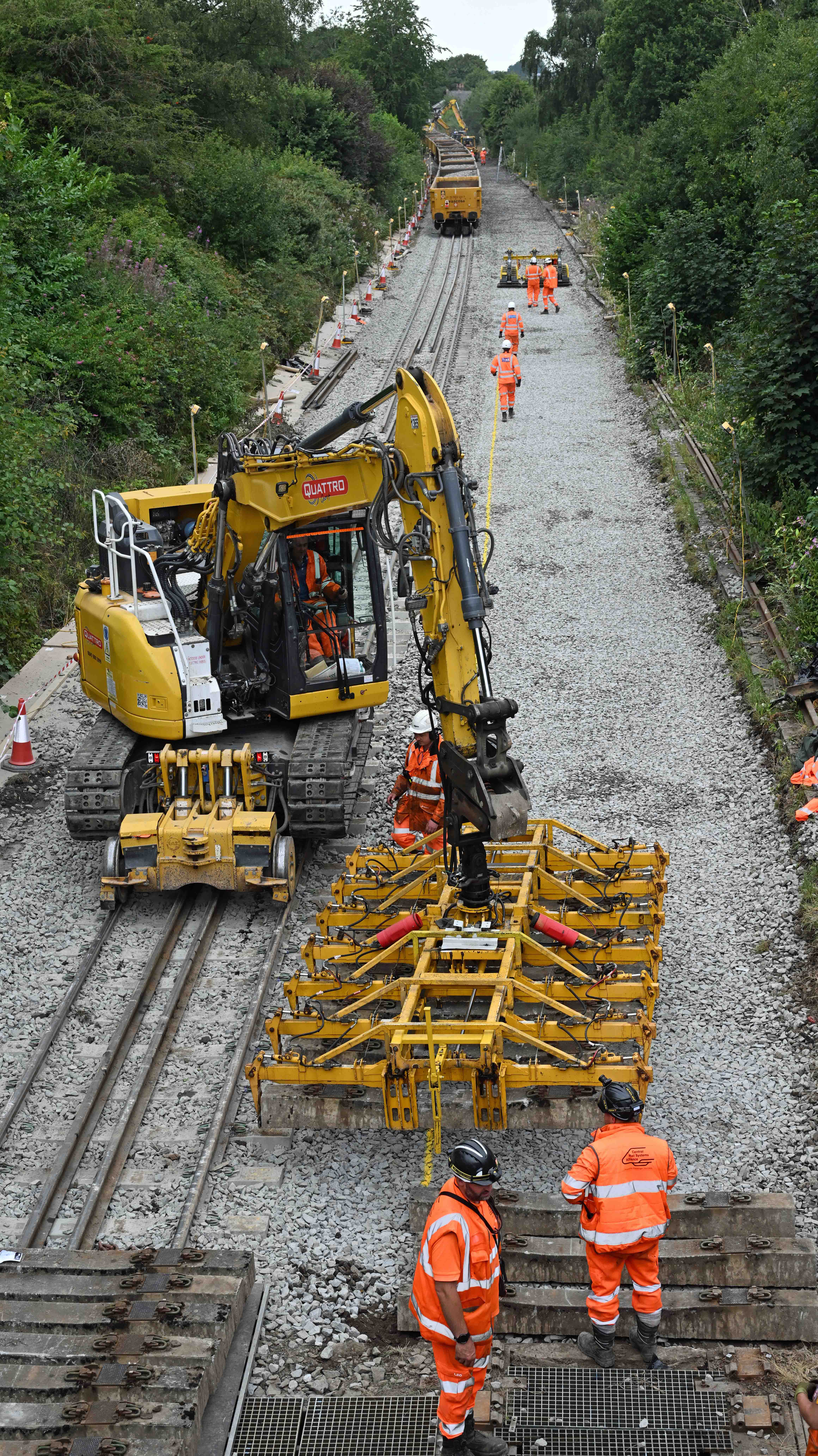
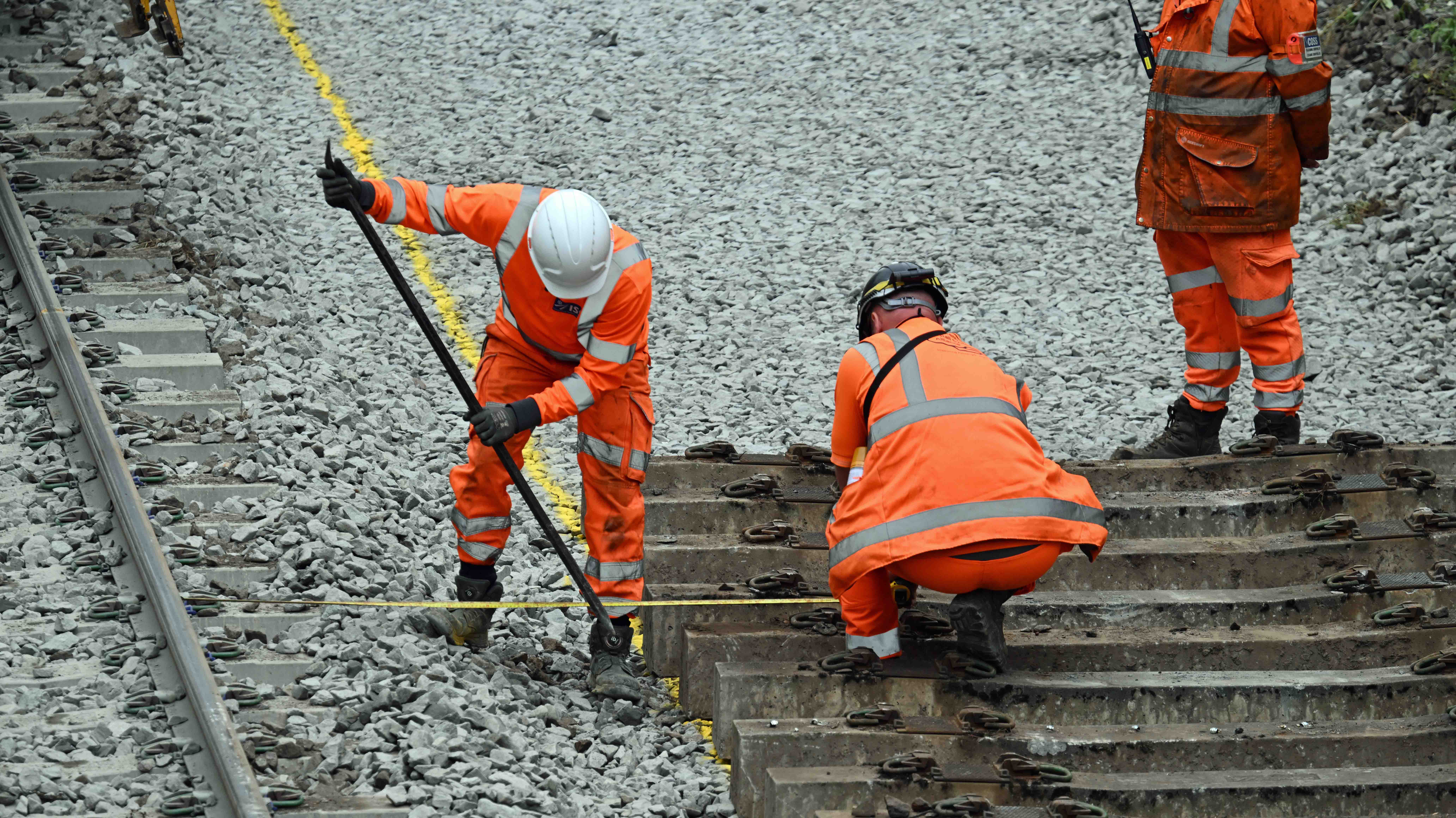
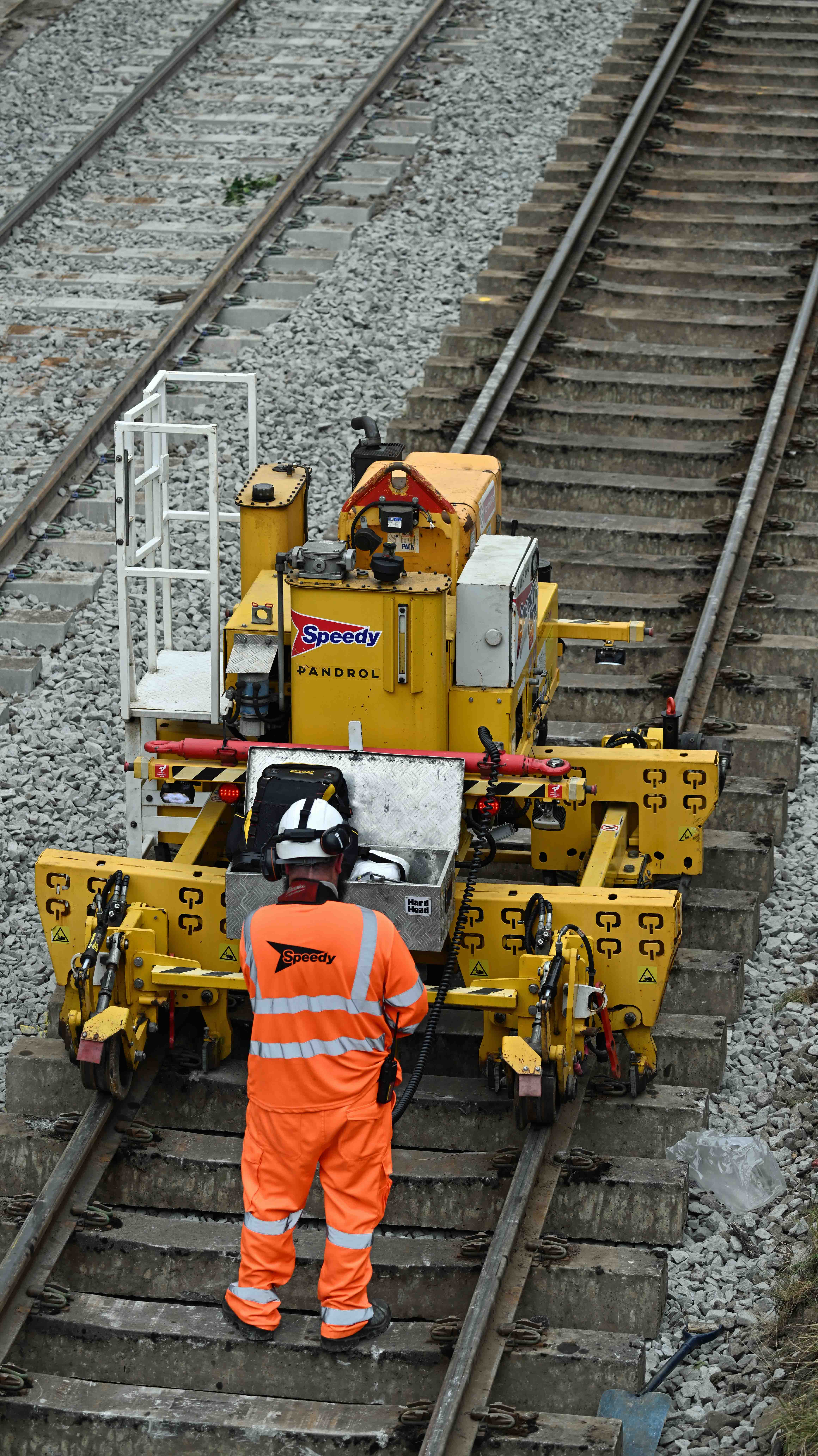
The life of an engine driver on a possession. More time’s spent with your feet up than actually driving! It’s a dull job.Overnight the old Up (Wigan bound) line has been stripped out and the formation levelled with fresh ballast which is being unloaded from the train behind. These remote controlled Wackers (yes, they’re really called that) are used to compact and level the ballast before sleepers are laid on top. Meanwhile, other RRVs are unloading more ballast. The whole thing has to be tightly choreographed as the RRVs can’t lay new sleepers until the ballast train is out of the way. On this job the original rails and sleepers are being relaid as they’re not that old and still have plenty of life left in them. The RRV on the left brings them in from a stockpile whilst the machine on the right places them into position. This RRv picks up six sleepers at a time and places them into position.Once in roughly the right position (see the yellow line spayed on the ballast behind) a measurement is taken from the opposite track to ensure they’re in exactly the right alignment.
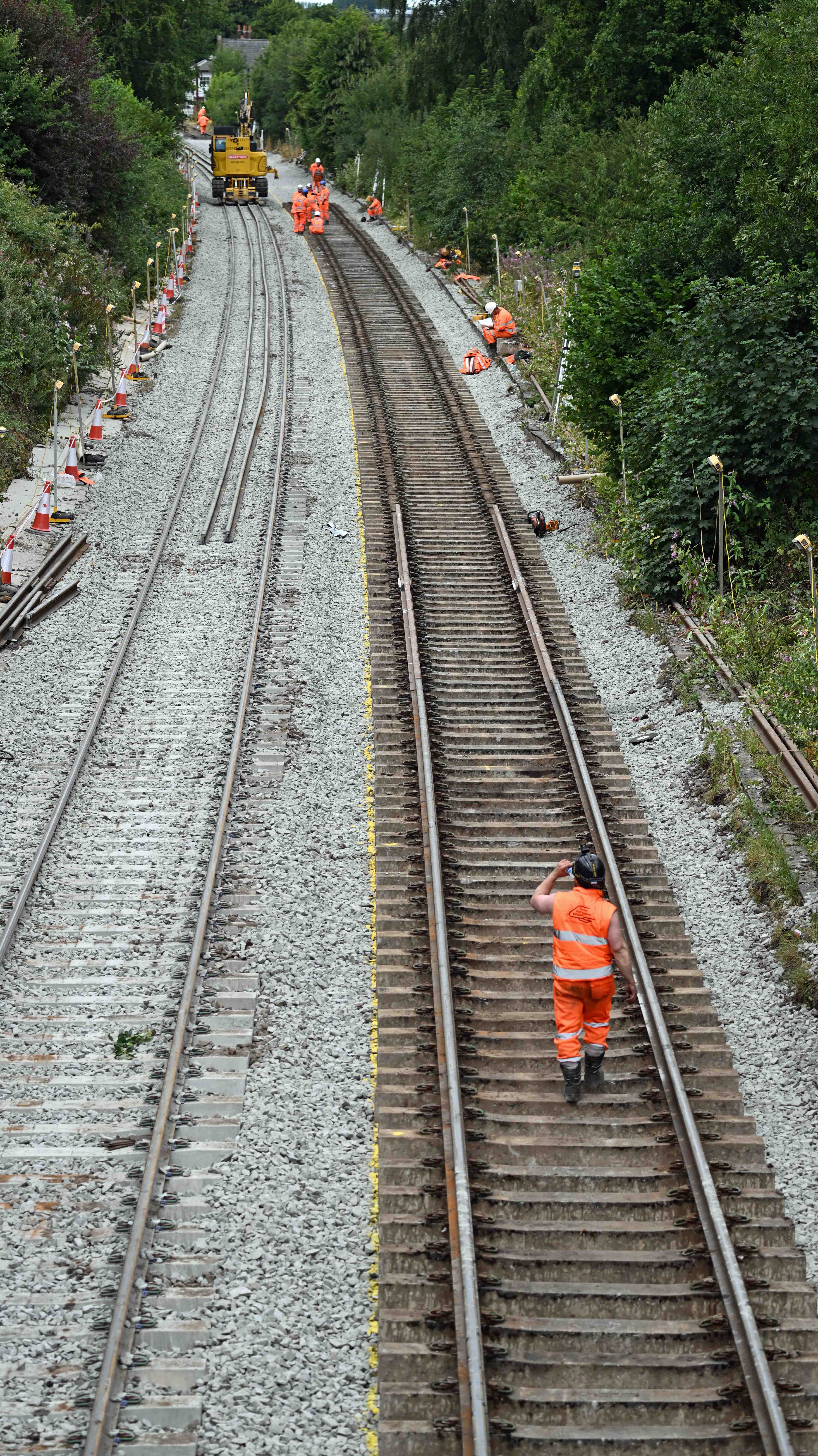
Having left the site for an hour or so to download these pictures I returned to find that the teams had made rapid progress.
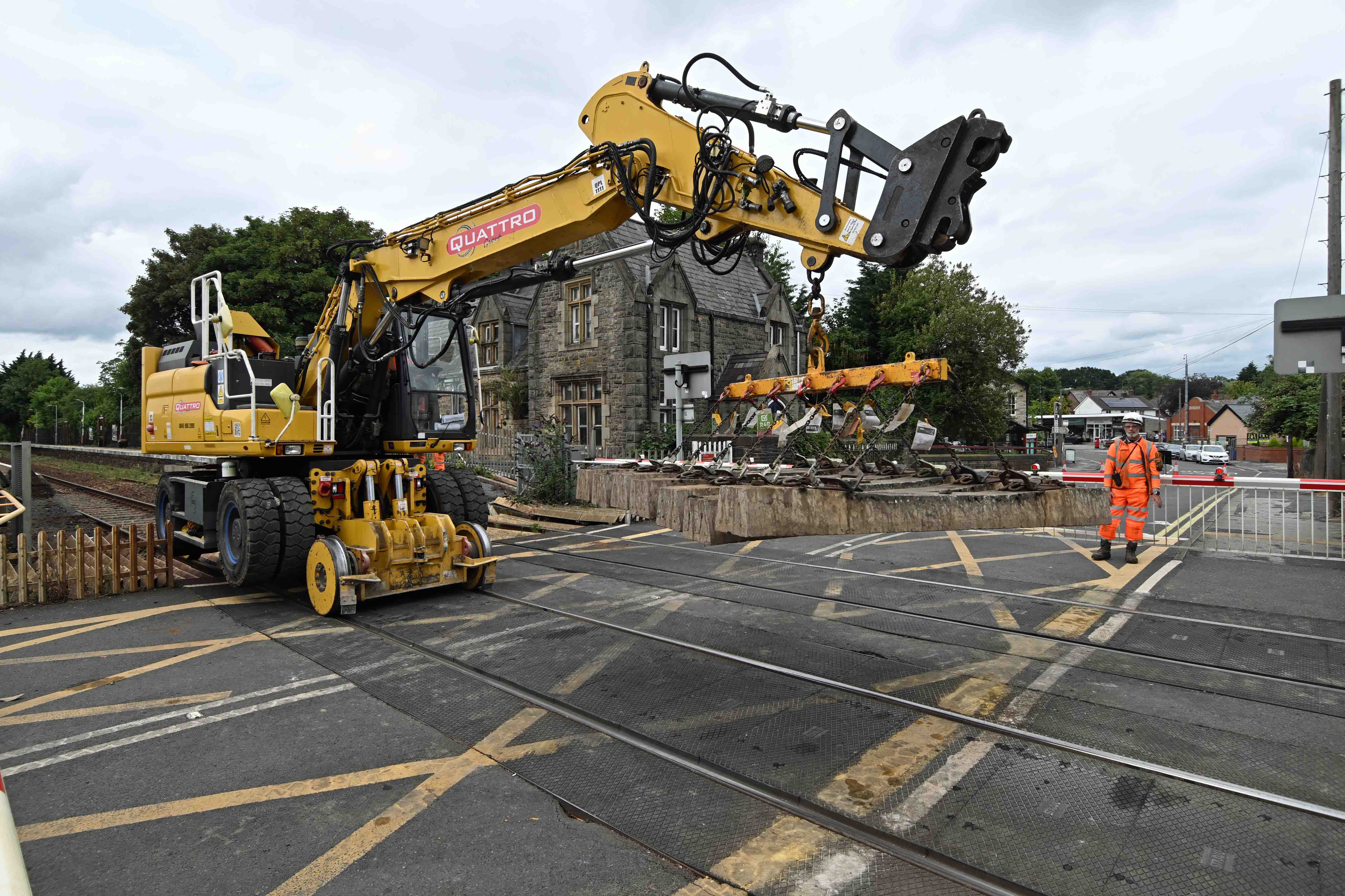
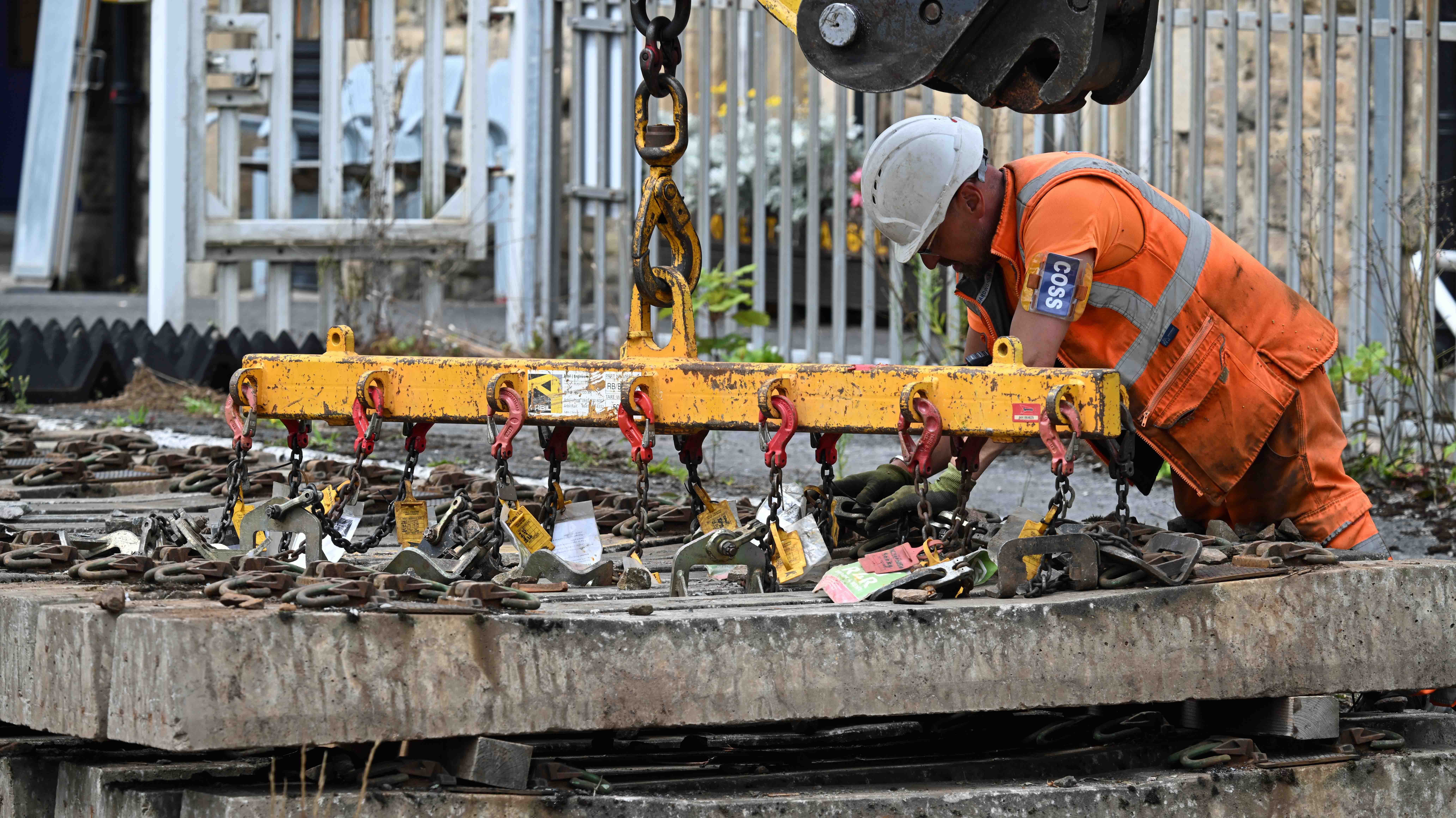
There was rapid progress on the Up (Wigan bound) line where rails had already been reinstated along part of the line, ready for being clipped into place. This clever little machine lifts the sleepers up and clips them onto the rails – several at a time, a job that once used to be done manually. An RRV moved stacks of sleepers that had been stored on the track in the station platform. This is one of the reasons the level crossing has been closed throughout the work. Space is limited and the crossing has also been an access point to allow equipment to be taken away or brought onto the worksite. A COSS (Controller Of Site Safety) clips sleepers to the RRV’s boom, ready to be lifted and moved to site. Wonder what all those paper things are? They’re tickets to say that all the chains have been inspected and are safe to use for the job.
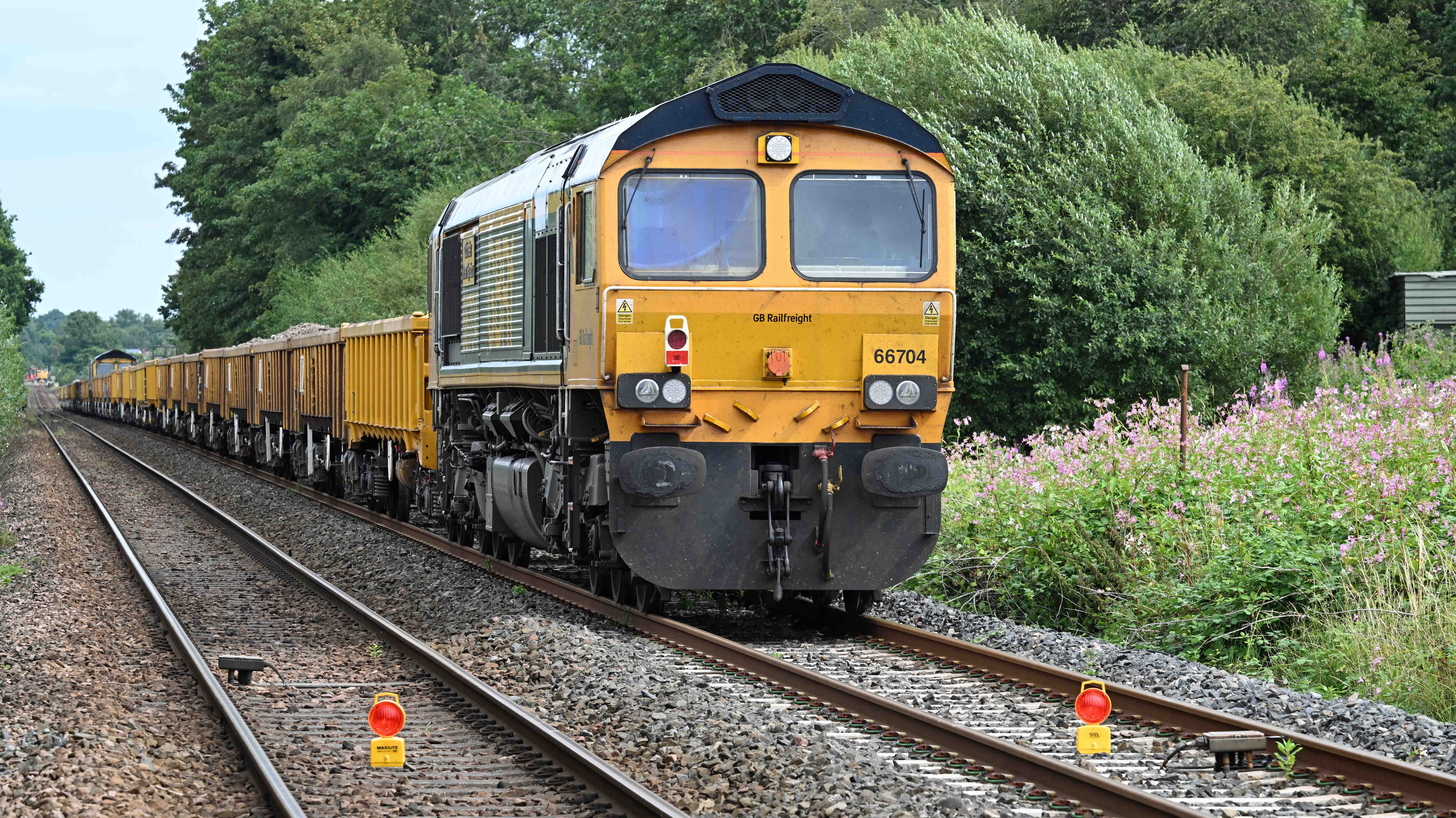
Rather than wait hours for the bus, I walked back to Burscough Bridge along the Leeds and Liverpool canal. It look around 90 mins but it allowed me to get a shot of these engineers trains parked up West of Parbold out of the way, but next to a level crossing so that the engine drivers could be relieved after the end of their shifts.
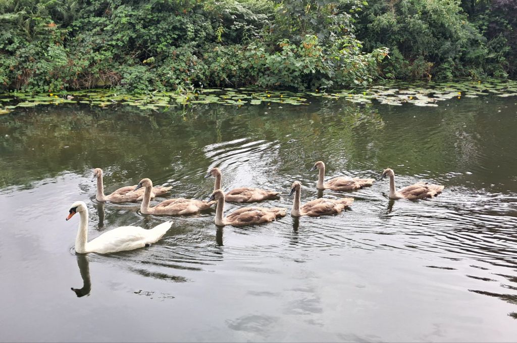
Mind you, that wasn’t all I saw en-route. There was also this flotilla of young swans on the canal.
I’ve a small favour to ask… If you enjoy reading this or any of the other blogs I’ve written, please click on an advert or two. You don’t have to buy anything you don’t want to of course – although if you did find something that tickled your fancy that would be fab! – but the revenue from them helps me to cover some of the cost of maintaining this site (which isn’t cheap and comes out of my own pocket). Remember, 99% of the pictures used in my blogs can be purchased as prints from my other website – https://paulbigland.zenfolio.com/
With the weather having picked up dramatically day 6 saw us off on another grand tour thanks to Clive, who spent the day driving us around Devon and into Somerset.
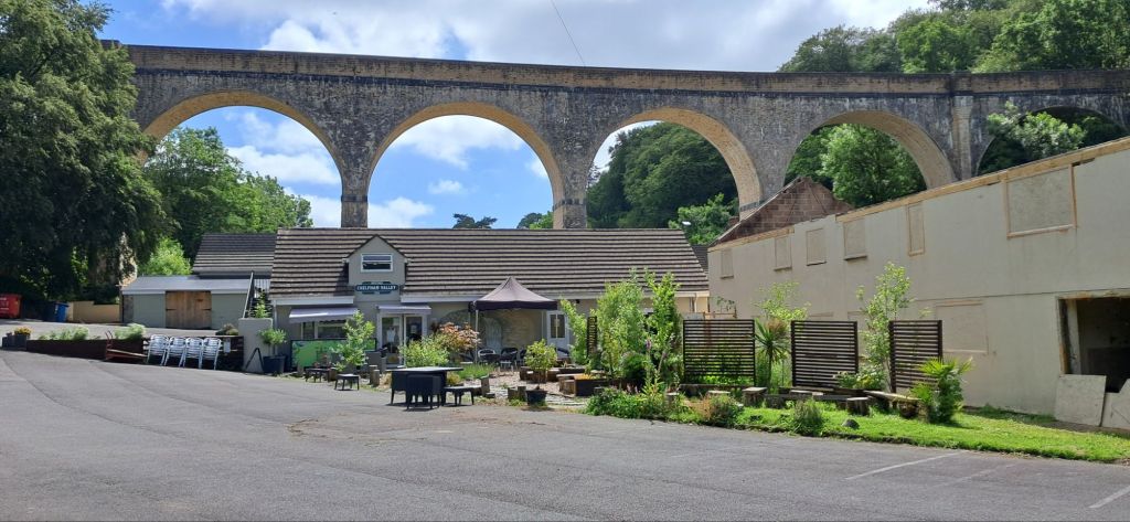
Our first port of call was Chelfham, a small village on the route of the old Lynton and Barnstaple railway. The landscape here is dominated by the impressive old viaduct.
Cafe and viaduct
Underneath it nestles an old mill and the ‘crafty cafe’ which is run by a community organisation called the growforward project. They serve great breakfasts as well as other food and drink and regularly hold music events, yoga sessions and all manner of community focussed activities.
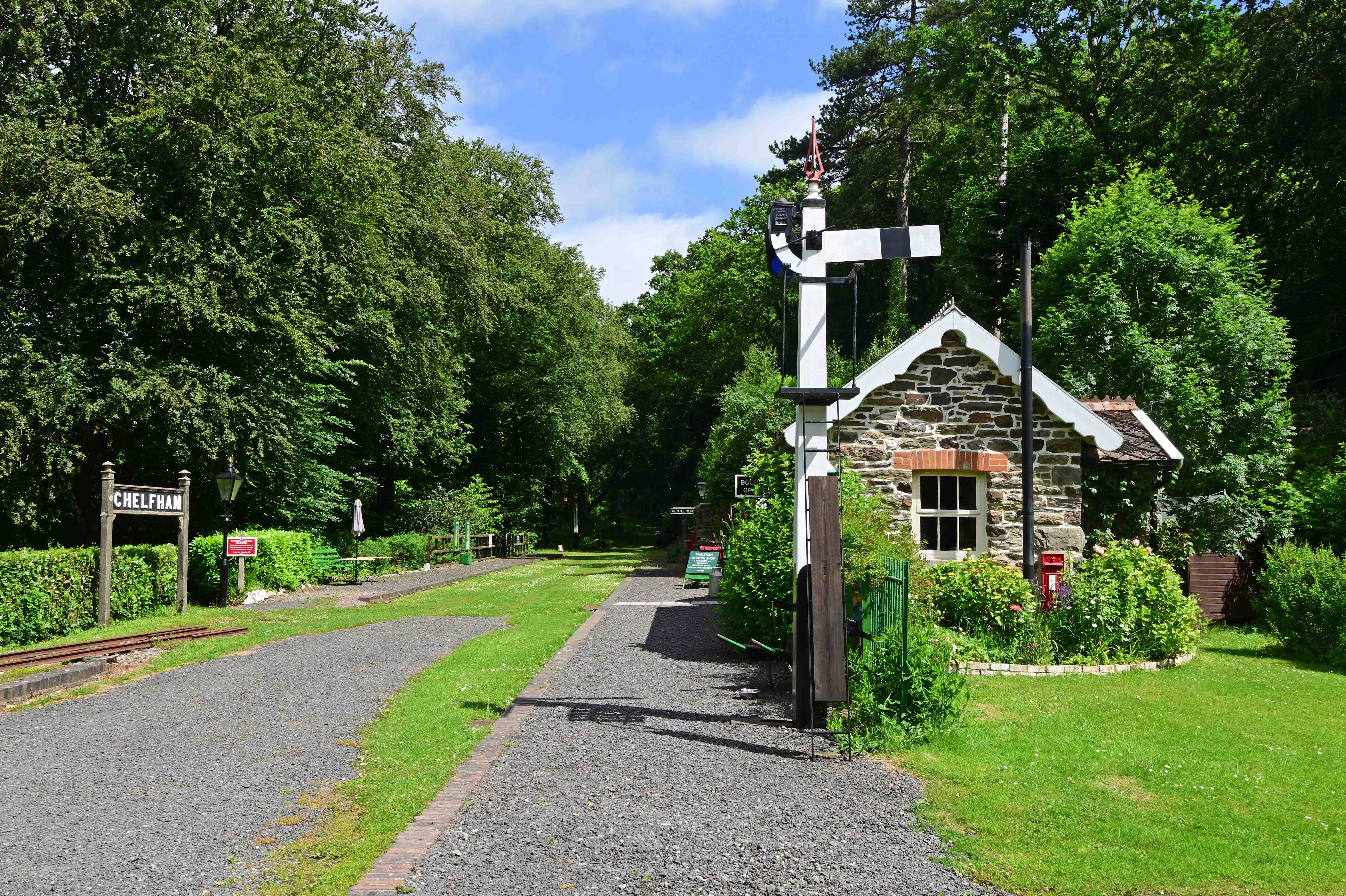
Whilst the reborn Lynton and Barnstaple railway hasn’t reached here yet the station’s been beautifully restored and is open on a regular basis.
Pretty Chelfham station.
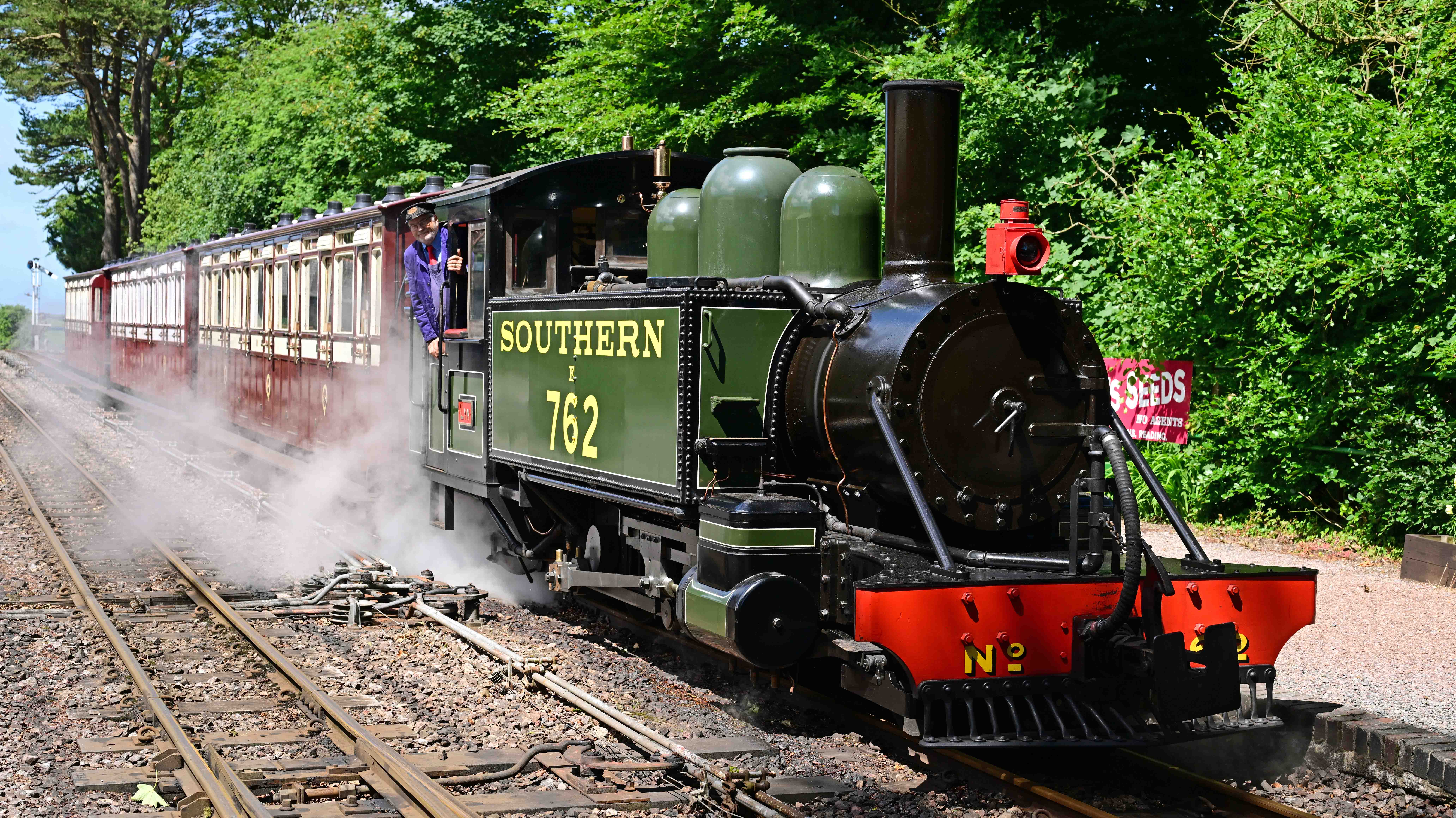
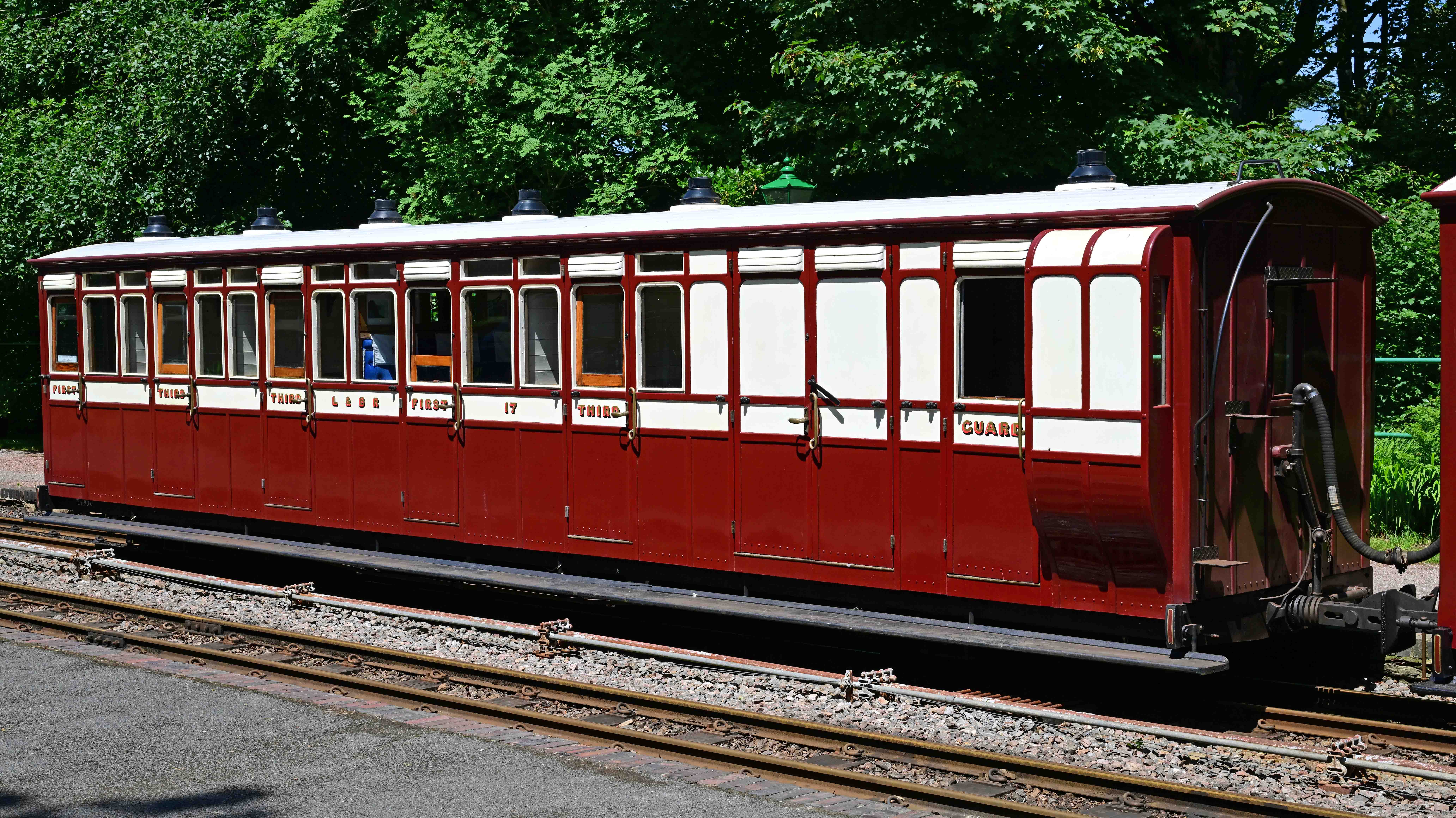
Our next stop was at the railway proper. The current base for the railway is at Woody Bay. The old station building contains a ticket office, cafe and shop with the rest of the site containing the line’s loco depot and carriage shed. It’s all beautifully kept and a real credit to the volunteers. Trains run along the former line as far as Killington Lane which is roughly a mile away. The trip offers some fantastic views of the Devon coastline – and what better way to see it than in some superbly restored railway coaches hauled by a steam locomotive which is a carbon copy of one of the line’s original engines?
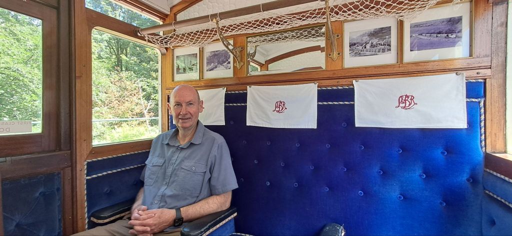
No 762 is a modern recreation of one of the original engines used on the Lynton and Barnstaple before its closure in 1935.One of the beautifully restored old coaches.Clive enjoying 1st Class luxury!
I wish the L&B every success with their ambitious plans to extend the line in each direction as it really is a little gem of a railway.
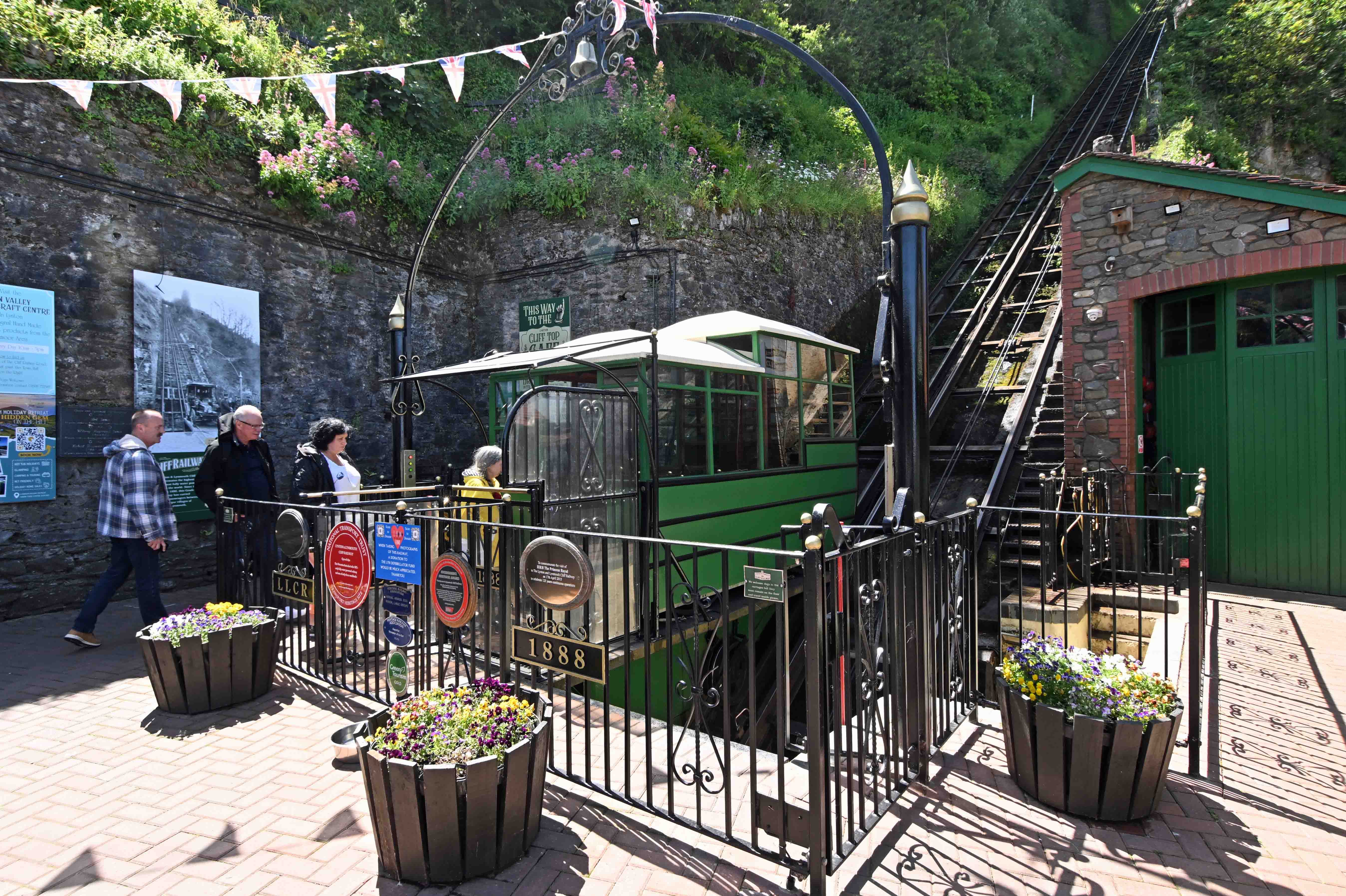
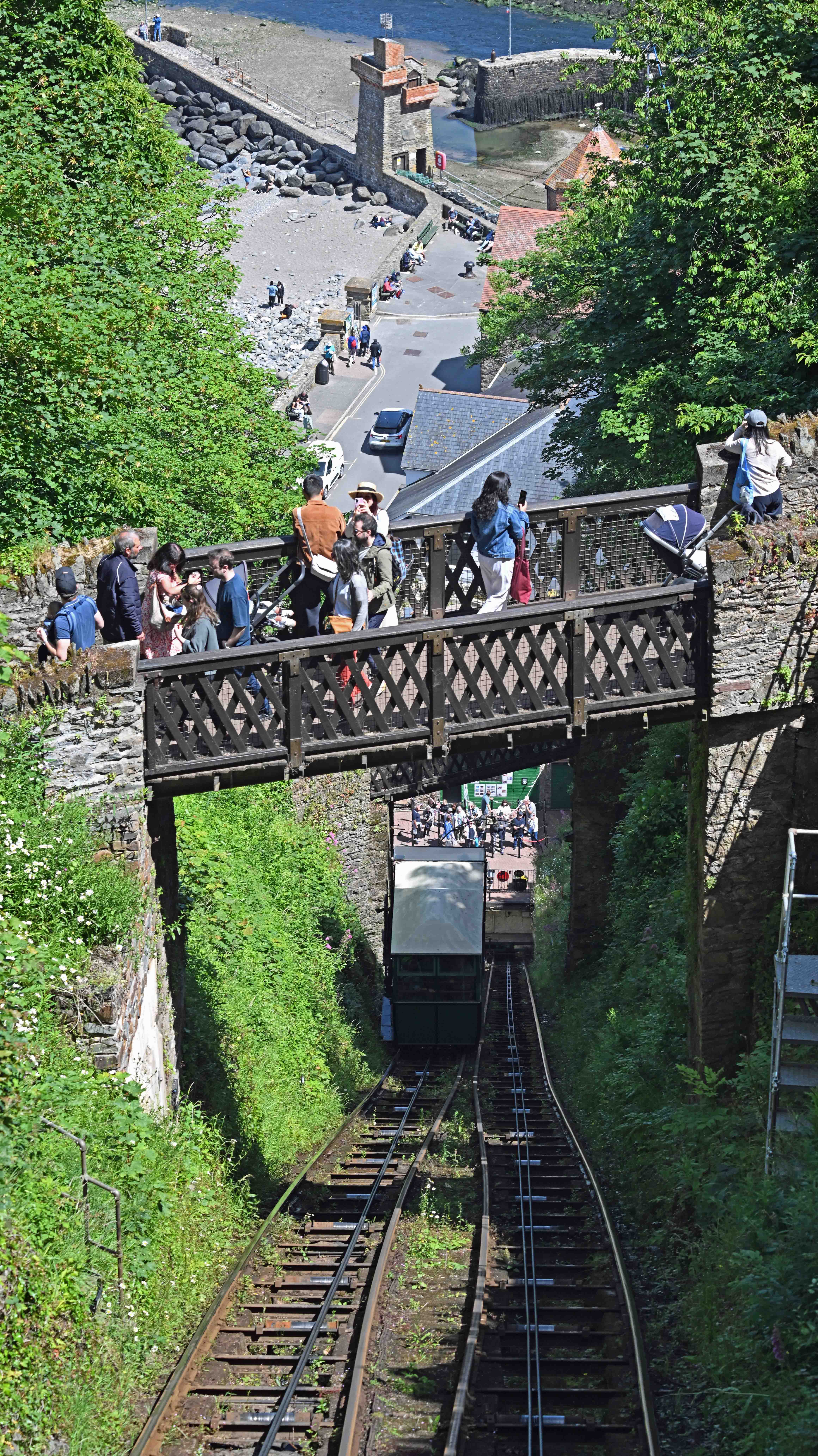
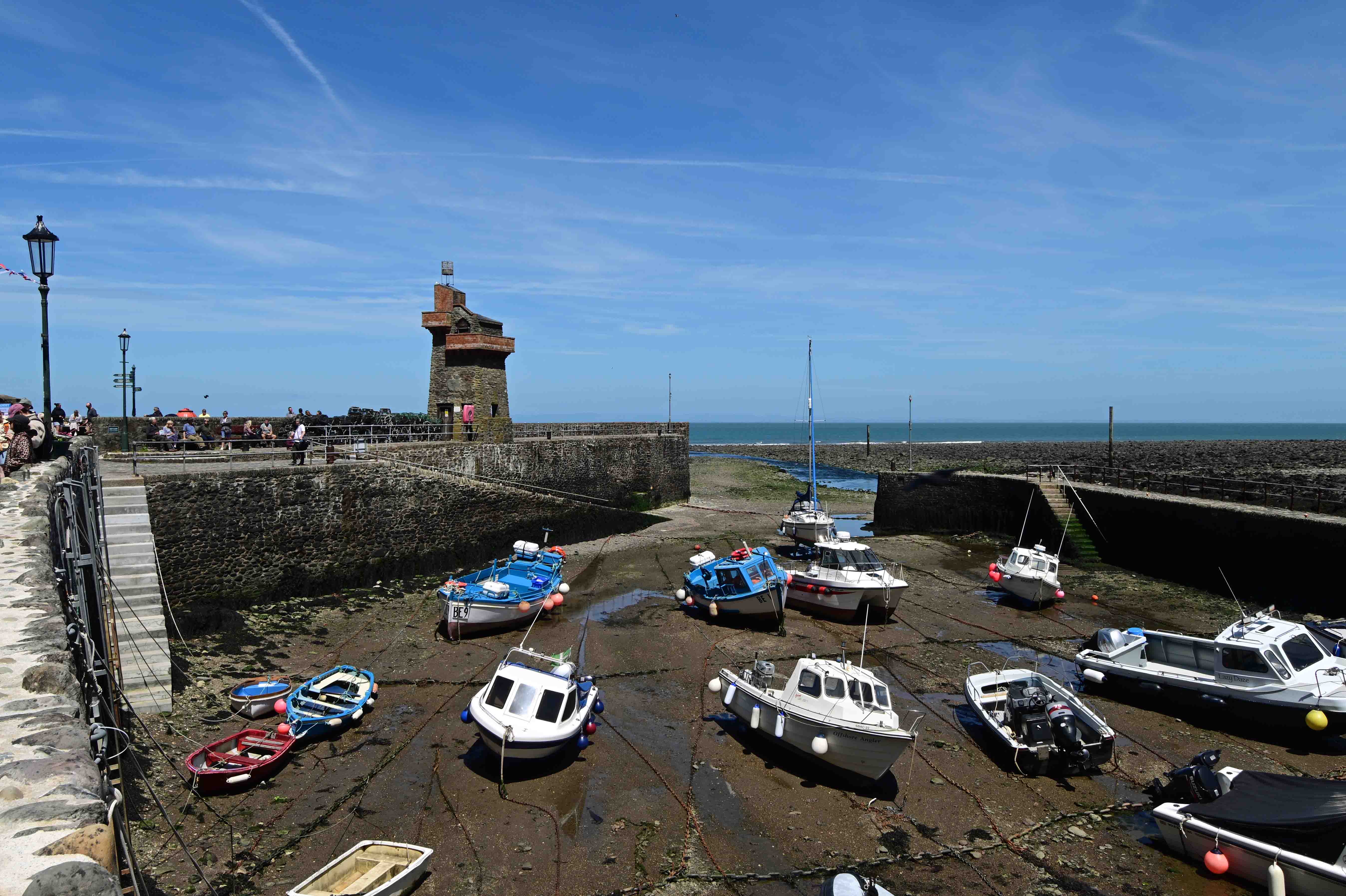
Our next port of call was the coastal town of Lynton, where we took the funicular railway down to Lynmouth. The funicular has the distinction of being the highest and steepest water worked railway in the world. Lynmouth itself is a pretty little harbour with a torrid past. In 1952 the village suffered a terrible flood which killed 34 people and left the place buried in mud. There’s little sign of the event now other than a small museum which tells the story of the tragedy.
Joining the funicular car at Lynmouth for a trip up to Lynton.When they said the funicular was steep, they weren’t kidding!Lynmouth harbour
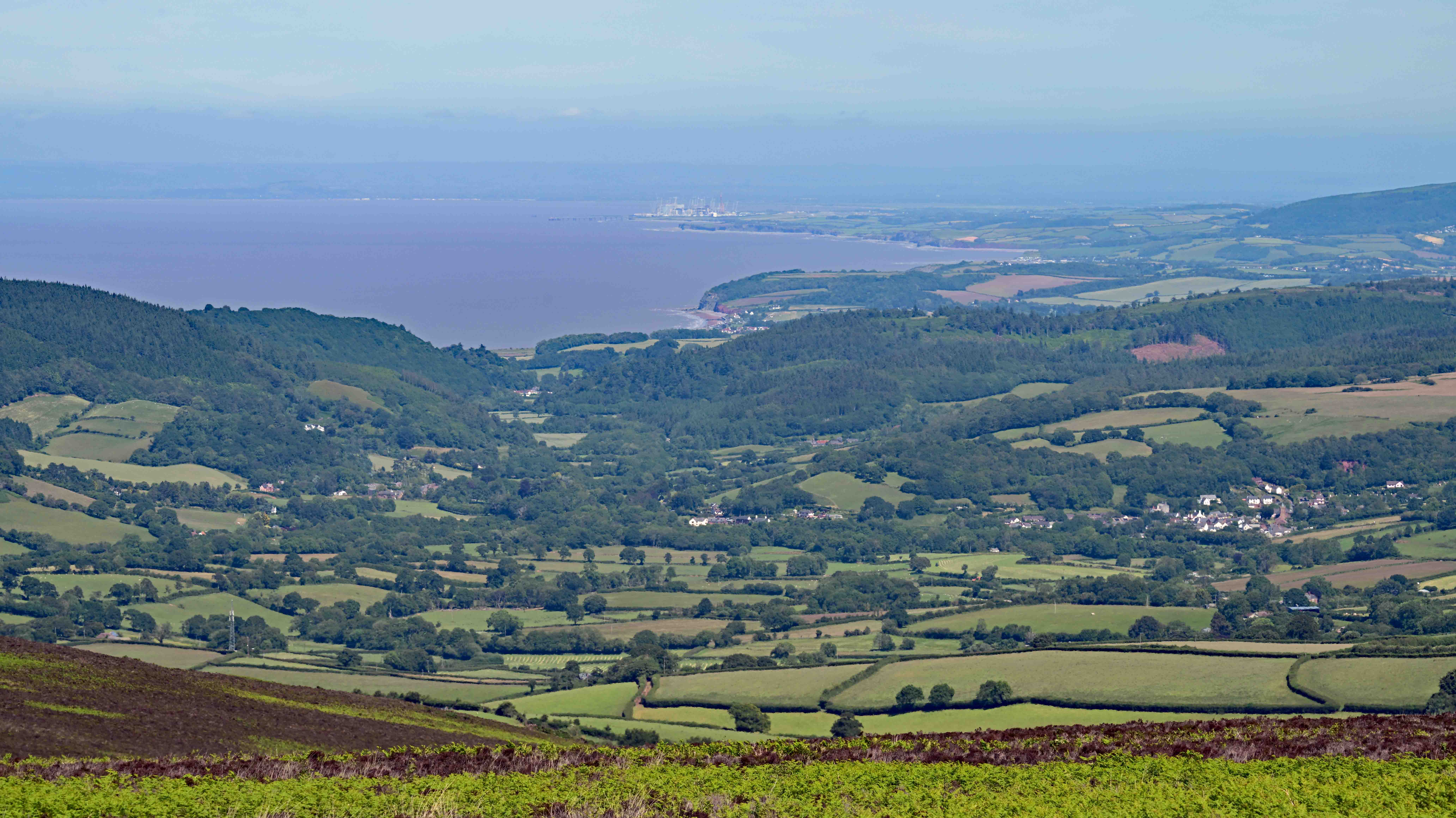
Having explored and filled ourselves with ice cream we set off again, this time to Exmoor , where we crossed the border into Somerset. There’s some fantastic views to be had from the moors. You can look across the Bristol channel to South Wales, or along the Somerset coast to spy places like Minehead and Hinkley nuclear power station.
Looking along the coast from Exmoor towards Minehead, with Hinkley nuclear power station in the distance
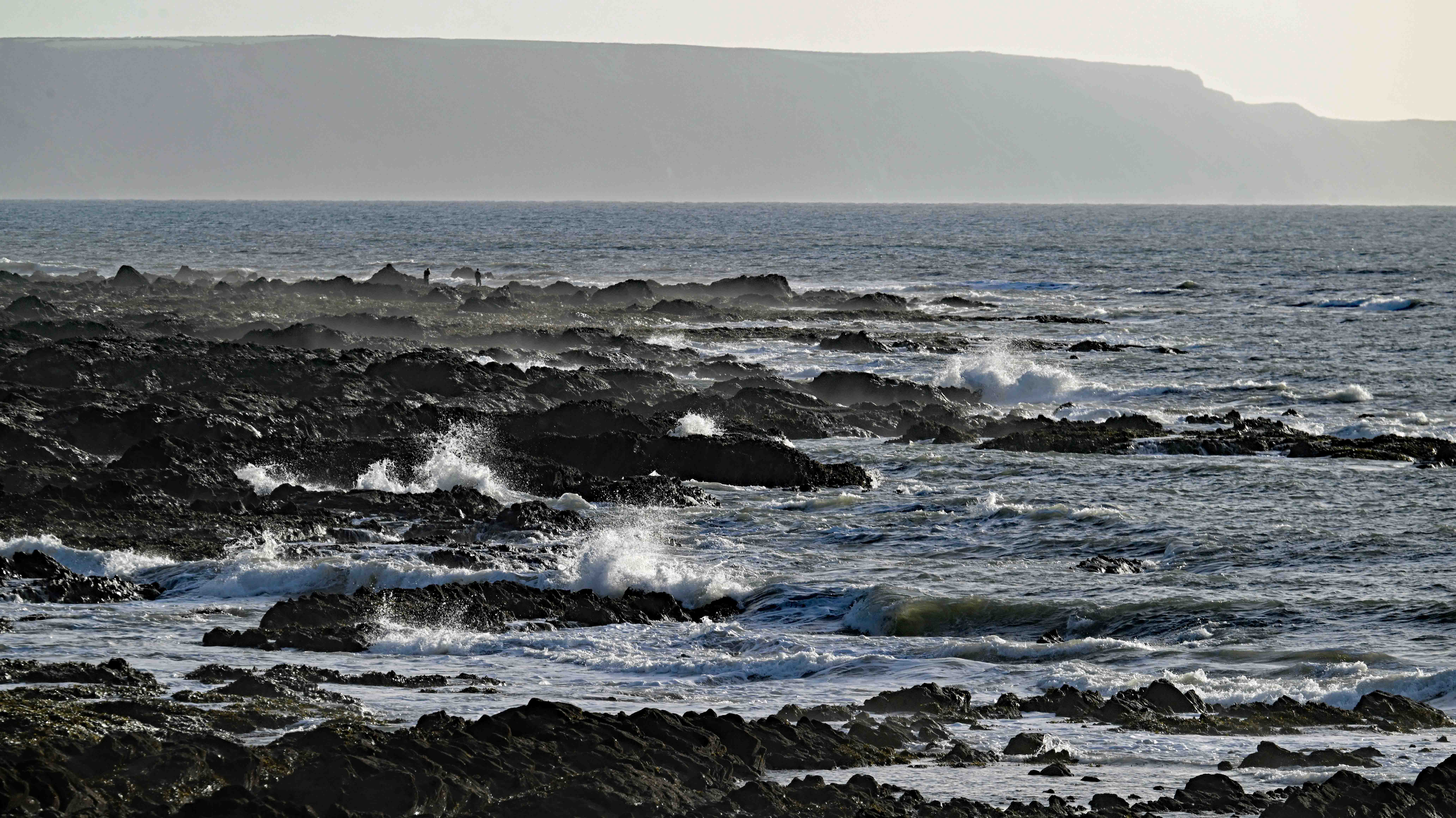
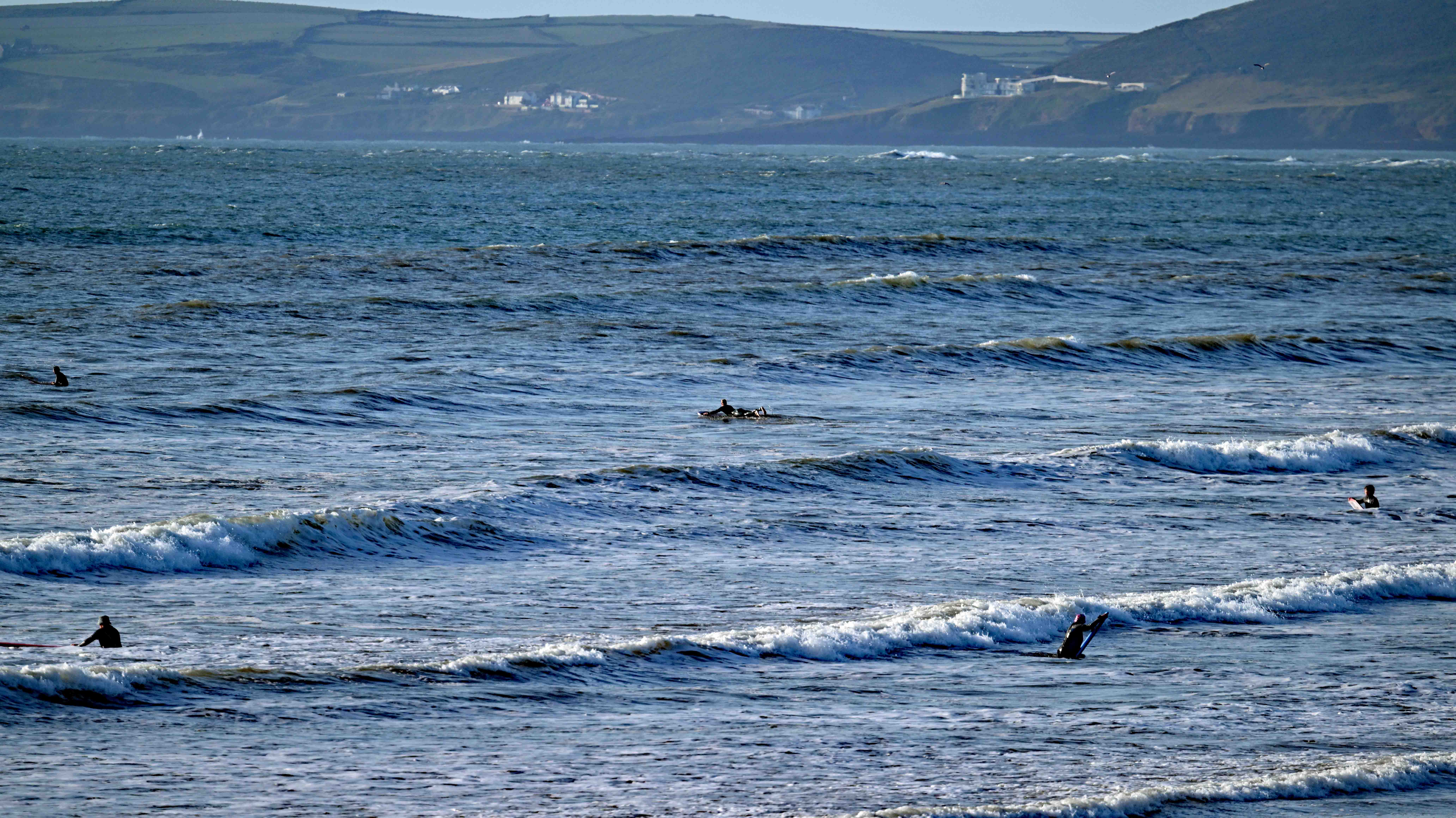
Having driven back to base the day ended with an evening out at Westward Ho! where we enjoyed a few drinks by the beach before tucking into fish and chips. Well, what else should you eat besides the sea!
Low tide at Westward Ho! with the wind driving the sea onto the rocks.In the opposite direction, surfers hope to catch a few waves.
I’ve a small favour to ask… If you enjoy reading this or any of the other blogs I’ve written, please click on an advert or two. You don’t have to buy anything you don’t want to of course – although if you did find something that tickled your fancy that would be fab! – but the revenue from them helps me to cover some of the cost of maintaining this site (which isn’t cheap and comes out of my own pocket). Remember, 99% of the pictures used in my blogs can be purchased as prints from my other website – https://paulbigland.zenfolio.com/
The weather here in Devon picked up again on Friday. We still saw mixed skies and the occasional light shower, but sunshine was a constant visitor throughout the day and temperatures were ideal for walking – which is what we did.
Today’s plan was to walk more of the Tarka trail, this time South from Bideford to Torrington, a distance of about 6 miles. Clive had some work to do which left our trio (Dawn, Ann and I) to complete the trek and meet Clive for tea and cake at the other end.
Here’s a few pictures from the walk.
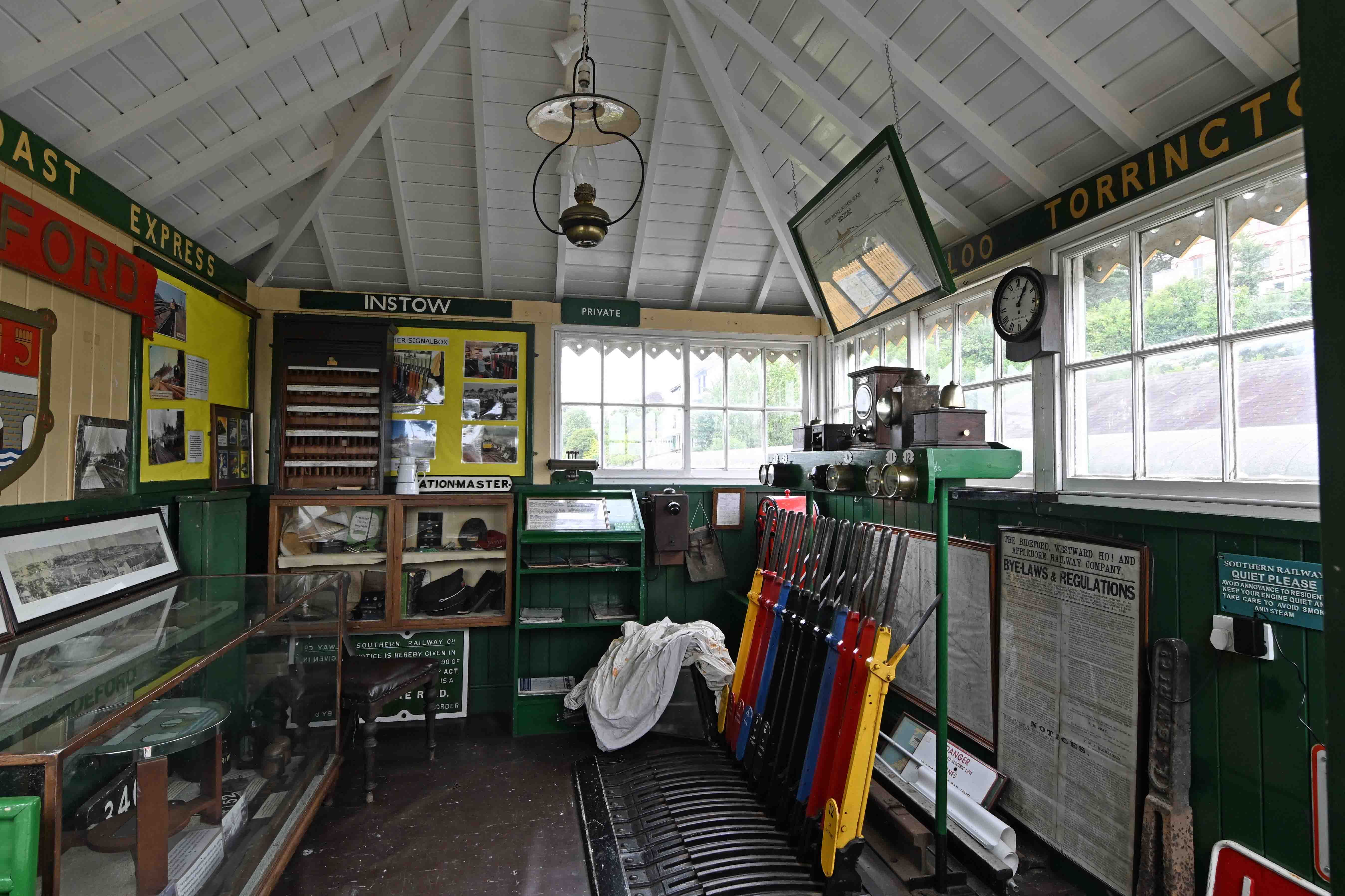
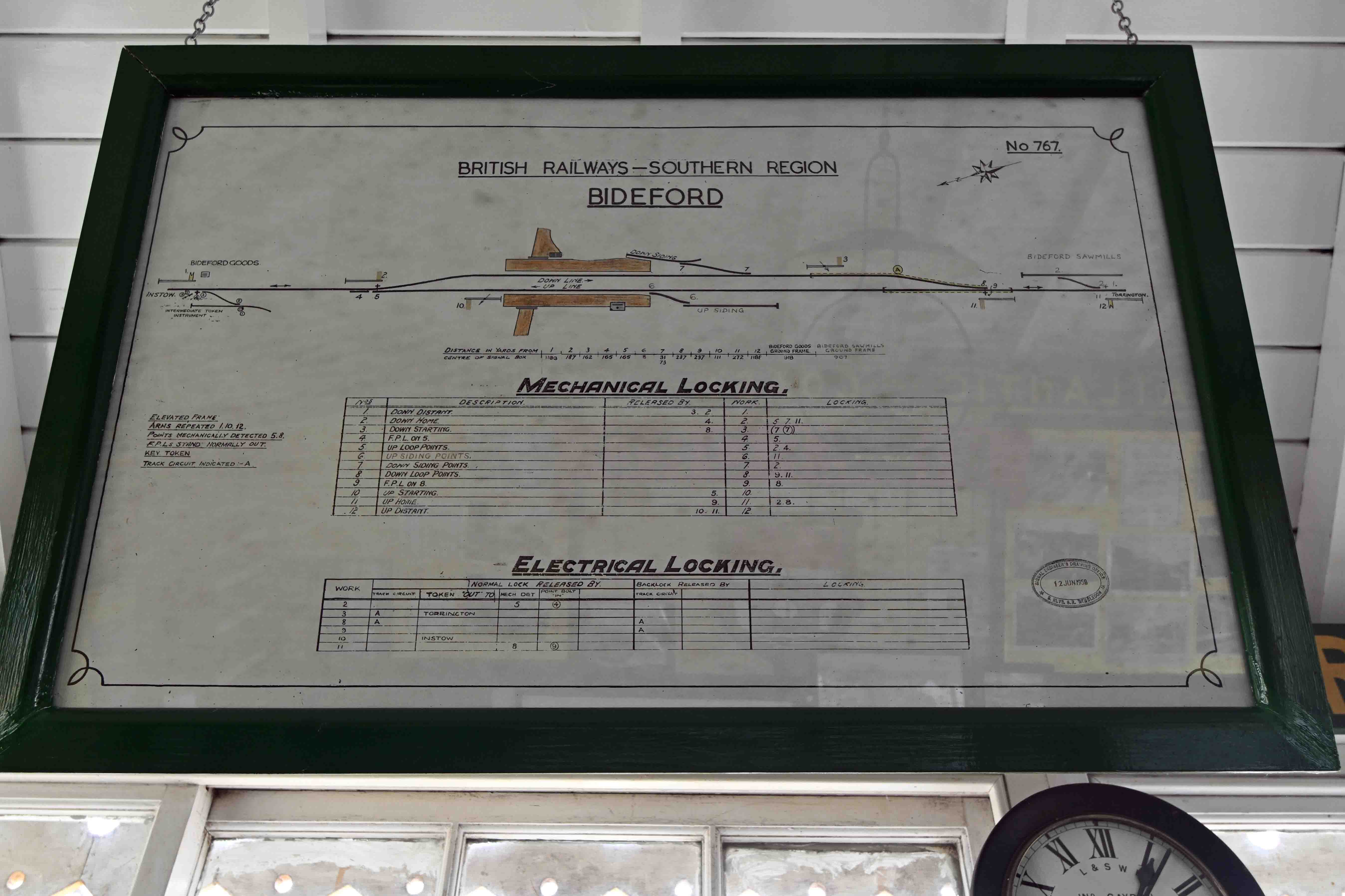
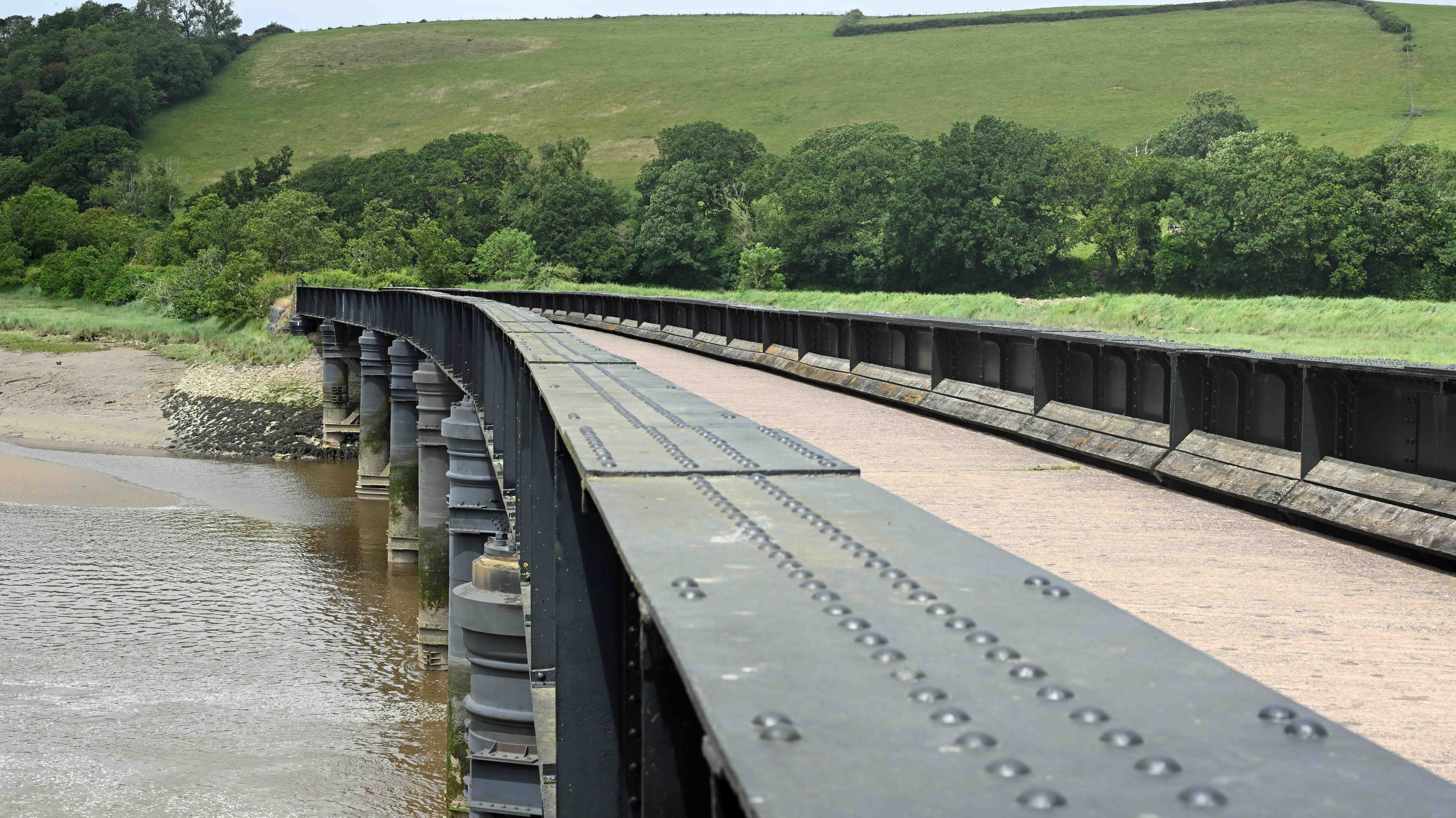
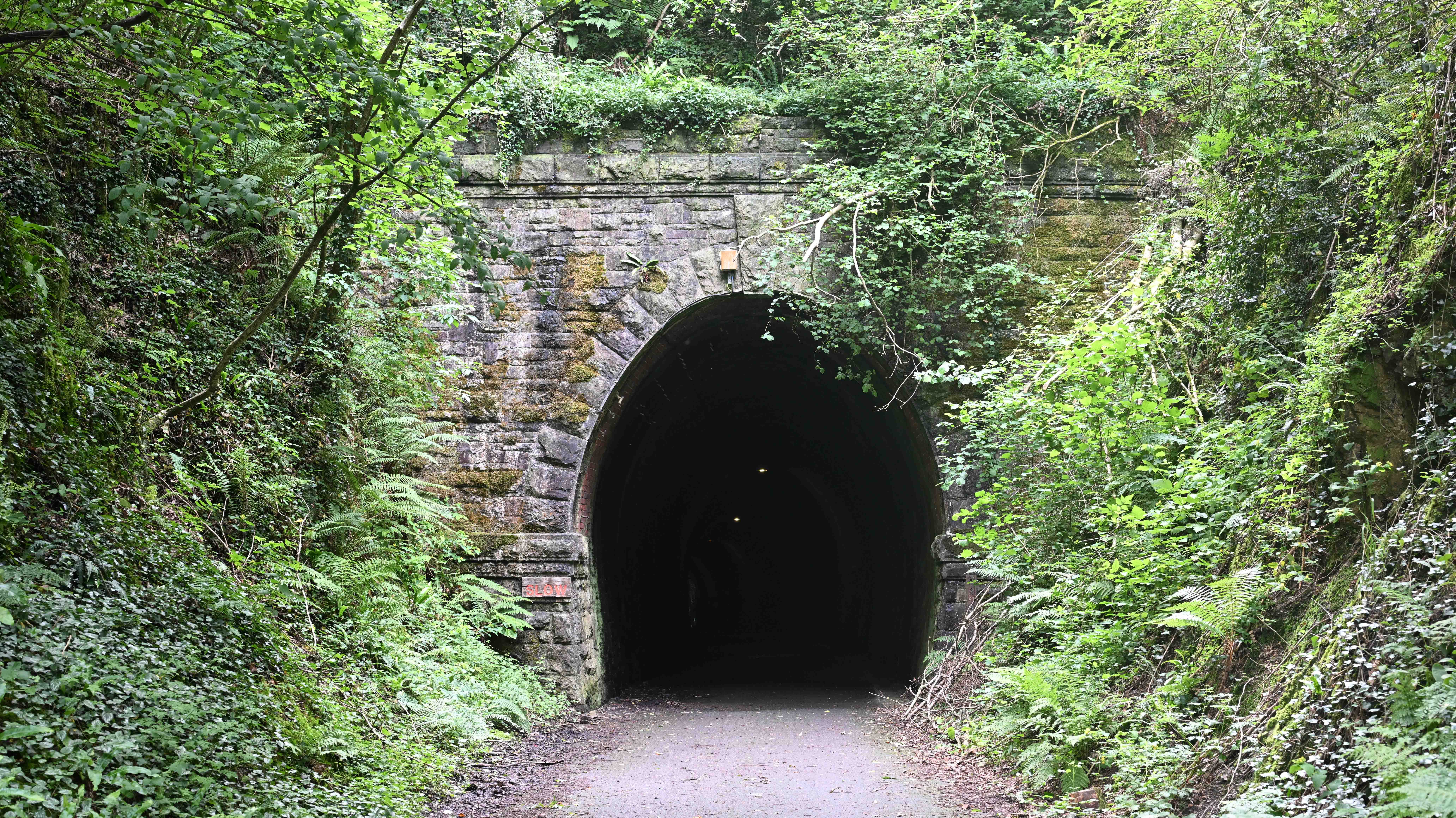
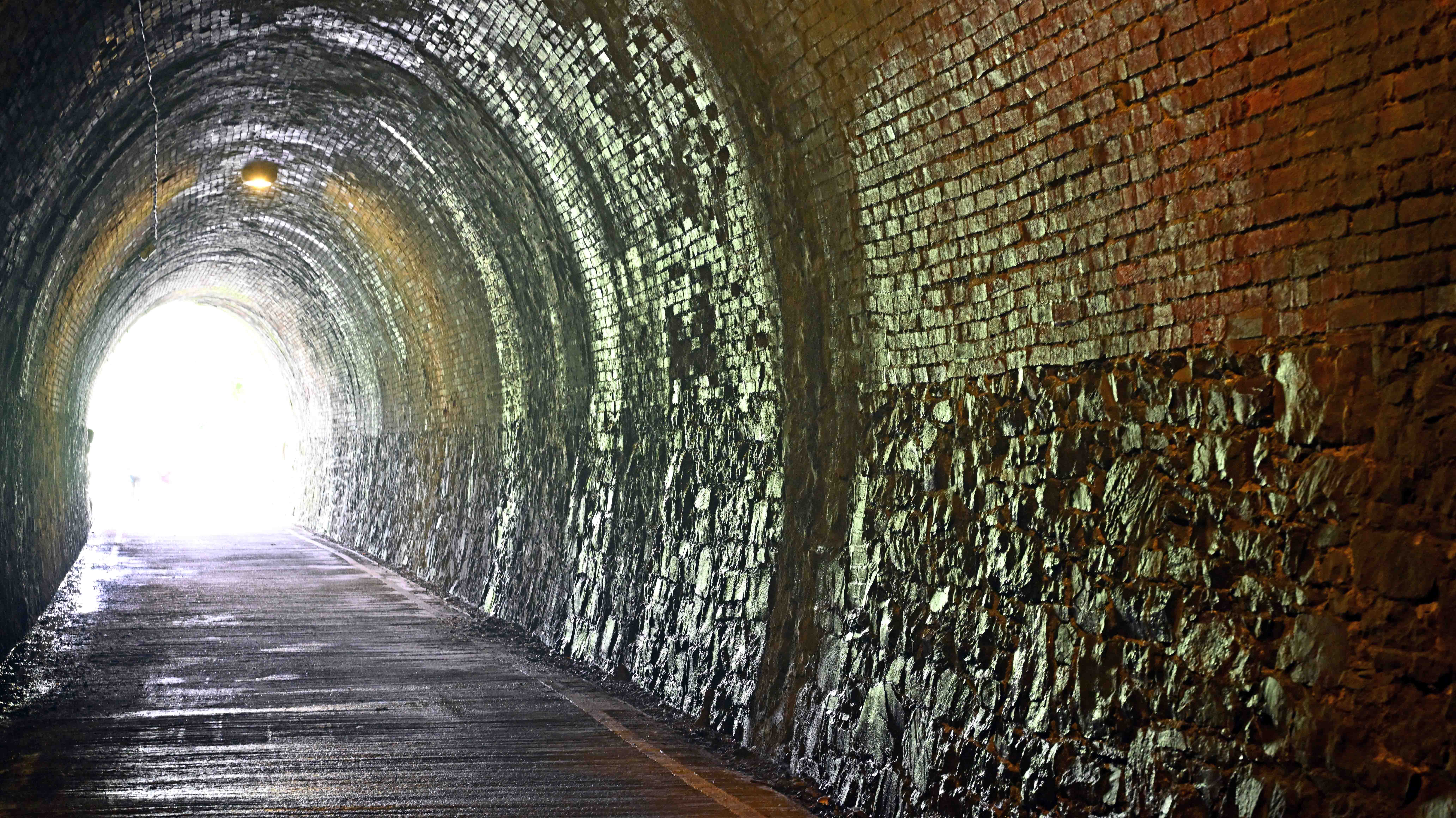
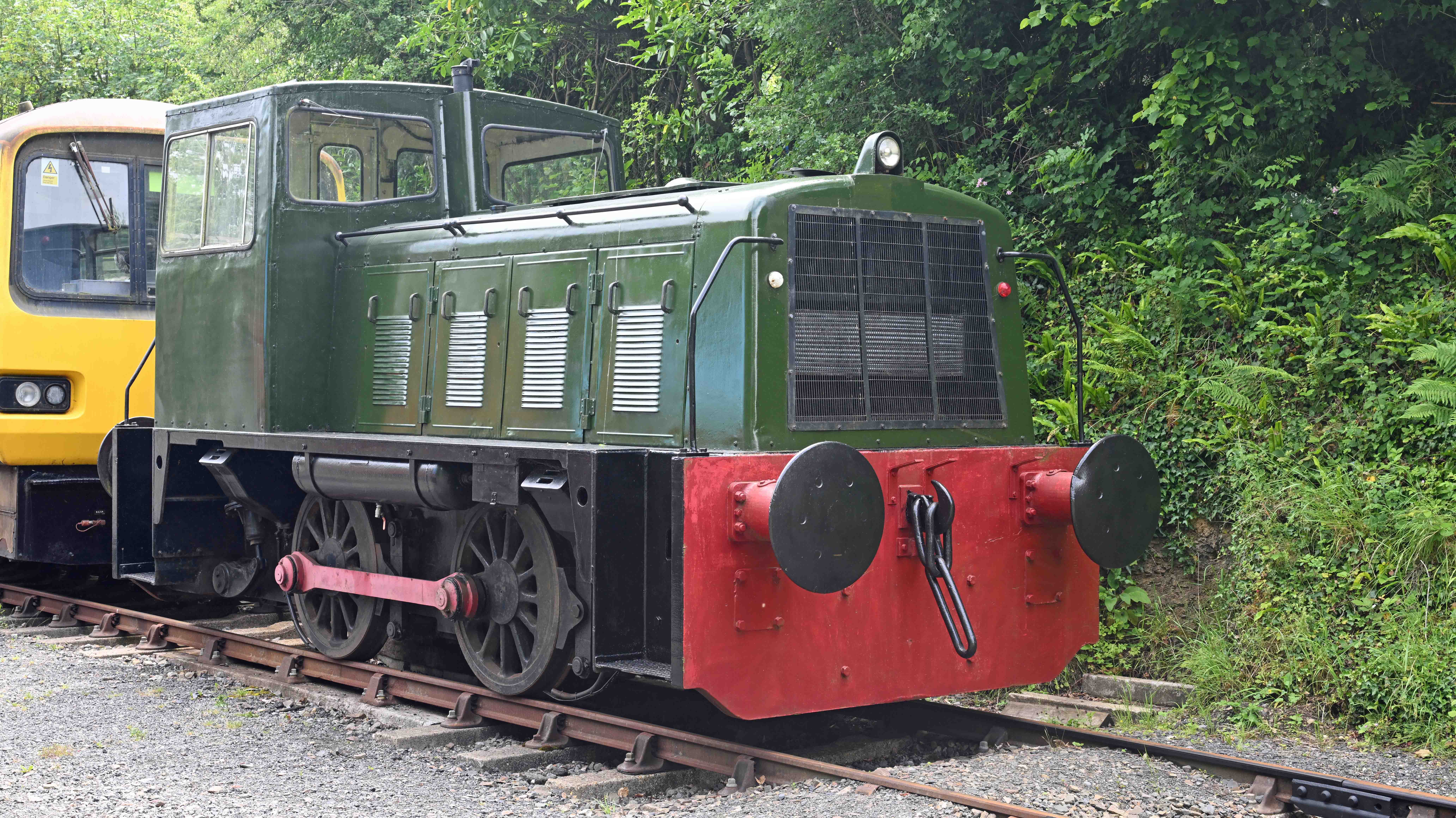
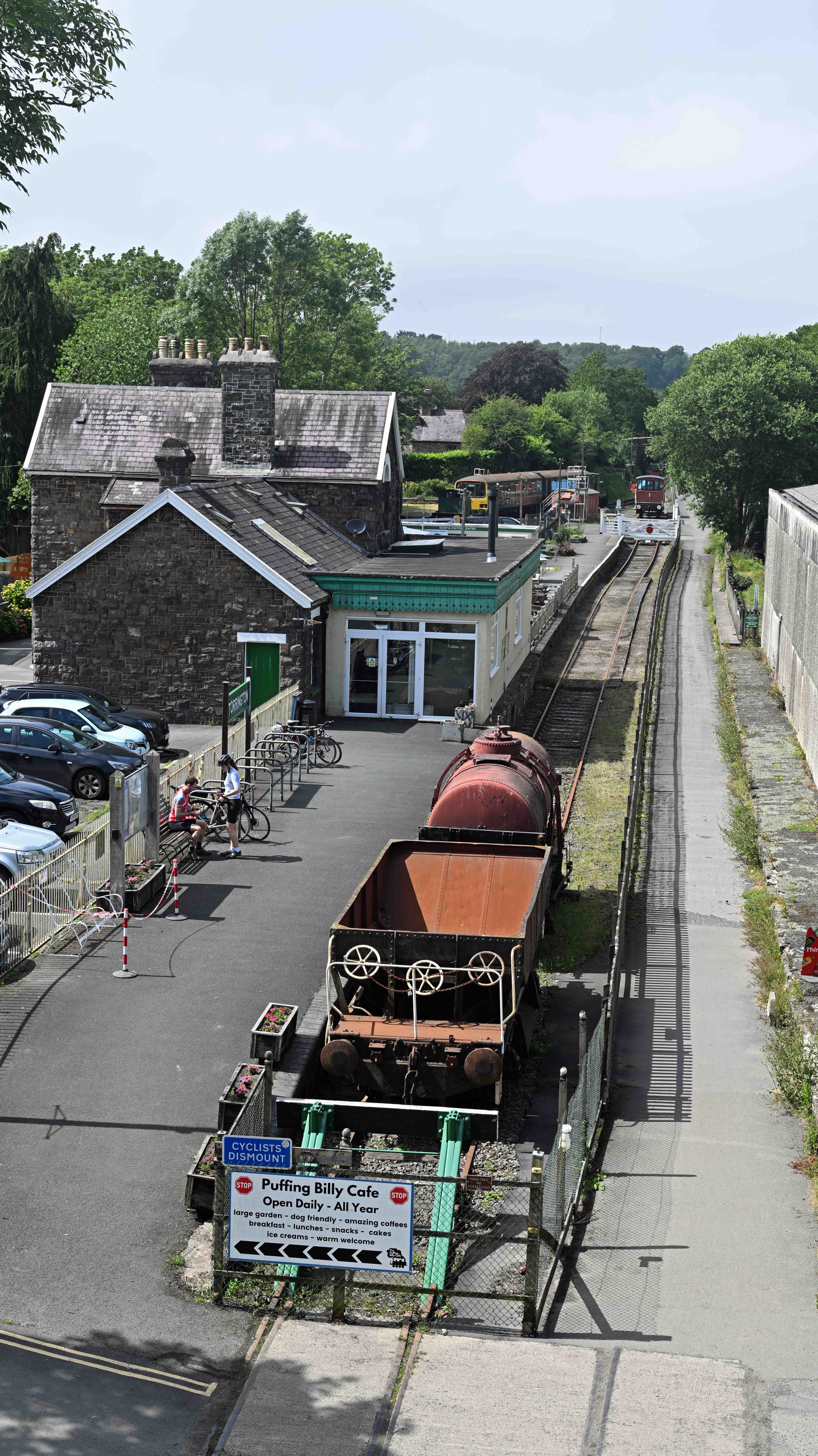
We joined the Tarka trail at Bideford station, where the old signalbox museum was open. Here’s a look inside. The signalling diagram for Bideford station, showing the old track layout. The railway bridge over the River Torridge is a great place to stop and watch the wildlife on land and sea. There’s a short tunnel on the section between Torrington and Bideford which is fun to walk through. It’s well lit, so not too spooky!Inside the tunnel, showing the mixture of construction techniques. There’s plenty of wildlife en-route, including butterflies like this. Torrington is the site of the Tarka Valley Railway. They have a couple of old industrial diesel shunters and an ex- GWR Class 143 ‘Pacer’ DMU. This is a Ruston and Hornsby 0-4-0 built in February 1969 as a 192hp diesel electric shunter. Works number 544998, it was last standard gauge locomotive built by the company. It was delivered new to the Nevils Dock and Railway Company in Llanelli where it continued to work until 1990. Torrington station contains the Puffing Billy cafe which offers a range of snacks, drinks and meals. The station was once an important freight location, sending two daily trains of milk tankers to London Waterloo station.
I’ve a small favour to ask… If you enjoy reading this or any of the other blogs I’ve written, please click on an advert or two. You don’t have to buy anything you don’t want to of course – although if you did find something that tickled your fancy that would be fab! – but the revenue from them helps me to cover some of the cost of maintaining this site (which isn’t cheap and comes out of my own pocket). Remember, 99% of the pictures used in my blogs can be purchased as prints from my other website – https://paulbigland.zenfolio.com/
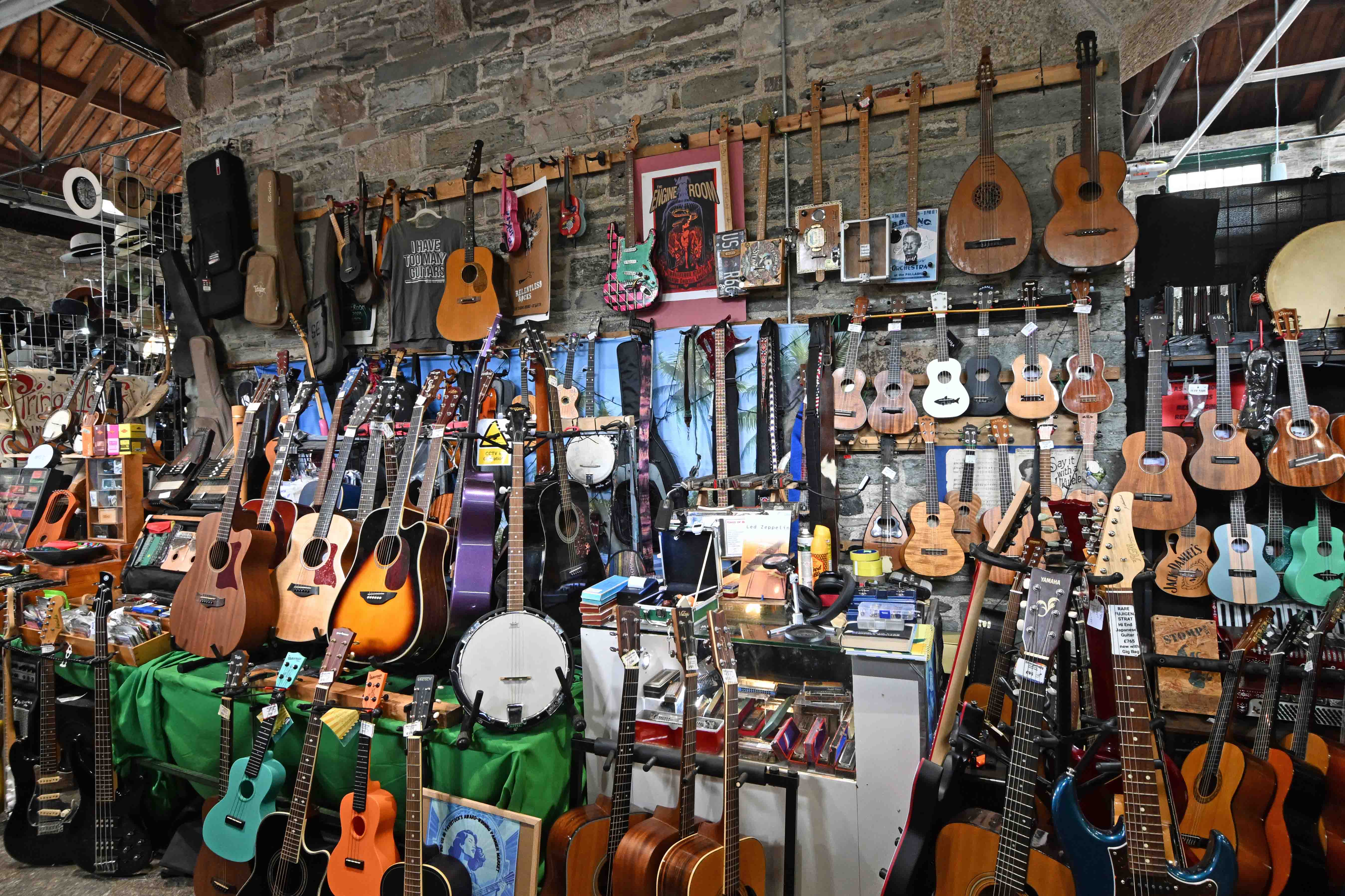
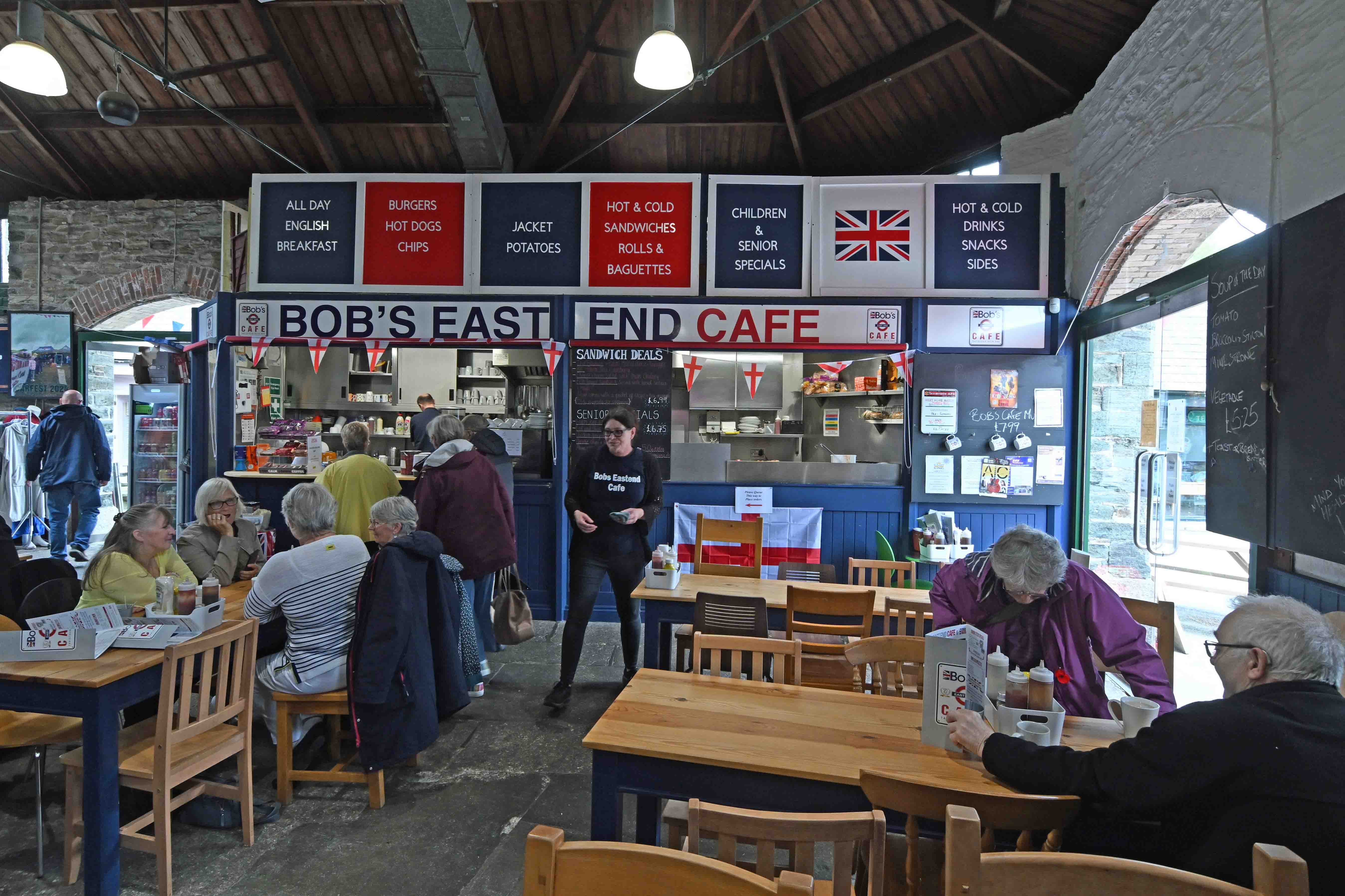
Our third day in Devon was less about trekking and more about touring – although we still managed an old railway walk! Clive drove the three of us over to Tavistock, a lovely old town neither Dawn nor I had ever visited before. Tavi’ has a fantastic indoor market which is well worth a visit. It certainly separated us from some money!
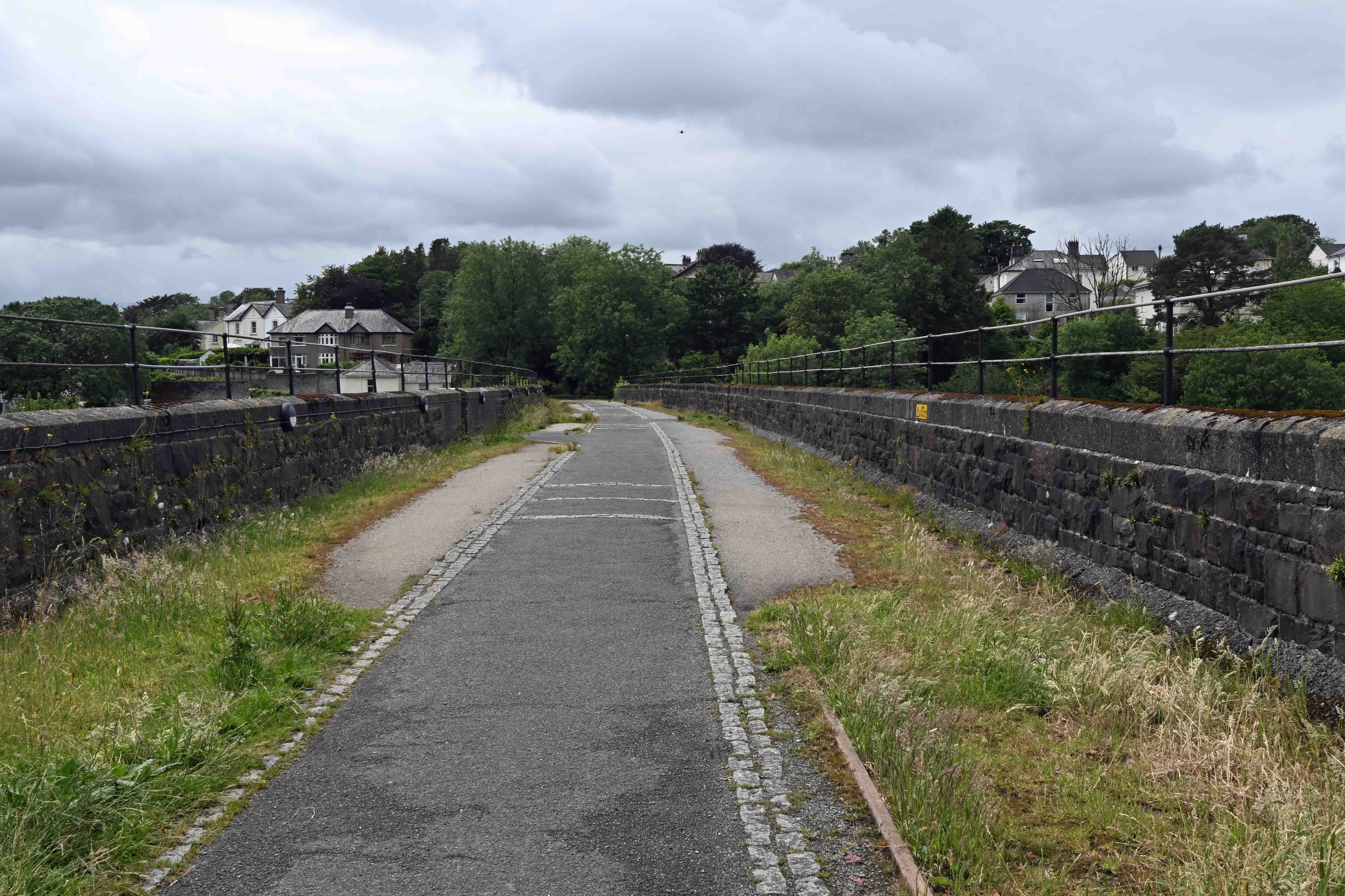
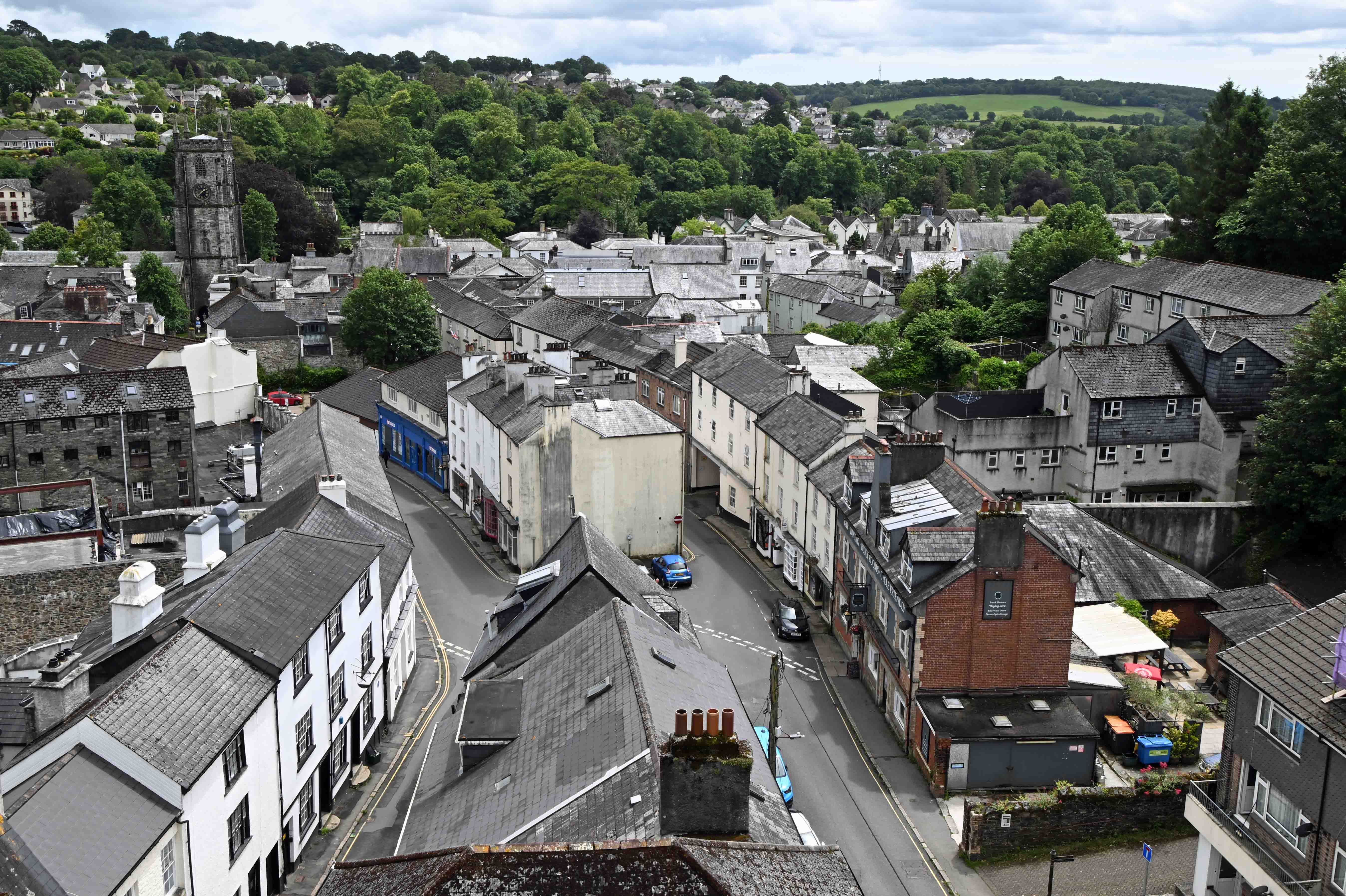
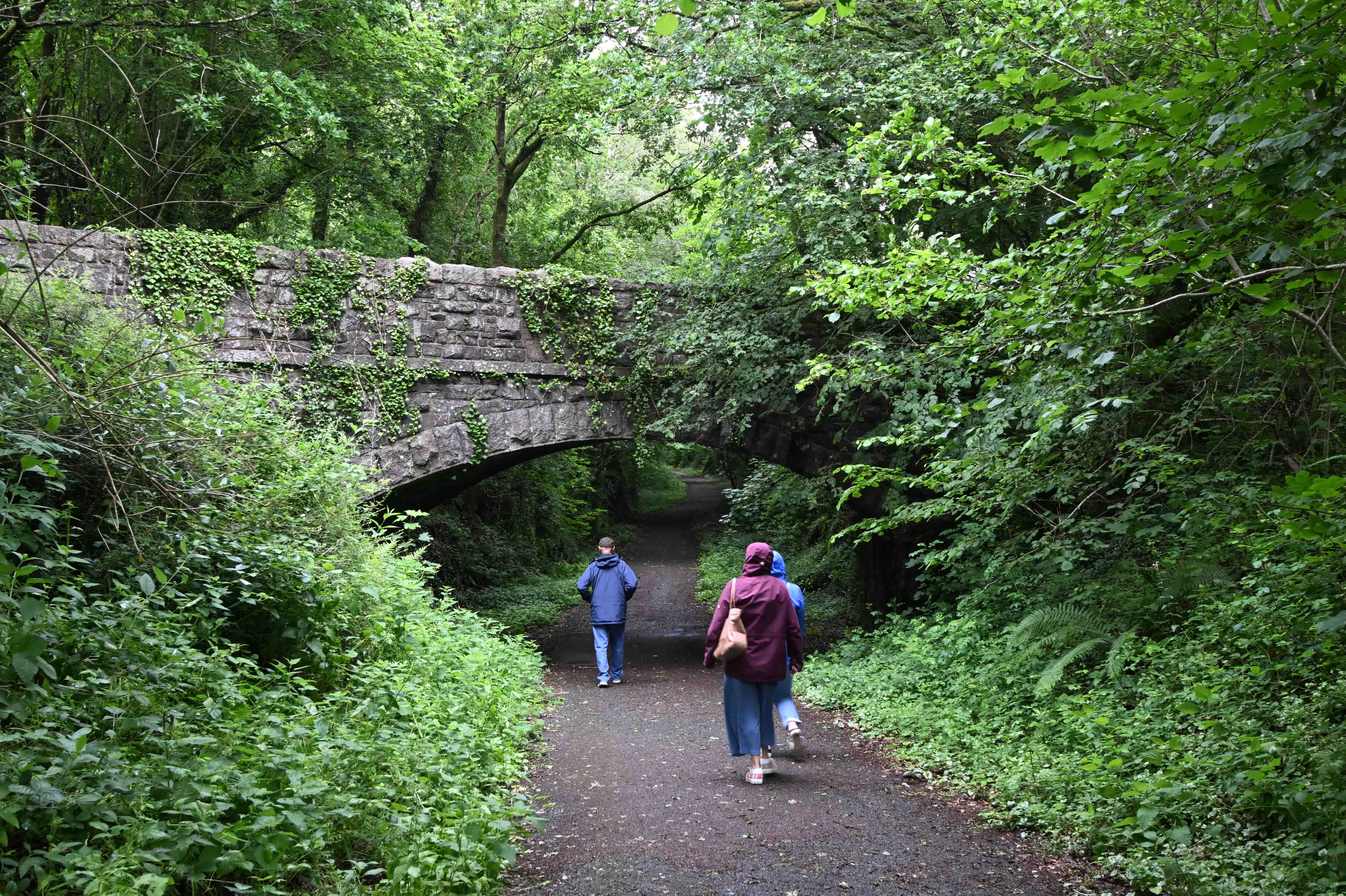
Tavistock once had two railway lines serving the town. Both have been closed. Tavistock South was on a line from Plymouth owned by the Great Western Railway whilst Tavistock North was part of the London and South Western Railway. The LSWR was built above the town, which it crossed on on a high viaduct. This is now part of a cycle and walking trail which offers good views across town.
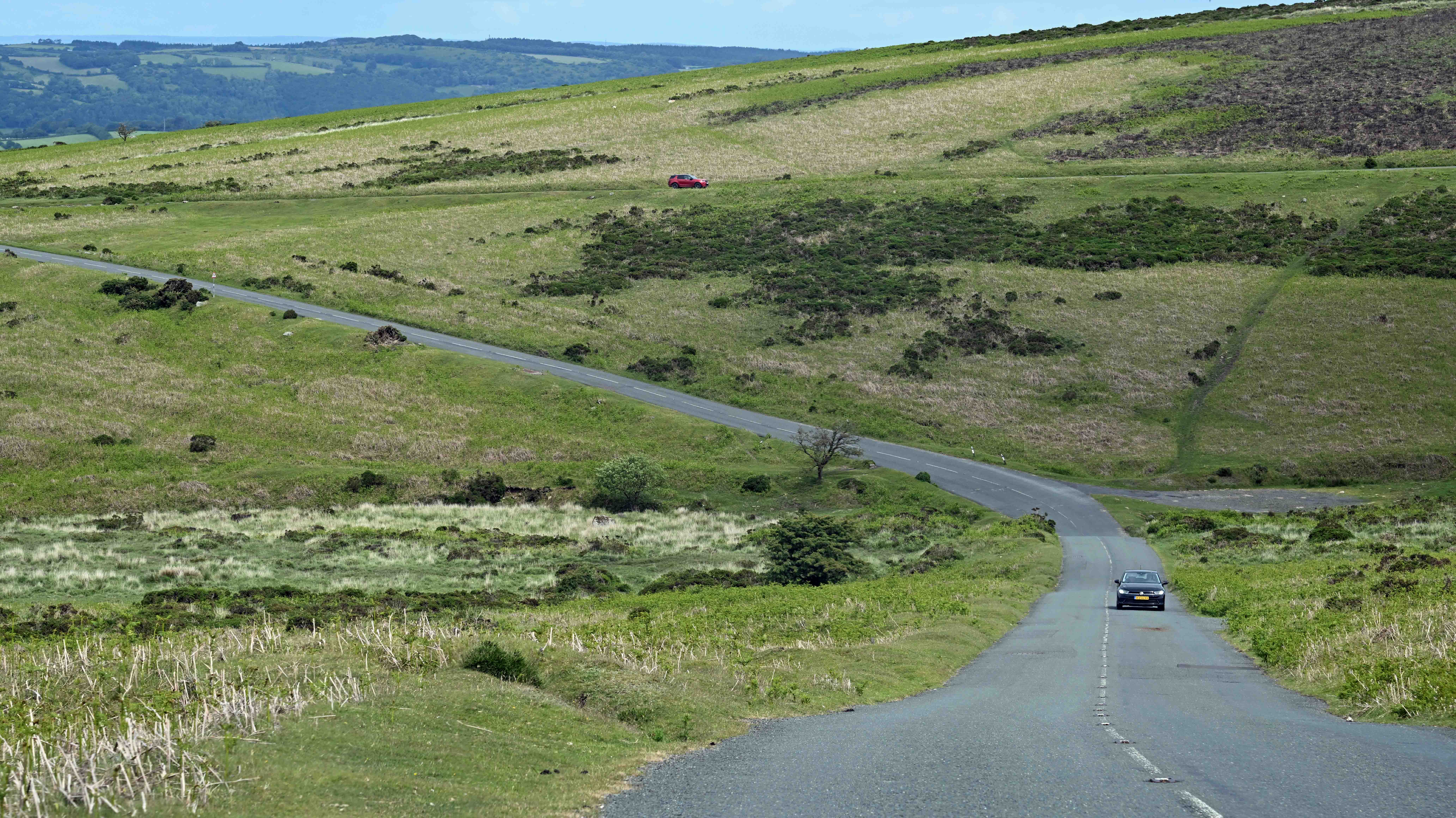
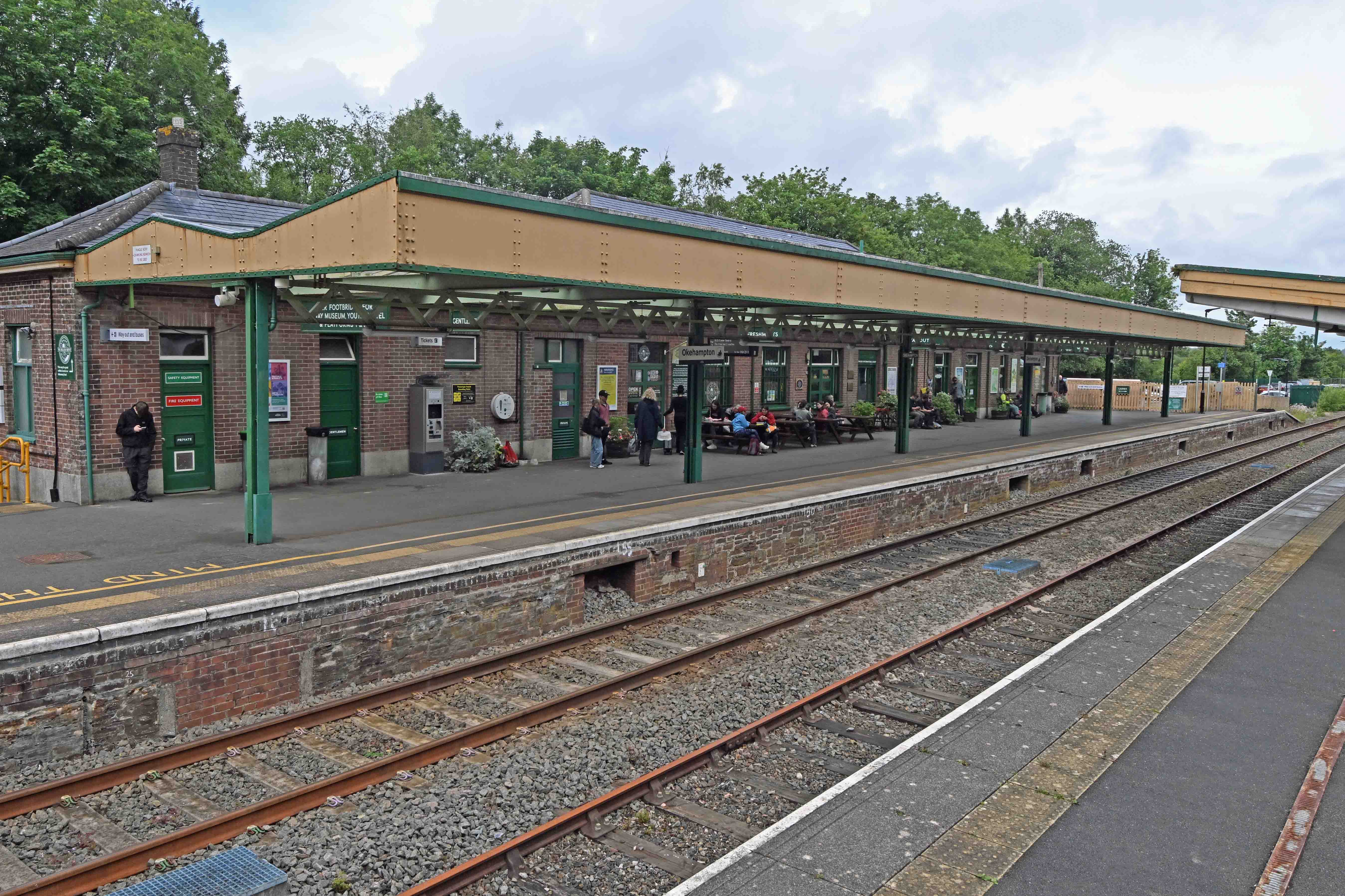
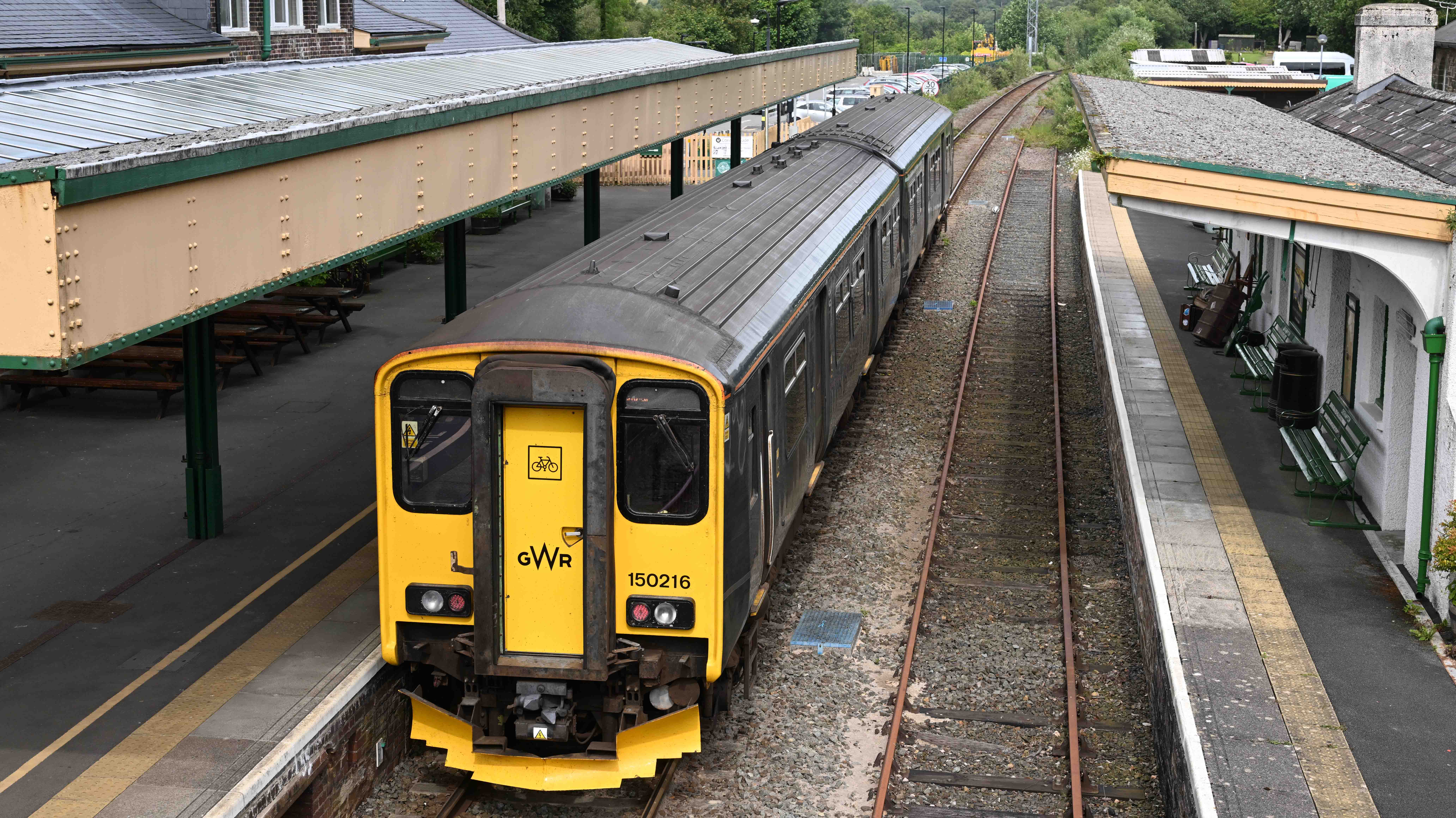
Moving on from Tavi we had a tour of Dartmoor which is reminiscent of North Yorkshire. After which we called in at Okehampton, where the town was restored to the national railway network in 2021. Here’s a few pictures from our travels…
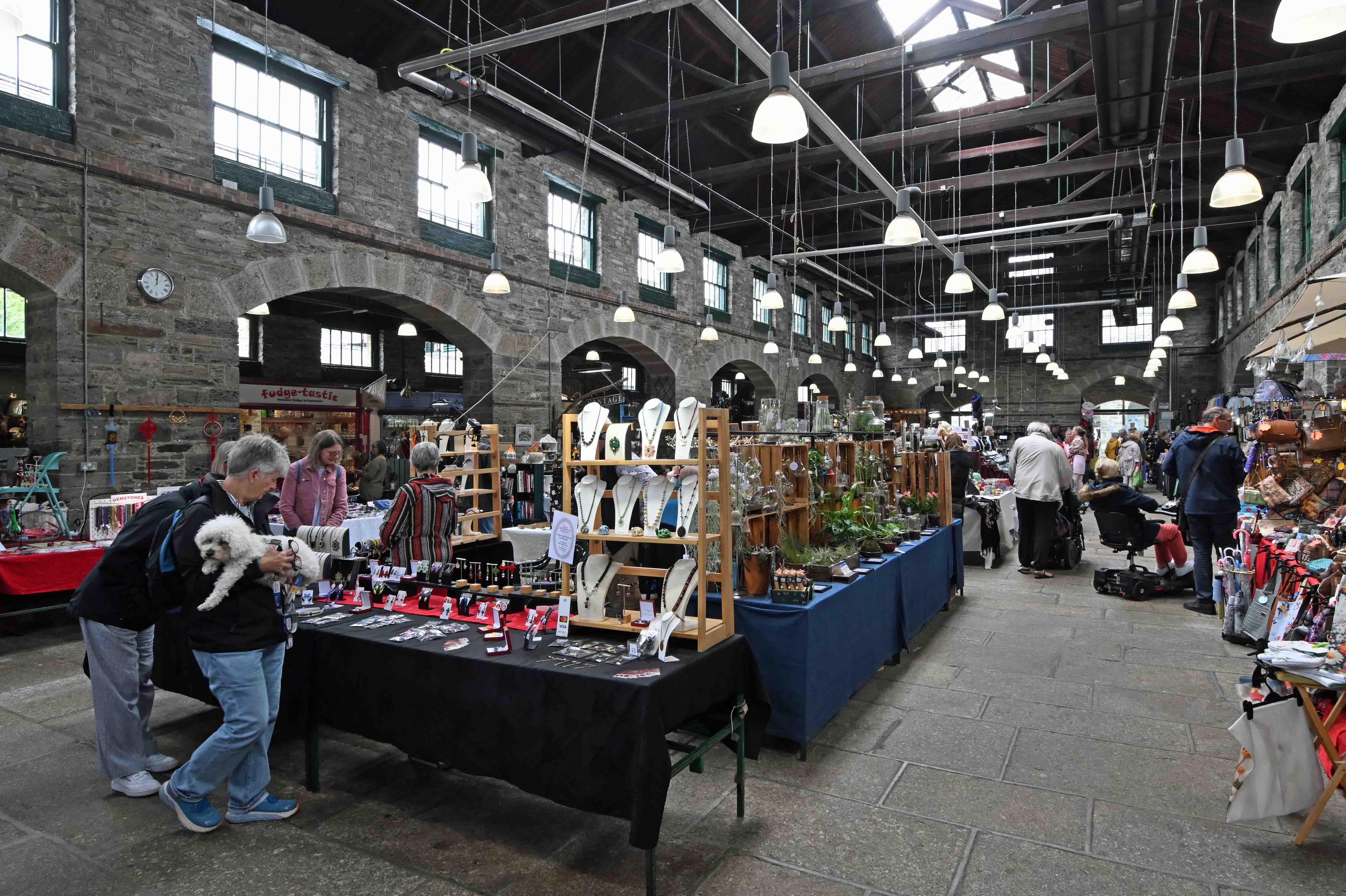
Inside Tavistock’s Pannier market. There’s a great selection of stalls selling all sorts of stuff, old and new…Need a guitar or ukulele?Bob’s East End cafe in the Pannier market. A great place for an all day breakfast at very reasonable prices. The LSWR viaduct in central Tavi was completed in 1890. It’s 420ft (128m) long and is made up of eight spans; five of 50ft (15m) and three of 32ft, (10m) with a height of 70ft (21m) to the road below. The old station is behind the camera but access is restricted as it’s now a private dwelling.The view from the viaduct looking over town. Walking along the old line. The trackbed has been raised in many places. – hence the low height of the overbridge. Dartmoor. You can see why they built a prison up here…Okehampton station has been restored and repainted in Southern railway colours, although…The Great Western Railway had the last laugh as the current train service to Exeter is operated by the GWR franchise – until it’s absorbed into the nationalised Great British Railways anyway…
I’ve a small favour to ask… If you enjoy reading this or any of the other blogs I’ve written, please click on an advert or two. You don’t have to buy anything you don’t want to of course – although if you did find something that tickled your fancy that would be fab! – but the revenue from them helps me to cover some of the cost of maintaining this site (which isn’t cheap and comes out of my own pocket). Remember, 99% of the pictures used in my blogs can be purchased as prints from my other website – https://paulbigland.zenfolio.com/
Day 2 of our trip saw us on another long walk whilst visiting some historic places with rich social histories. Clive drove us to Westward Ho! the only place with an exclamation mark in its name. The name came from a Charles Kingsley book, titled Westward Ho! It was a best seller and brought a new wave of tourism to the Bideford area leading to the creation of the village, which has grown considerably in recent years.
Our walk took us along the coast on the trackbed of an old railway that I’d never heard of before. This was pretty unique too as it’s possibly the only standard gauge passenger railway that was never connected to the national network. The Bideford, Westward Ho! and Appledore railway had a very short life. It opened in 1901 and closed in 1917. Having walked along part of its route along the cliffs I’d have thought it would have made a great preserved railway and tourist attraction, but it never survived World War 1.
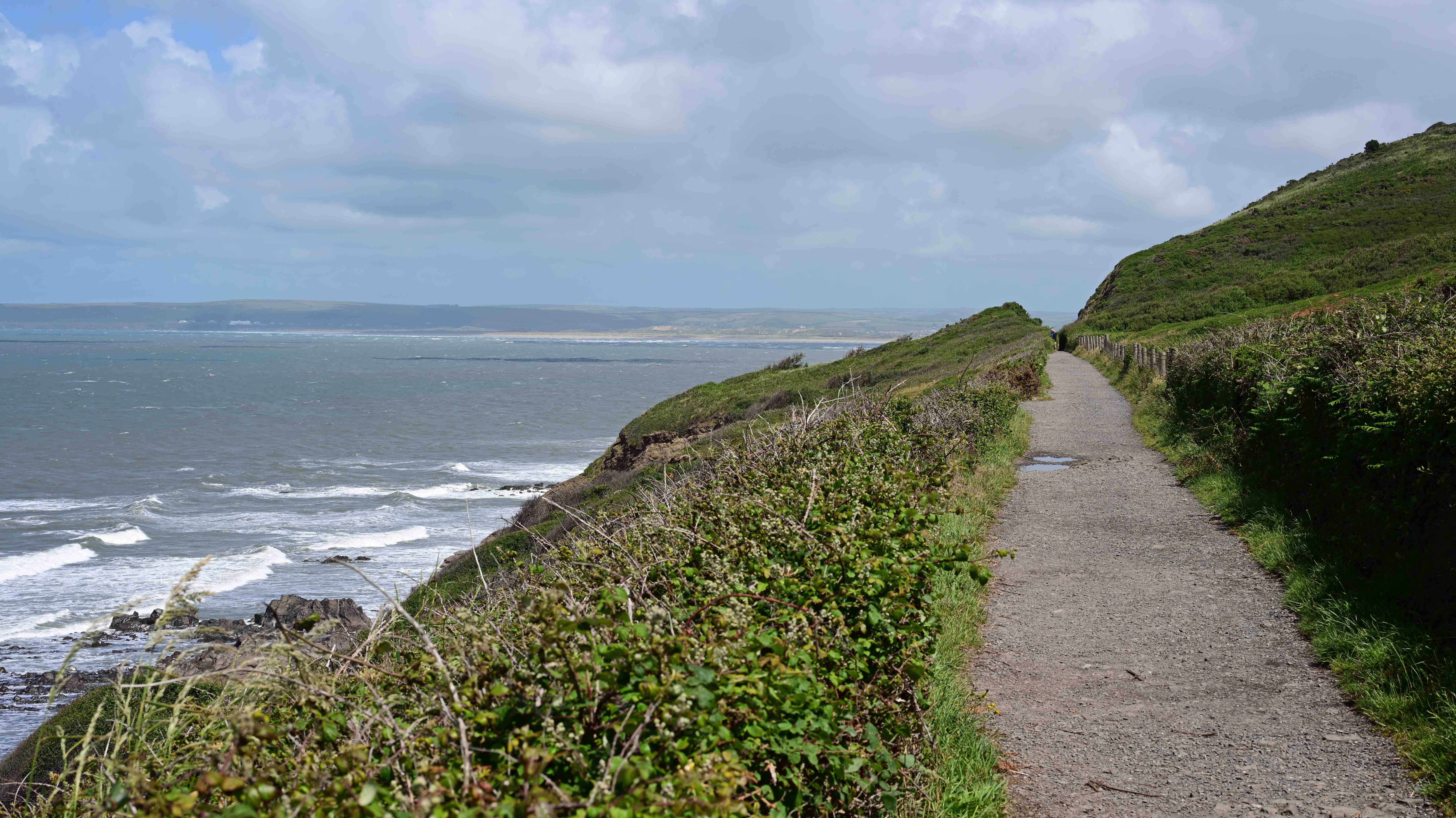
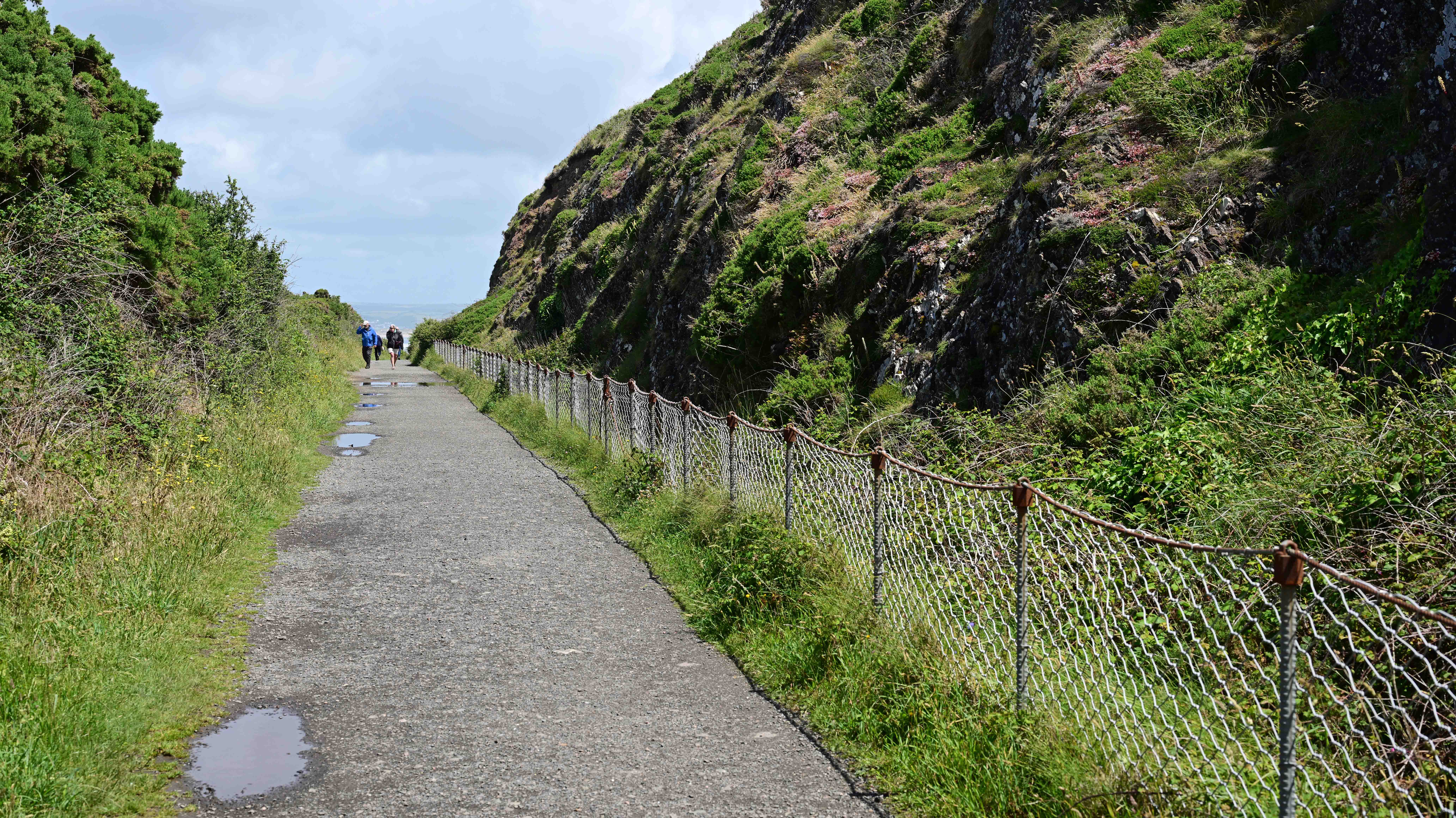
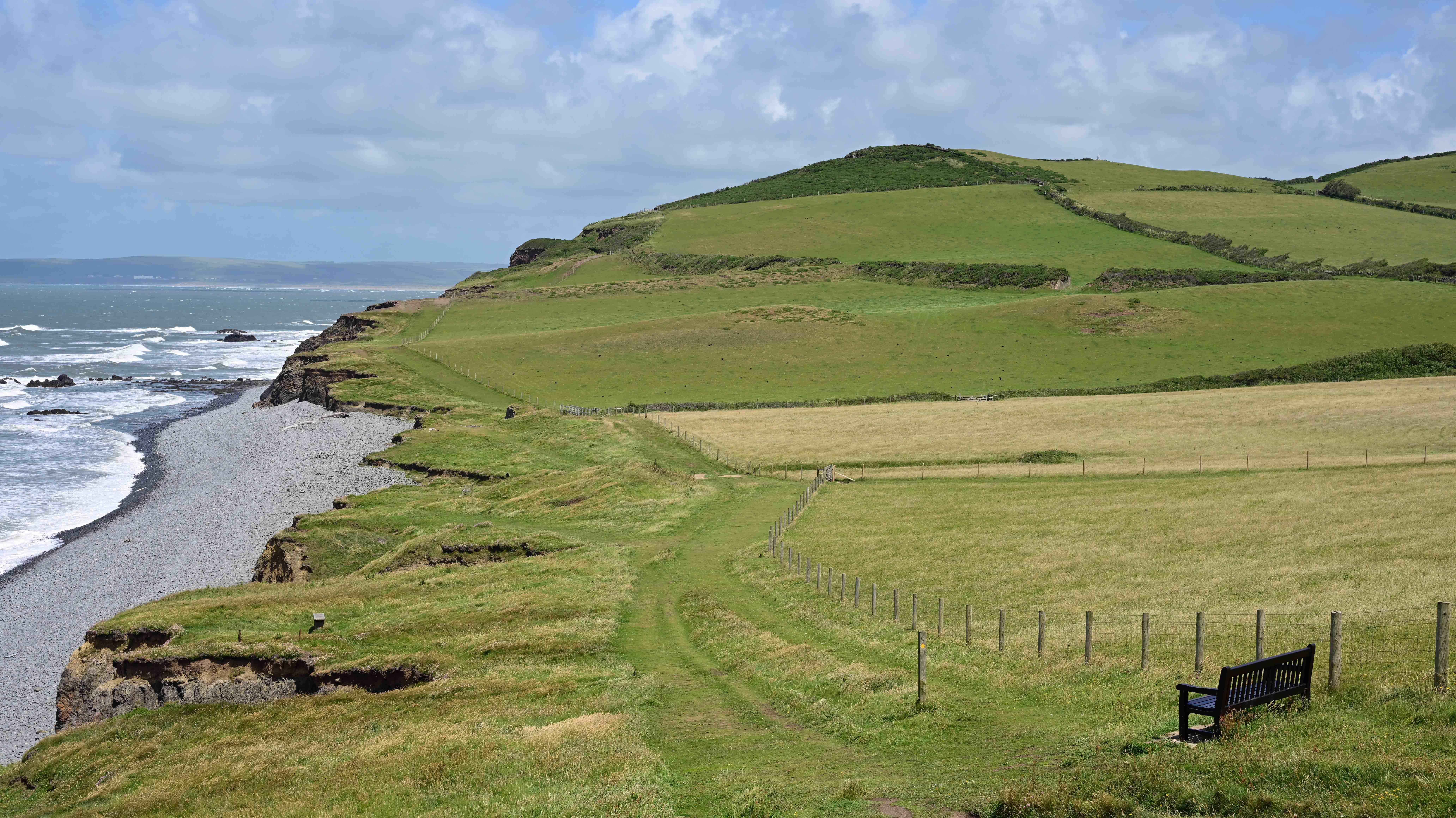
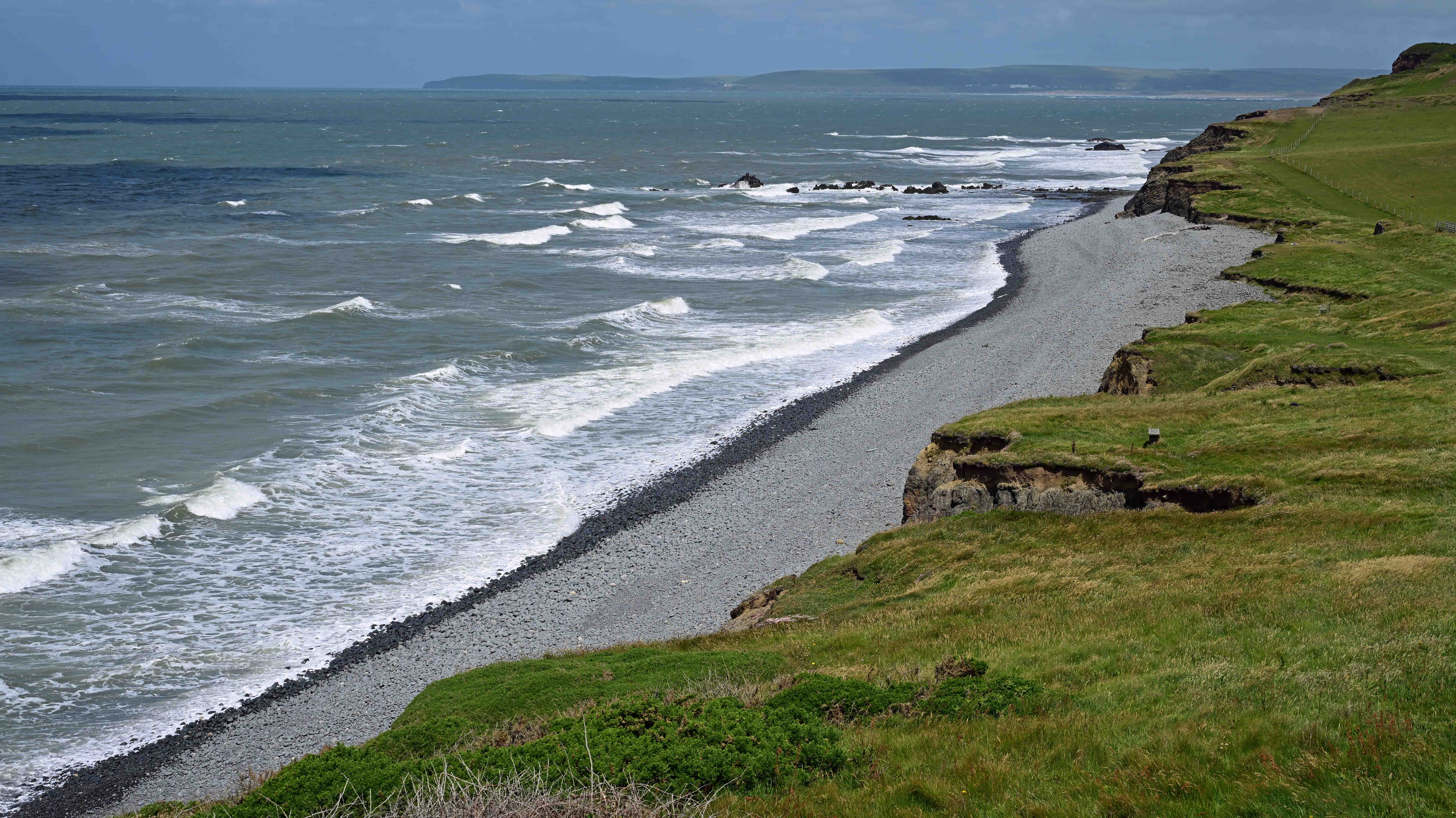
The course of the old railway makes a great coastal path. Here it is at Abbotsham Cliffs West of Westward Ho! At this point the old railway swung inland to head towards Bideford. You can see the course of the line and a couple of breaches in the trackbed near the top of the picture. This is a lovely place to stop and admire the coastline. The wind was whipping up quite a few white capped waves during our walk. Here’s the view looking East towards Baggy Point.
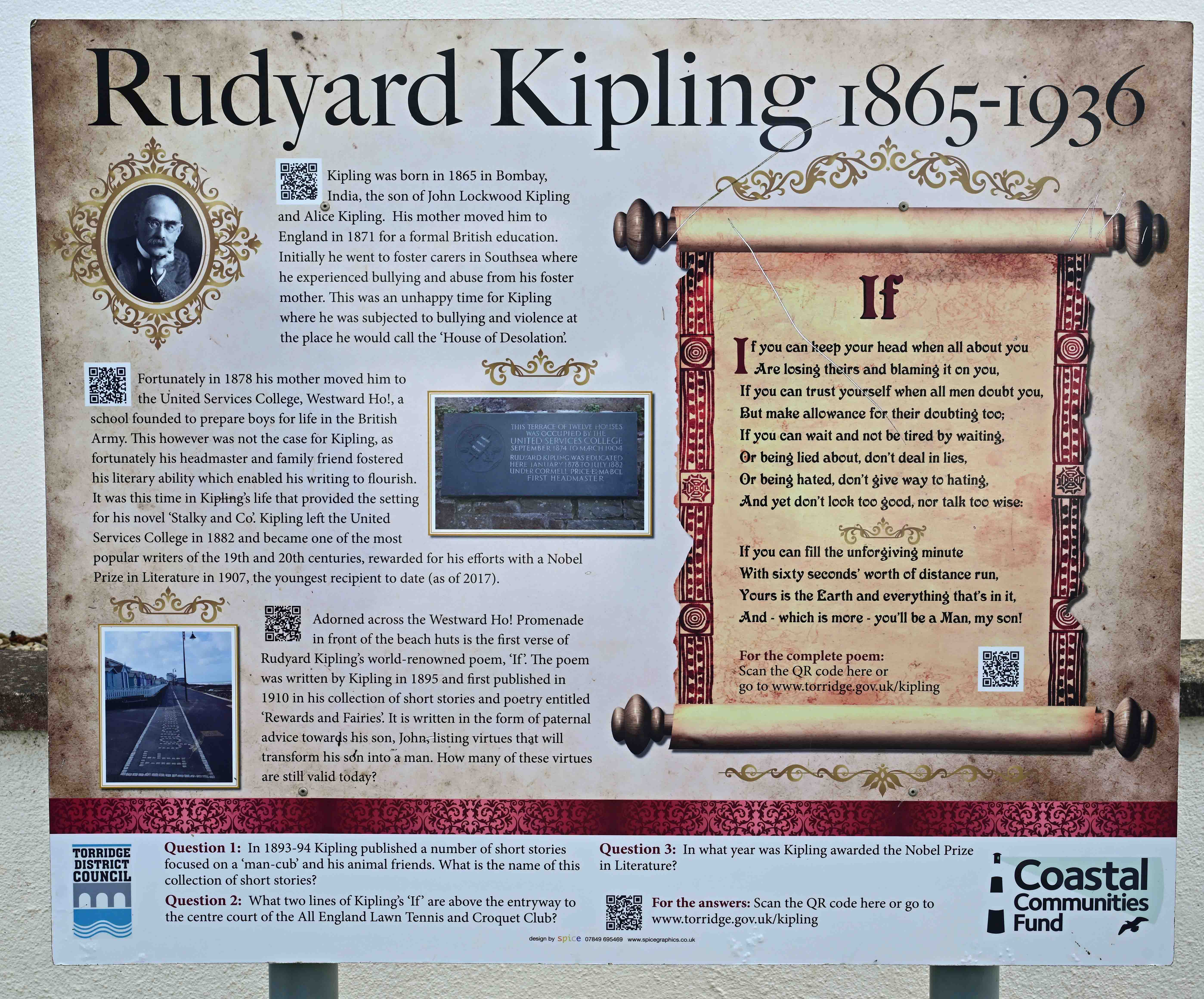
Back in Westward Ho! We explored the village and I discovered its link with one of Britain’s most famous authors whom I’ve long admired. Rudyard Kipling. Kipling went to school in Westward Ho! and he’s remembered by plaques and a line of his most famous poem ‘if) being incorporated into the seafront pavement.
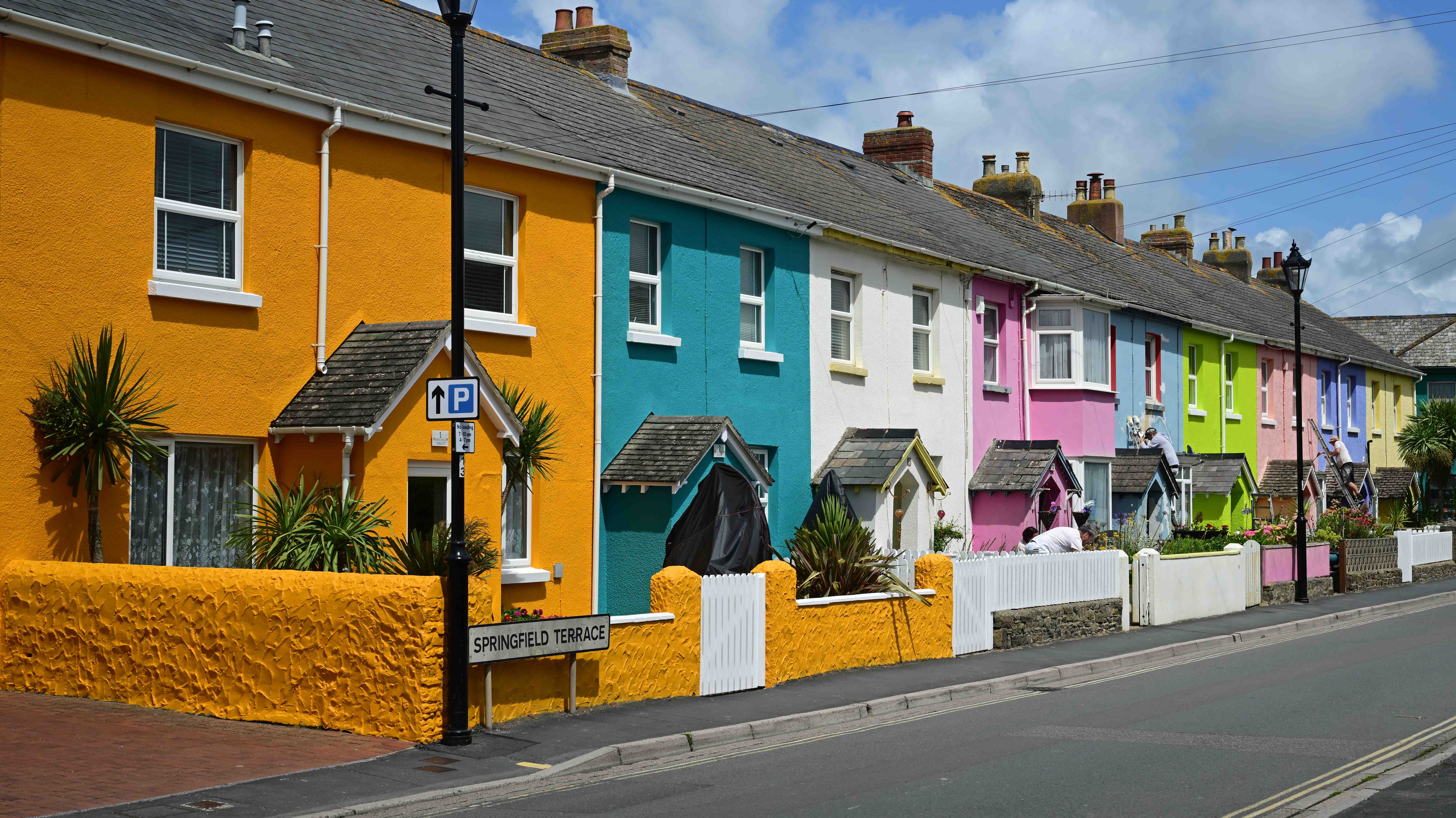
Memories of Kipling in Westward Ho!A colourful row of houses in Westward Ho! with several being repainted for the summer season.
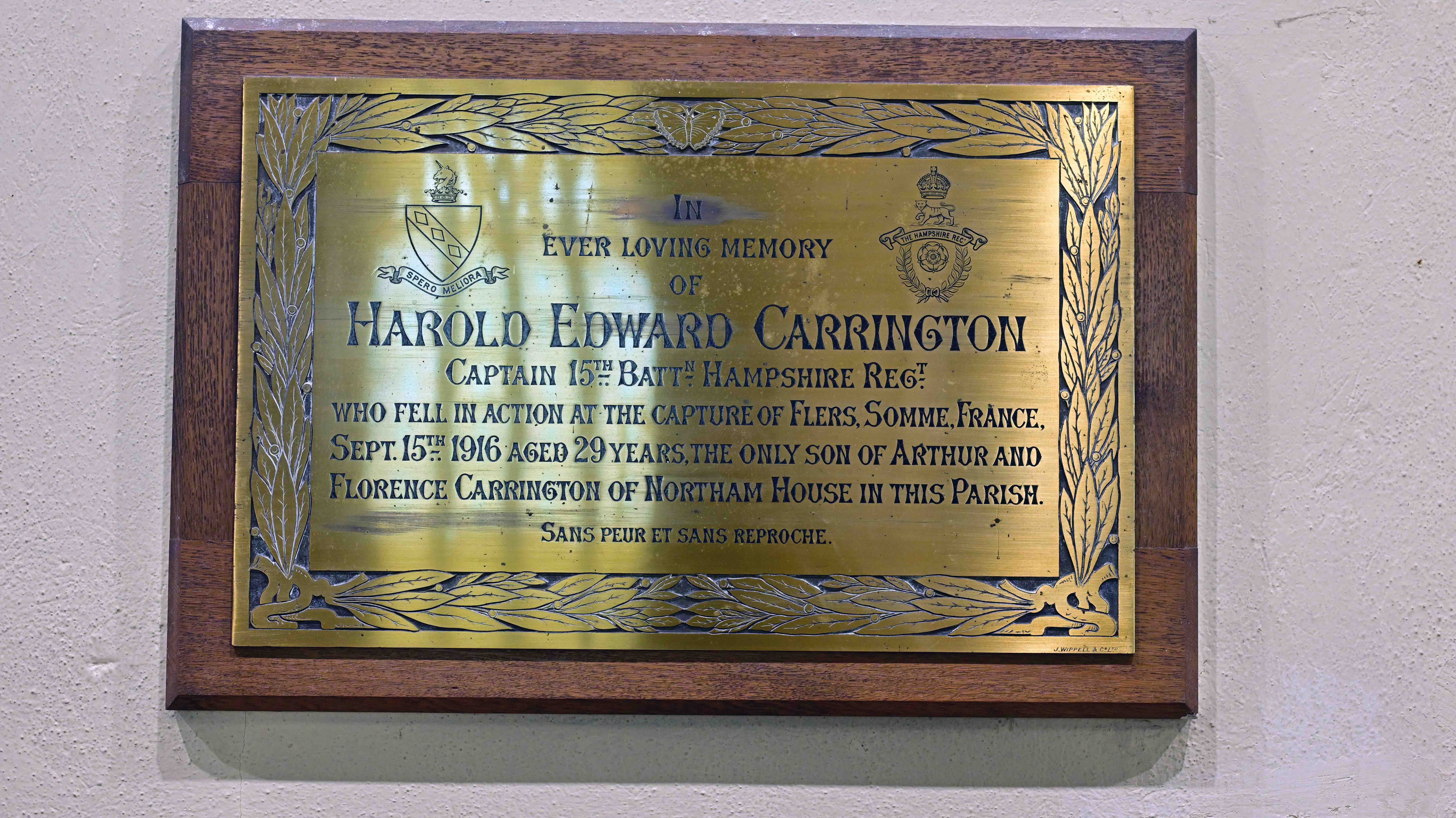
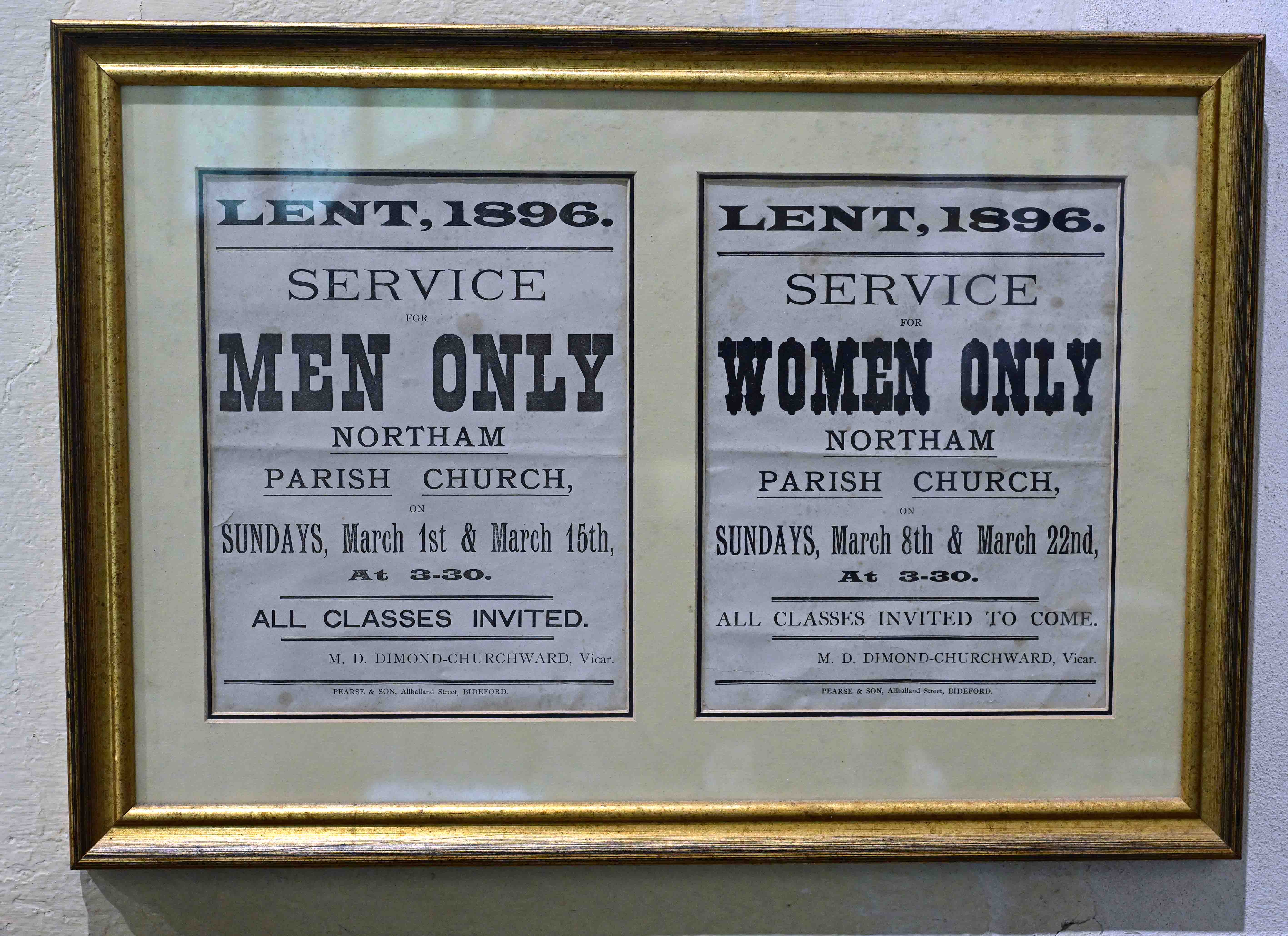
Having driven back to Northam we popped into the local church where Ann volunteers at their regular coffee and cake days. I’ve always enjoyed visiting country churches as they often provide fascinating glimpses into British social history and St Margaret’s was no exception. Oh, and the cakes were excellent!
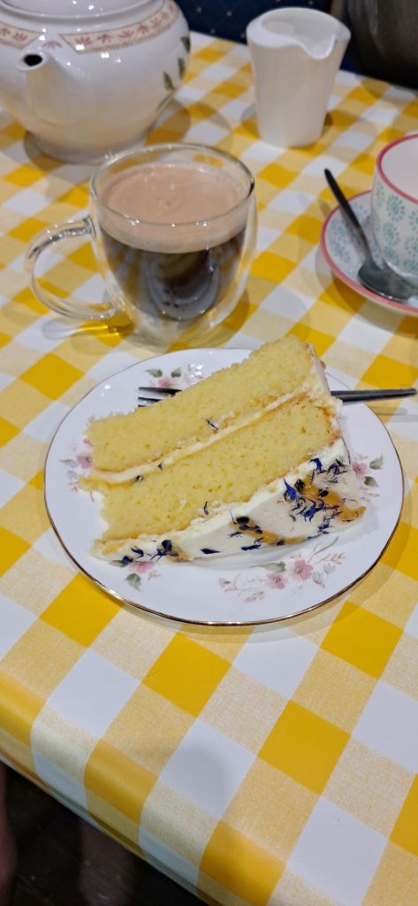
Many a well-to-do family’s line ended like this during the First World War, with the death of the only son.Segregated church services!Coffe with Passionfruit and lemon cake. Yum!
Having returned home to take our ease I couldn’t resist on last wander into Bideford to make the most of the weather in order to get a few pictures.
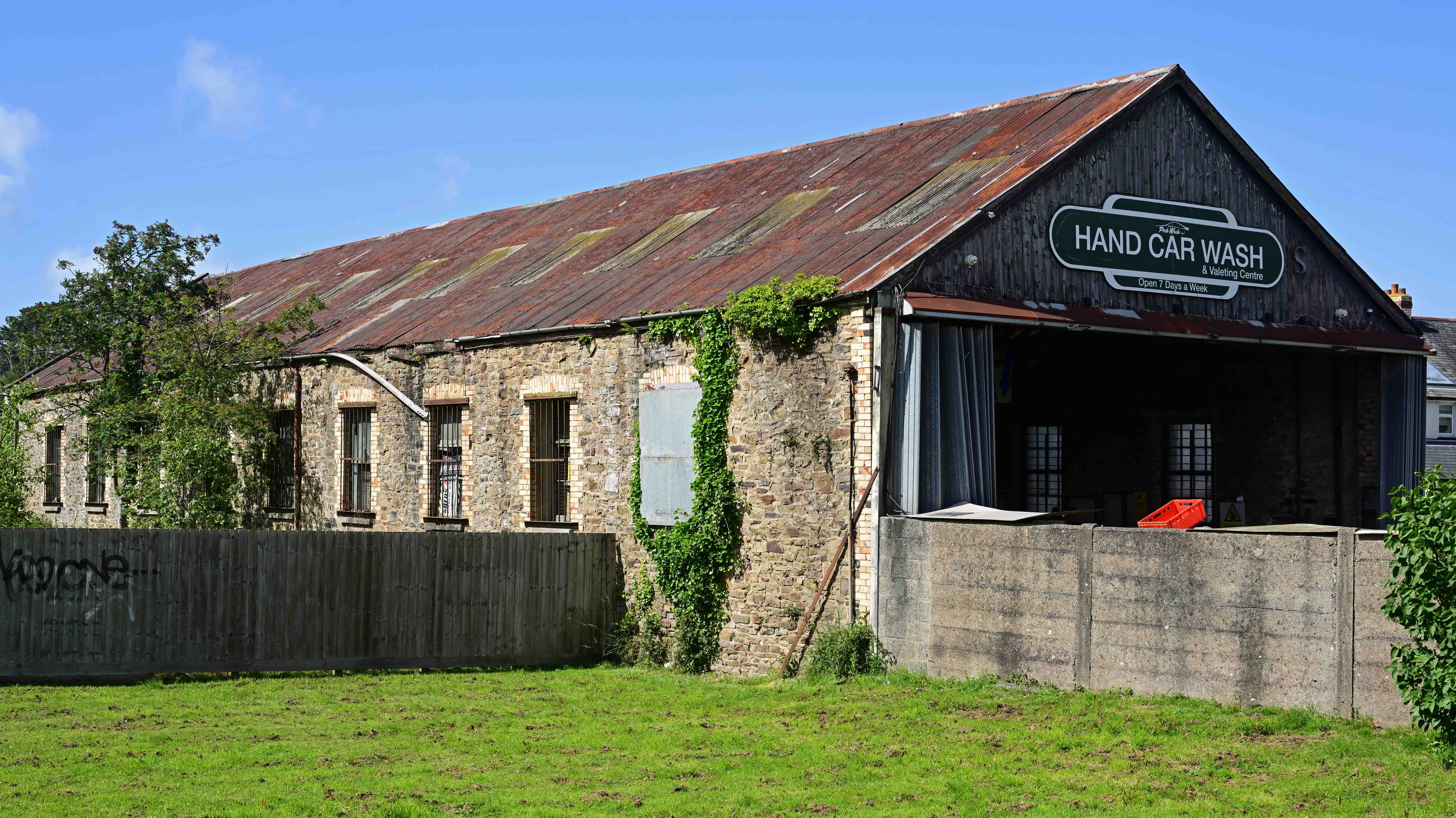
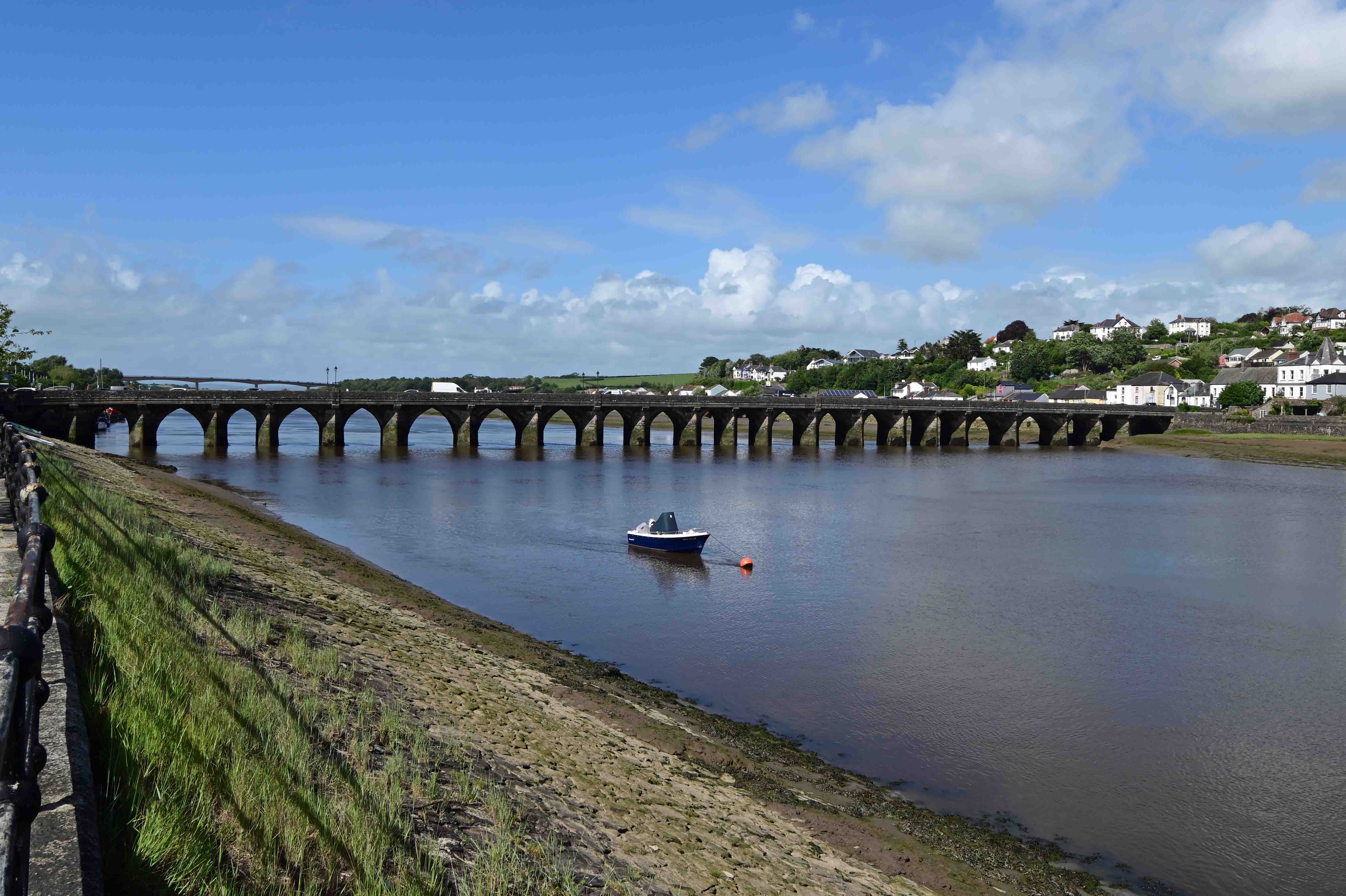
The most substantial surviving structure of the old railway is the engine and carriage shed in Bideford. Nowadays it’s used as a car-wash. The old bridge in Bideford with the modern bridge in the background.
I’ve a small favour to ask… If you enjoy reading this or any of the other blogs I’ve written, please click on an advert or two. You don’t have to buy anything you don’t want to of course – although if you did find something that tickled your fancy that would be fab! – but the revenue from them helps me to cover some of the cost of maintaining this site (which isn’t cheap and comes out of my own pocket). Remember, 99% of the pictures used in my blogs can be purchased as prints from my other website – https://paulbigland.zenfolio.com/
The sun’s shining here in West Yorkshire so I’m taking a break from decorating to have time out to check on progress with the Trans-Pennine Route Upgrade (TRU) on the railway line from Huddersfield to Leeds.
I’ve not been out that way for a while, and today seemed like the ideal opportunity. Right now I’m aboard a Northern service from Halifax to my first stop en-route. Mirfield. My first train was worked by one of the company’s aged Class 150s, which have been plying their trade since the mid 1980s.
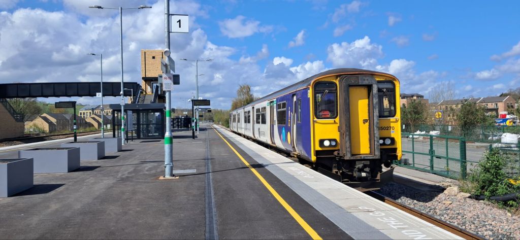
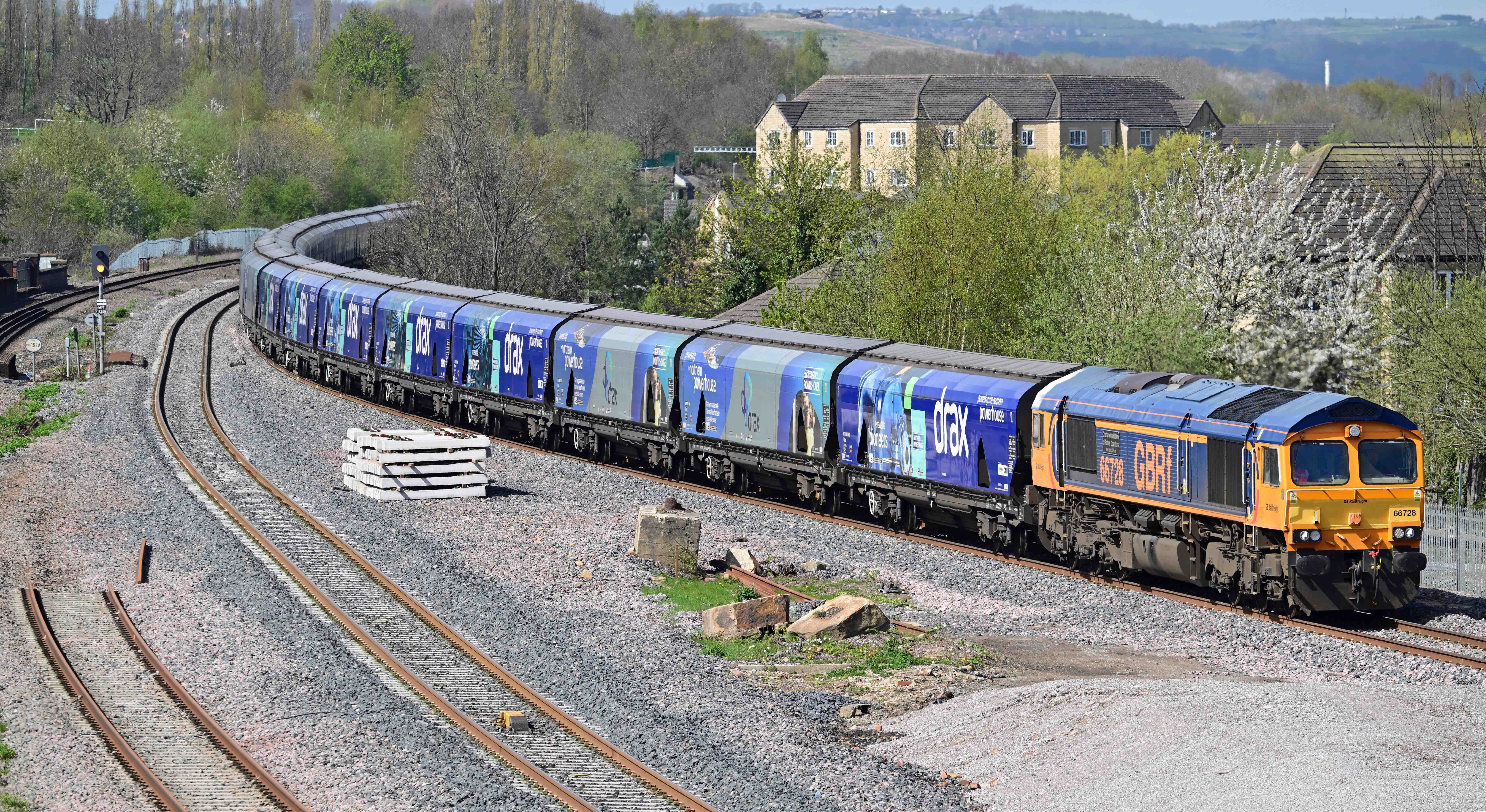
150270 on arrival at Mirfield.A GBRf Class 66 hauls a biomass train from Liverpool to Drax power station through Mirfield
Mirfield was interesting as the new footbridge adds an elevated vista, allowing a different perspective of the station and its approaches. Having got the shots I wanted I headed off along the nearby canal to get to Ravensthorpe. It’s a journey you can’t do by rail anymore as the old station’s been demolished and the new one won’t open for several years.
The canal towpath’s a lovely walk and an insight into how much railway and other industry has disappeared.
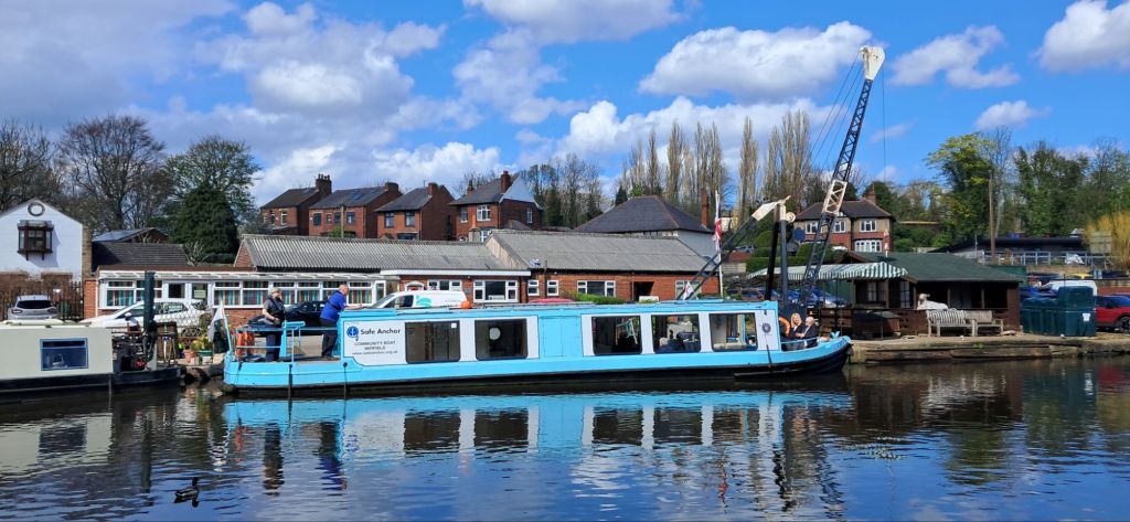
The remains of the old railway from Mirfield towards Heckmondwyke seen from the canal.The canal basin at Shepley Bridge shows its industrial heritage but now leisure activities keep it going.
Having strolled as far as Ravensthorpe I found the weather decided not to play ball as more and more cloud appeared. Even so, there was still chance to get some good record shots.
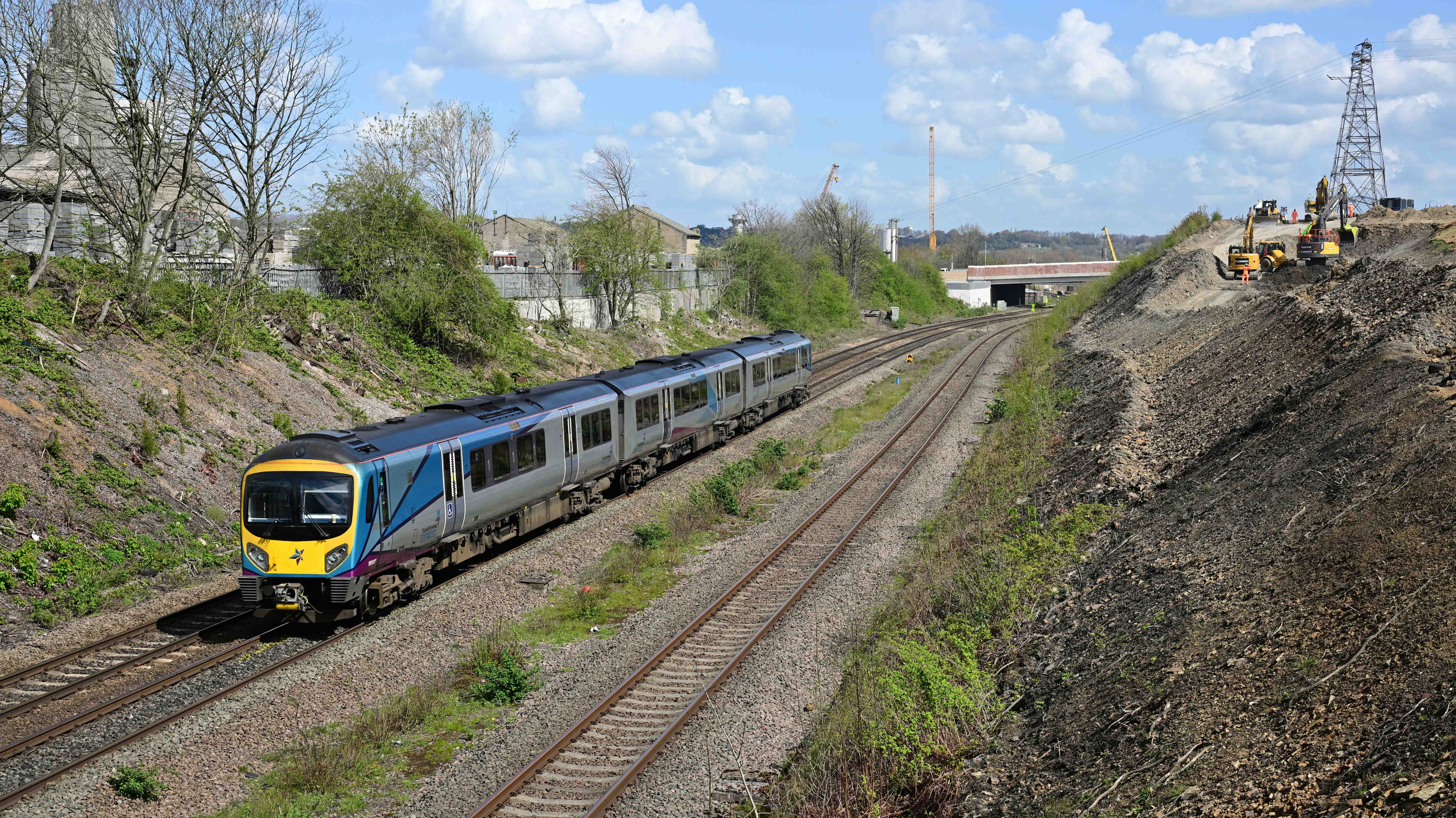
A TPE service passes the site of what will be the new Ravensthorpe station which will be just behind the train. Here’s what was the old station (to the left). All gone now. The only familiar landmark is the signal gantry. Meanwhile, behind it, the abutments of the new fast lines flyover take shape behind it.
15th April update.
Sorry folks. I got waylaid for various reasons that I’ll explain in the next blog.
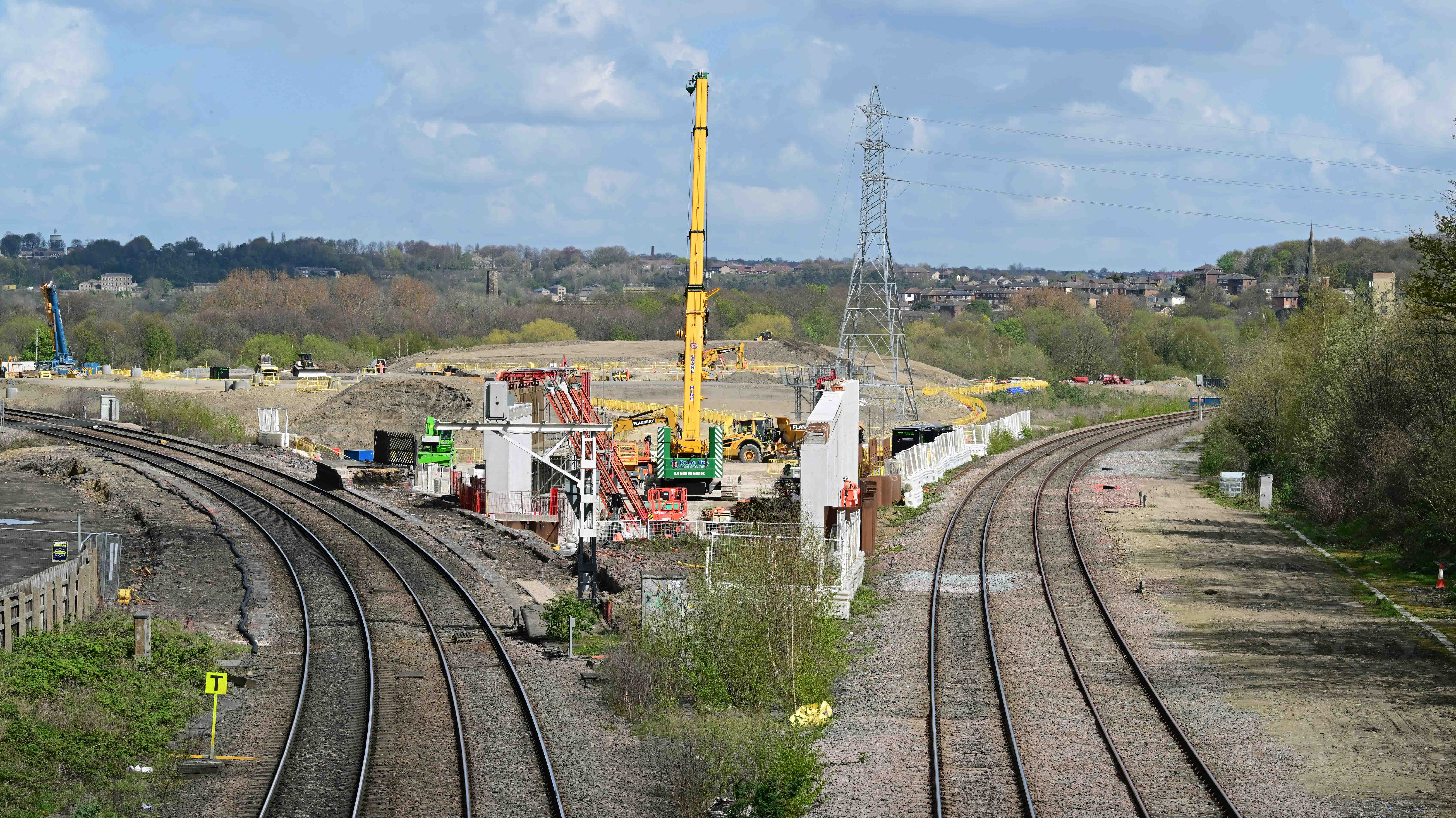
Now, where was I? Oh, yes, Ravensthorpe. As you can see from the pictures, it’s changed a bit. The old station’s vanished and there’s some serious civil engineering taking place where it was situated. That said, the bridge I was stood on to get these pictures will disappear too. You can see the new one in the picture before last.
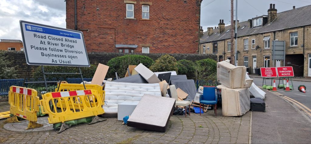
Ravensthorpe is an odd place. I’m sure a new station will help to regenerate the area, but it’s going to take a lot, lot more. As there’s no trains I had to wander up to the main road in order to get to Dewsbury. There’s some lovely old terraced houses in the area but the air of decay and lack of civic pride is all to obvious.
Fly-tipping on a public space in Ravensthorpe.
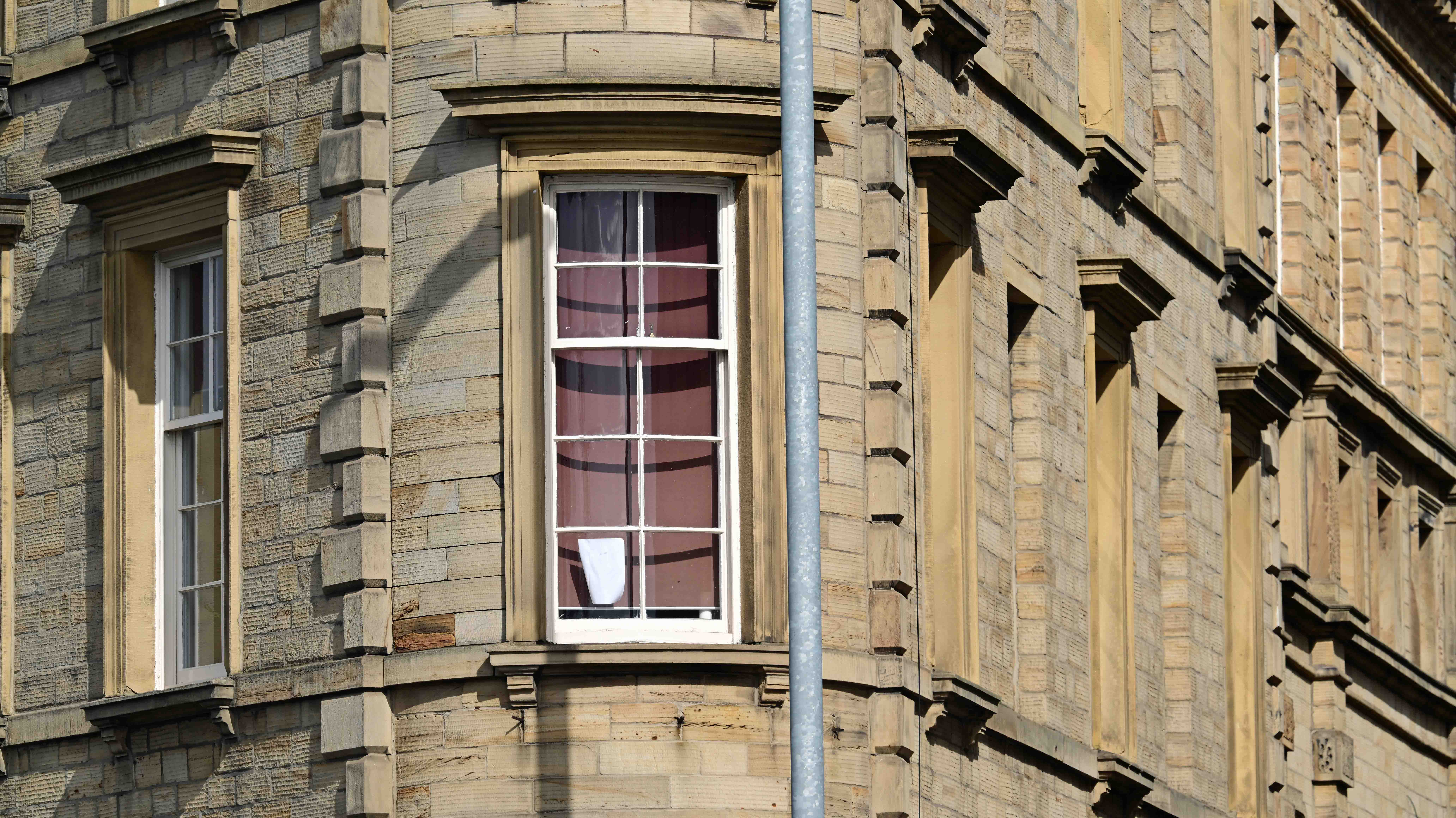
I was tempted to walk all the way to Dewsbury but I was running out of time. Instead, I so brandished my bus pass and took the easy option. Doing so deposited me at a part of Dewsbury I’d never visited. The bus station, which is seeing major investment. The town’s an odd place. The old Victorian buildings are a solid testament to the prosperity it once had. But the world’s moved on, and like many Northern towns it’s been ignored by a series of Governments from Left to Right.
Victorian buildings to die for. If they were anywhere else…
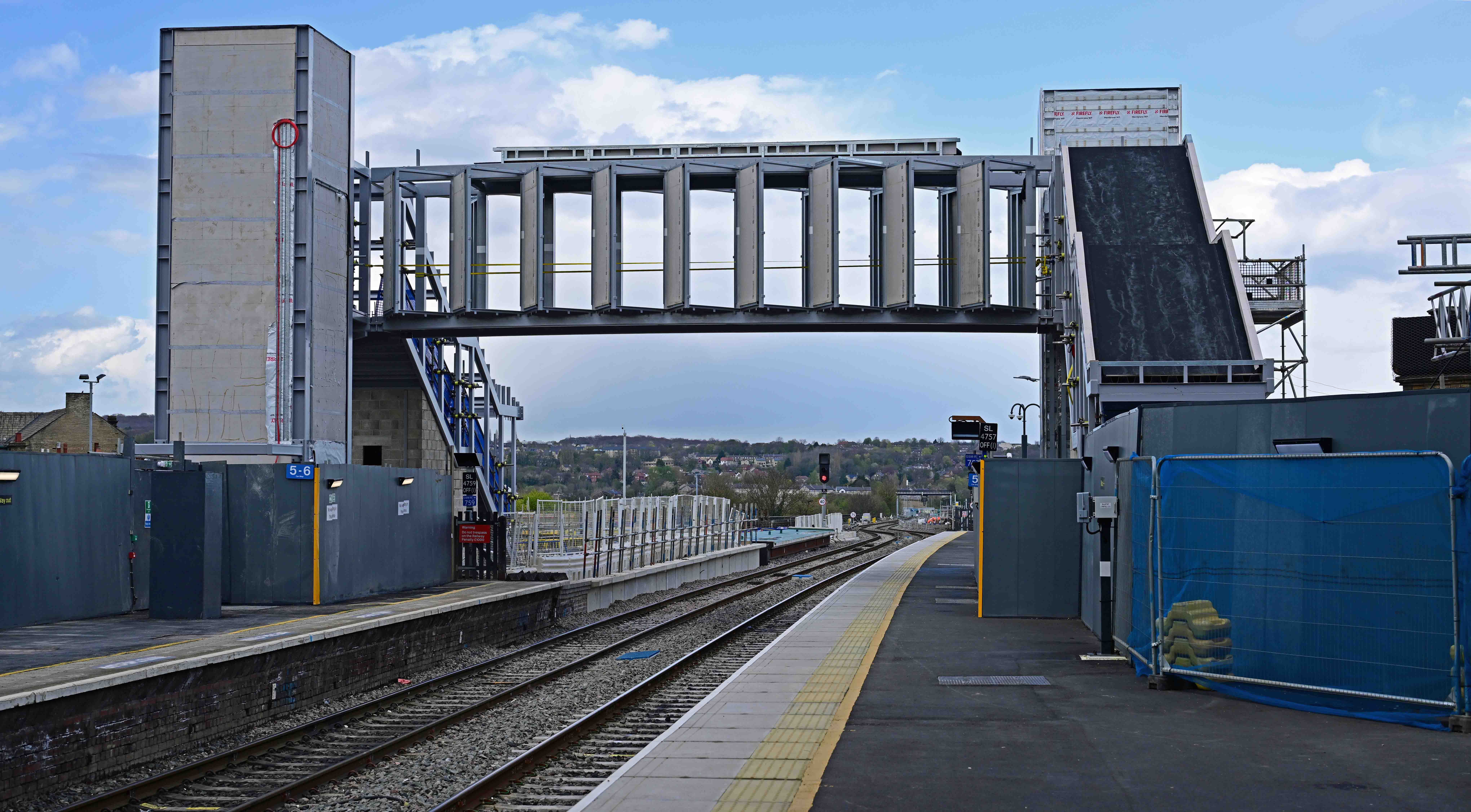
After a swift pint in the institution that’s the West Riding refreshment rooms on the station I caught a train to Huddersfield. This allowed me to see some major TRU changes en-route that demand another visit. That said, work at Huddersfield hasn’t exactly stood still as part of a new over bridge has appeared since my last visit.
The over bridge will eventually extend to the left when the new through platforms are completed.
Having explored, I’ve realised I’ve some catching up to do on TRU. Expect an update soon…
I’ve a small favour to ask… If you enjoy reading this or any of the other blogs I’ve written, please click on an advert or two. You don’t have to buy anything you don’t want to of course – although if you did find something that tickled your fancy that would be fab! – but the revenue from them helps me to cover some of the cost of maintaining this site (which isn’t cheap and comes out of my own pocket). Remember, 99% of the pictures used in my blogs can be purchased as prints from my other website – https://paulbigland.zenfolio.com/
Yesterday, Valentine’s day – and for one day only, the weather decided to give us a break from continuous and monotonous rain. Mind you. it had dumped several inches of snow on the high ground, just to make things more interesting! That said, where we live in the Calder valley was just too low to be in the snow line. We could see the stuff on the high ground on the opposite side of the valley, but we had barely a sniff. That worked to our advantage…
Saturday began with clear blue skies and the sort of weather that – after weeks of rain- made you itch to get out. But where to go? Having perused maps and looked at where the snow lay we decided to drive out South, through Ripponden and across the M62 motorway in search of higher ground. We found what we were looking for at Moss Moor, off the A672 to Oldham where you’re over 450m above seal-level and there’s nothing stopping the wind anywhere. Even on a hazy day you can see the city of Manchester miles below. On a good day you can pick out the Lancashire coast.
Leaving the car we headed off South along the Pennine way. Here’s how the world looked…
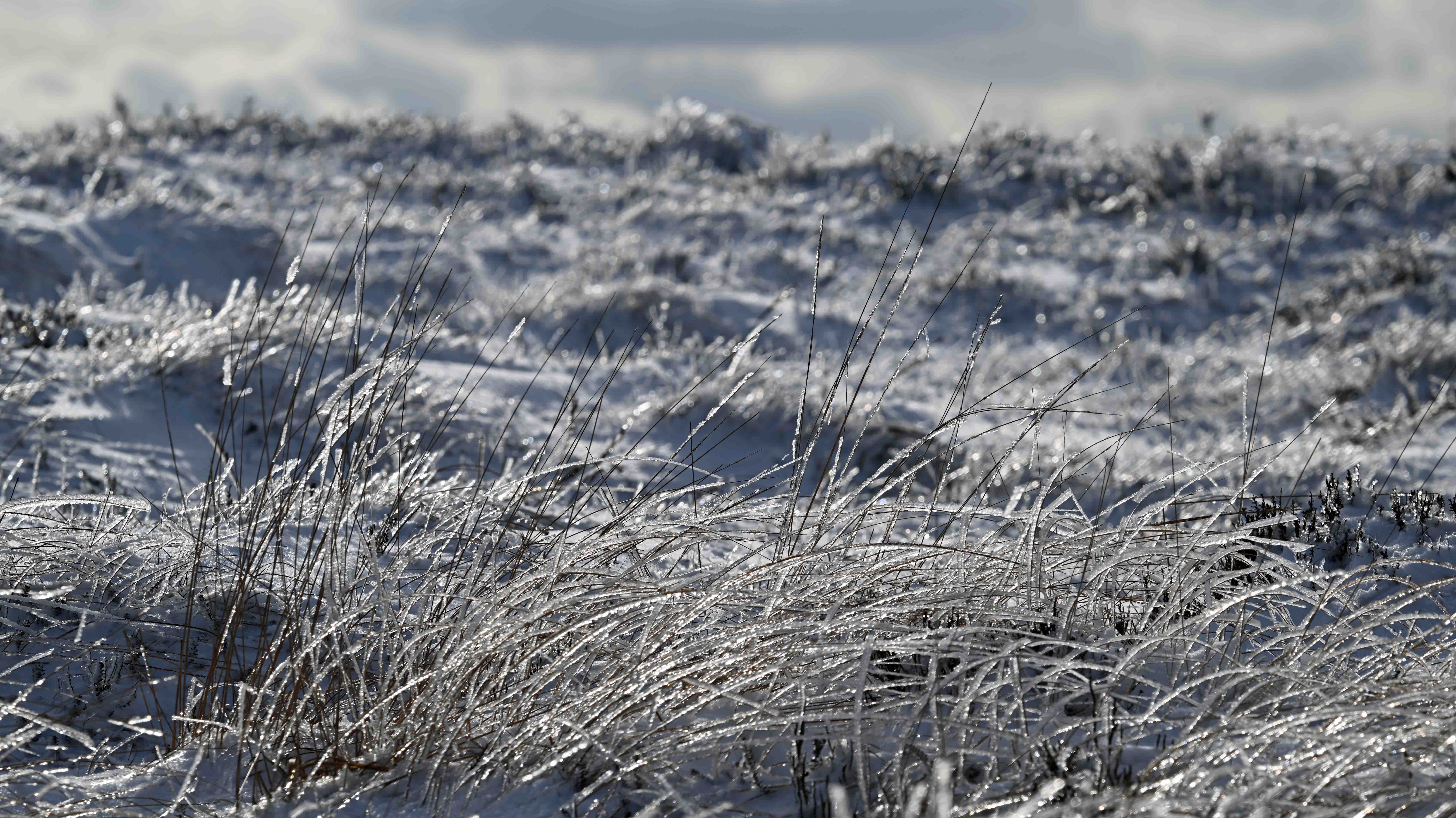
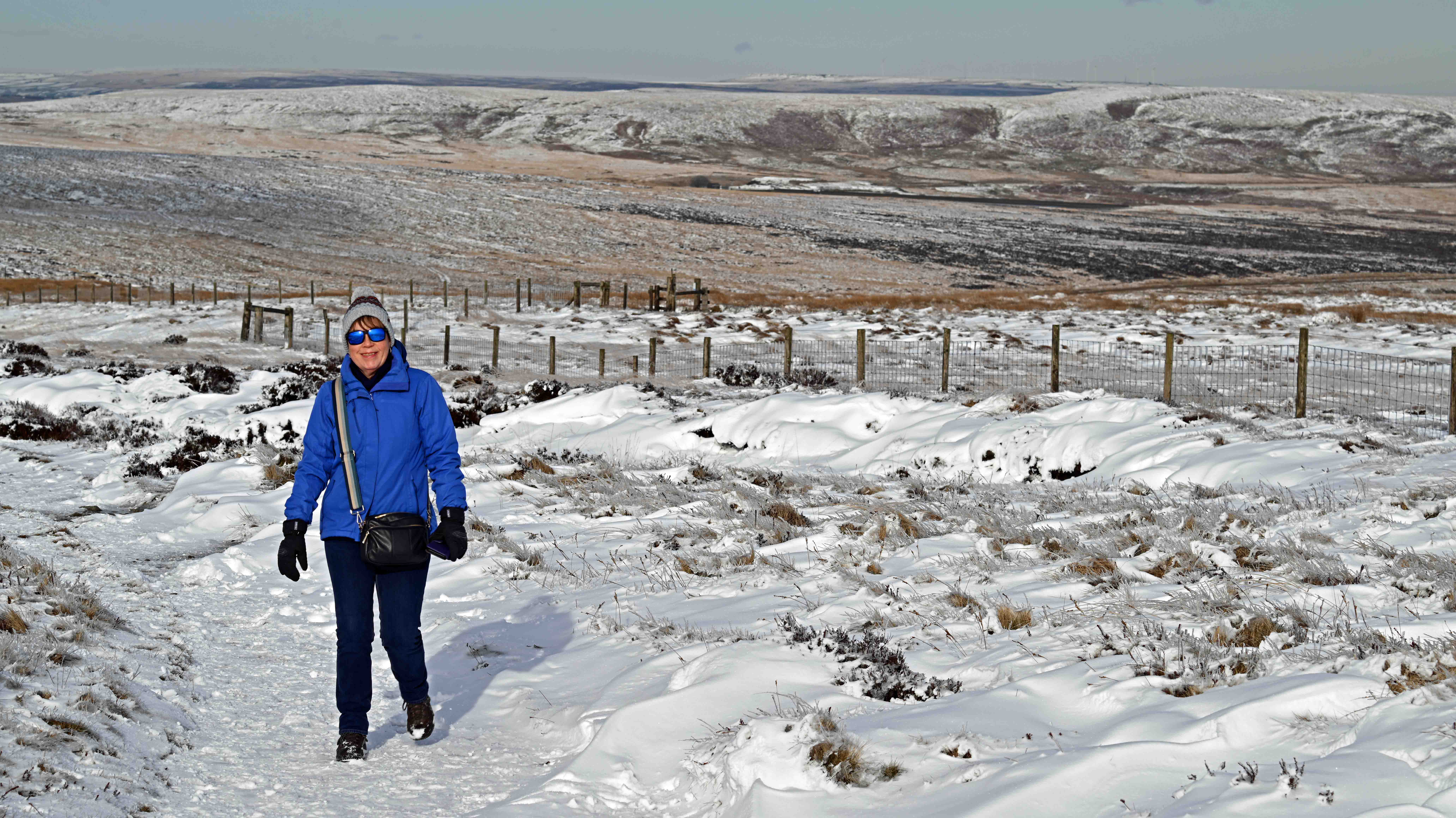
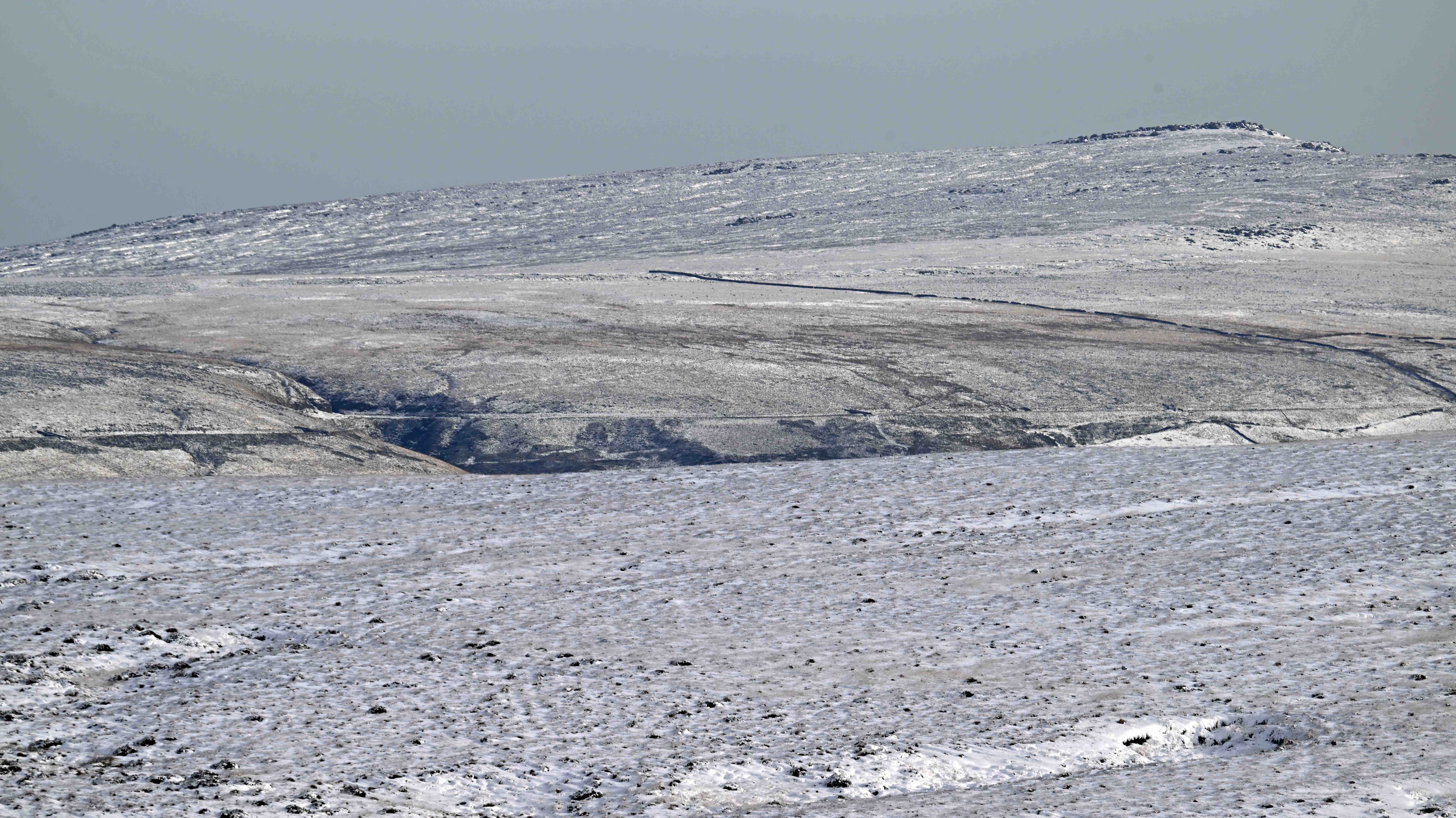
Looking out over Moss Moor, which is the origin of the river Tame apparently.Wind conditions in such an exposed location led to some great photo opportunities, where the grass had literally frozen, then was backlit by the low sun. Dawn strolling through the snow towards the White Hill Trig pint (466m). Believe it or not, the M62 motorway’s just out of shot to the right. Conditions underfoot where ‘interesting’. The fresh snow and drifts were easy to walk in but every so often you hit an area that had been stripped bare by the wind so that you were walking on sheet ice. Looking across to Close Moss and Marsden (beyond). There’s a very long railway tunnel under here – somewhere…
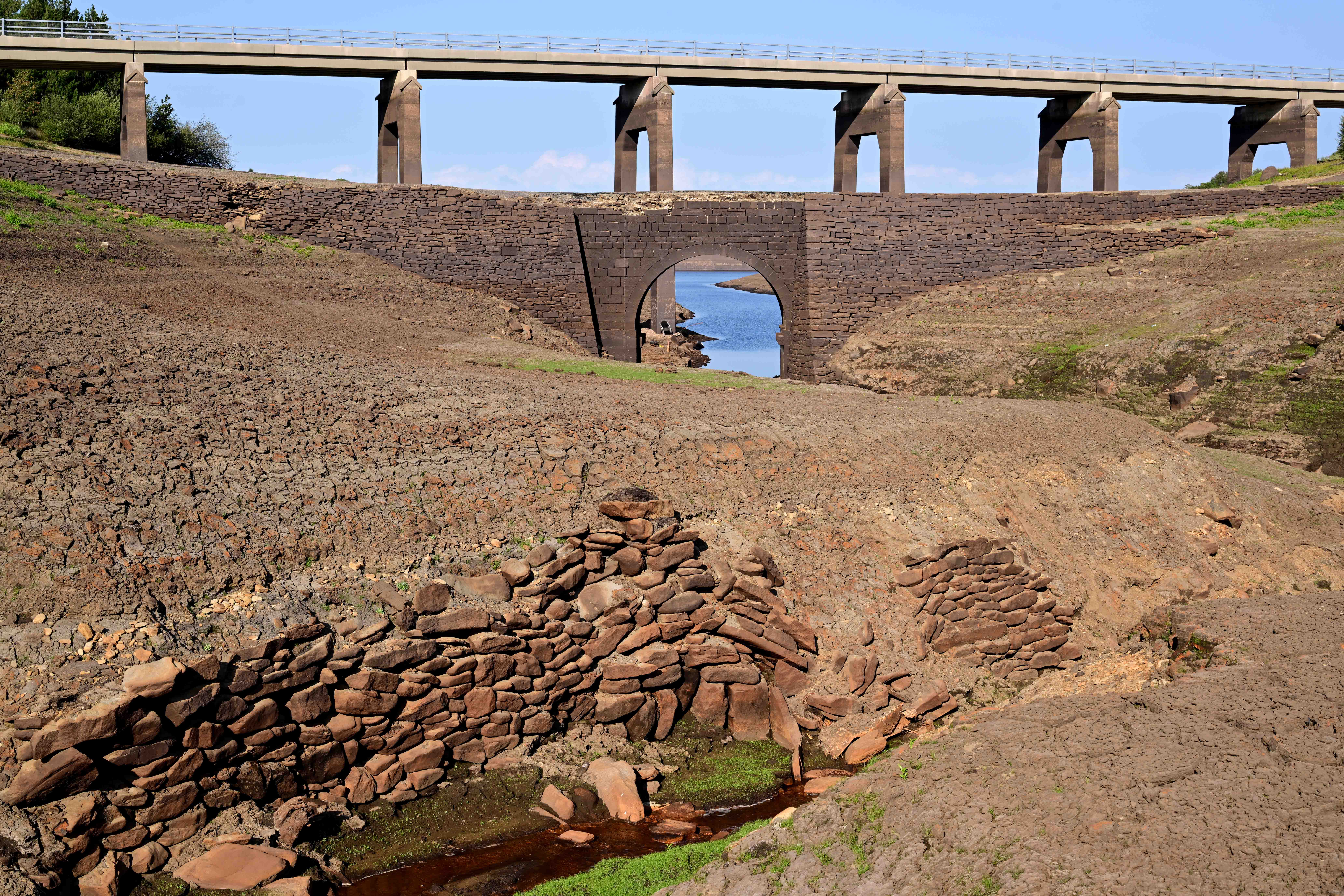
Having had our fill of the high moors we decided to head back via Baitings reservoir, which was a regular entry in last year’s ‘reservoir blogs’. Here’s how it looked in August last year.
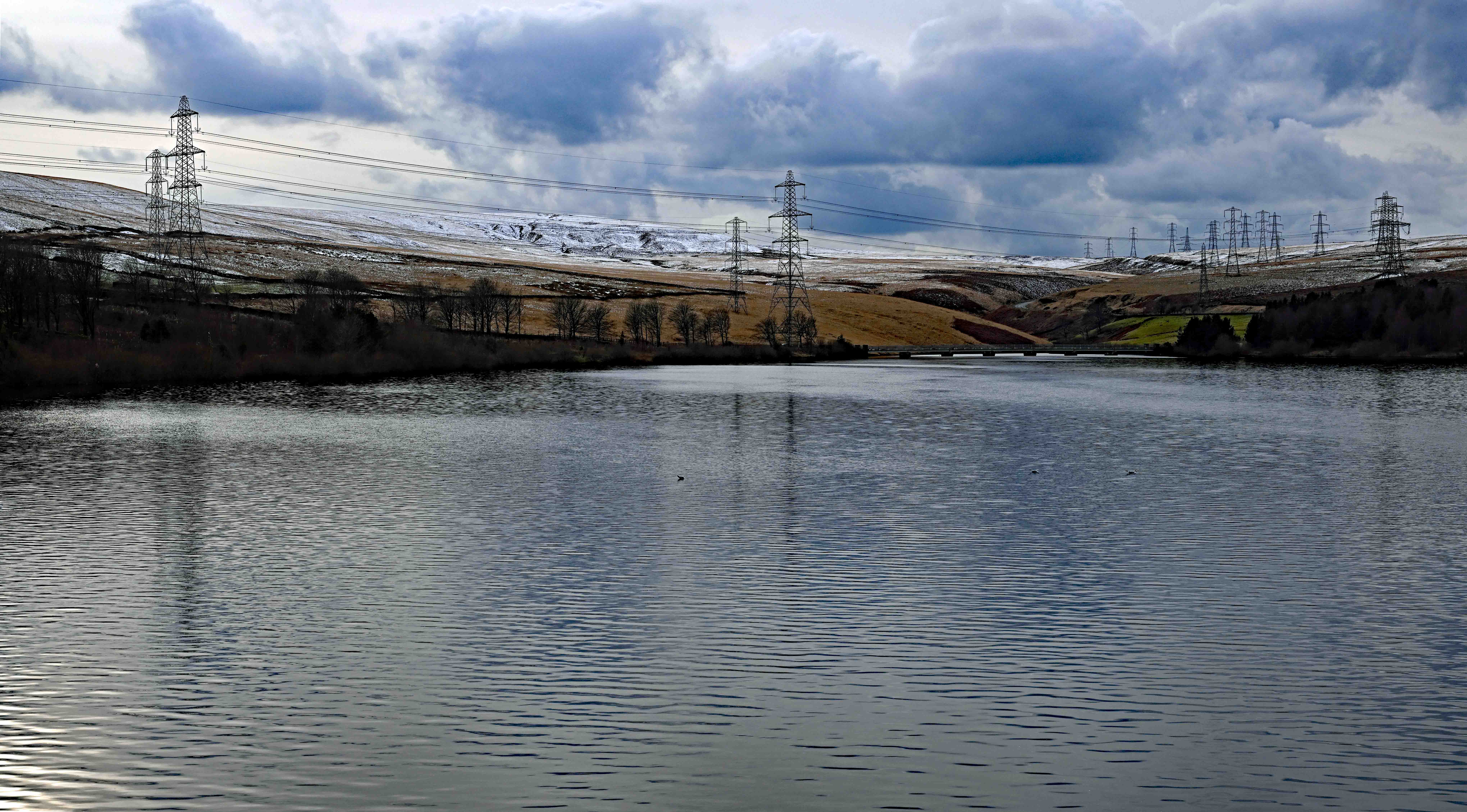
See the modern bridge beyond the old bridge? It’s here, in the distance. This is how full and overflowing the reservoir is today, with snow on the surrounding hills that will add even more water.
Sadly, the weather’s reverted to type. Today we’ve had grey skies and intermittent rain, a pattern that we seem to be stuck with. Never mind. Bugger the weather, tomorrow I’m having another day out to head over to Manchester and Southport in order to look at two very different events…
I’ve a small favour to ask… If you enjoy reading this or any of the other blogs I’ve written, please click on an advert or two. You don’t have to buy anything you don’t want to of course – although if you did find something that tickled your fancy that would be fab! – but the revenue from them helps me to cover some of the cost of maintaining this site (which isn’t cheap and comes out of my own pocket). Remember, 99% of the pictures used in my blogs can be purchased as prints from my other website – https://paulbigland.zenfolio.com/
Hooray! The weather finally cleared today, giving me the opportunity get out with the camera and enjoy decent visibility for a change. We even had some sunshine, but as usual, it was always at the most inopportune moment!
As the freight train I’d been stalking was running along the copy pit line today I decided to head out along the line to get pictures. The location I wanted was a good hour’s walk away, but that didn’t deter me as it gave me chance to explore along the Burnley road as far as my destination, just outside Cliviger, the site of the old colliery that was known as Copy Pit.
It was an interesting if somewhat sad walk, past many old mills, some converted to housing, other derelict and decaying. The mixture of housing styles was also interesting. Old stone farmhouses rubbed shoulders with Victorian terraces and bigger homes that betrayed how wealthy the area was when it was a hive of industry based around mills and coal. All these buildings were squeezed together in what’s actually a narrow valley. Nowadays much of it is tree covered, but go back 70-100 years and it would’ve been quite a bleak landscape, and polluted too, with all the soot and smoke from coal fires being trapped in the valley.
Just before Cliviger the valley opens up and you cross the modern-day boundary between West Yorkshire and Lancashire. I was headed for a bridge over the railway at a place called Dean Farm, which allows great views along the railway. On arrival I found that the train I was waiting for was running an hour late so I filled my time by walking further up the Burney road which parallels the railway at this point, allowing me to get shots like this, looking back towards Dean farm.
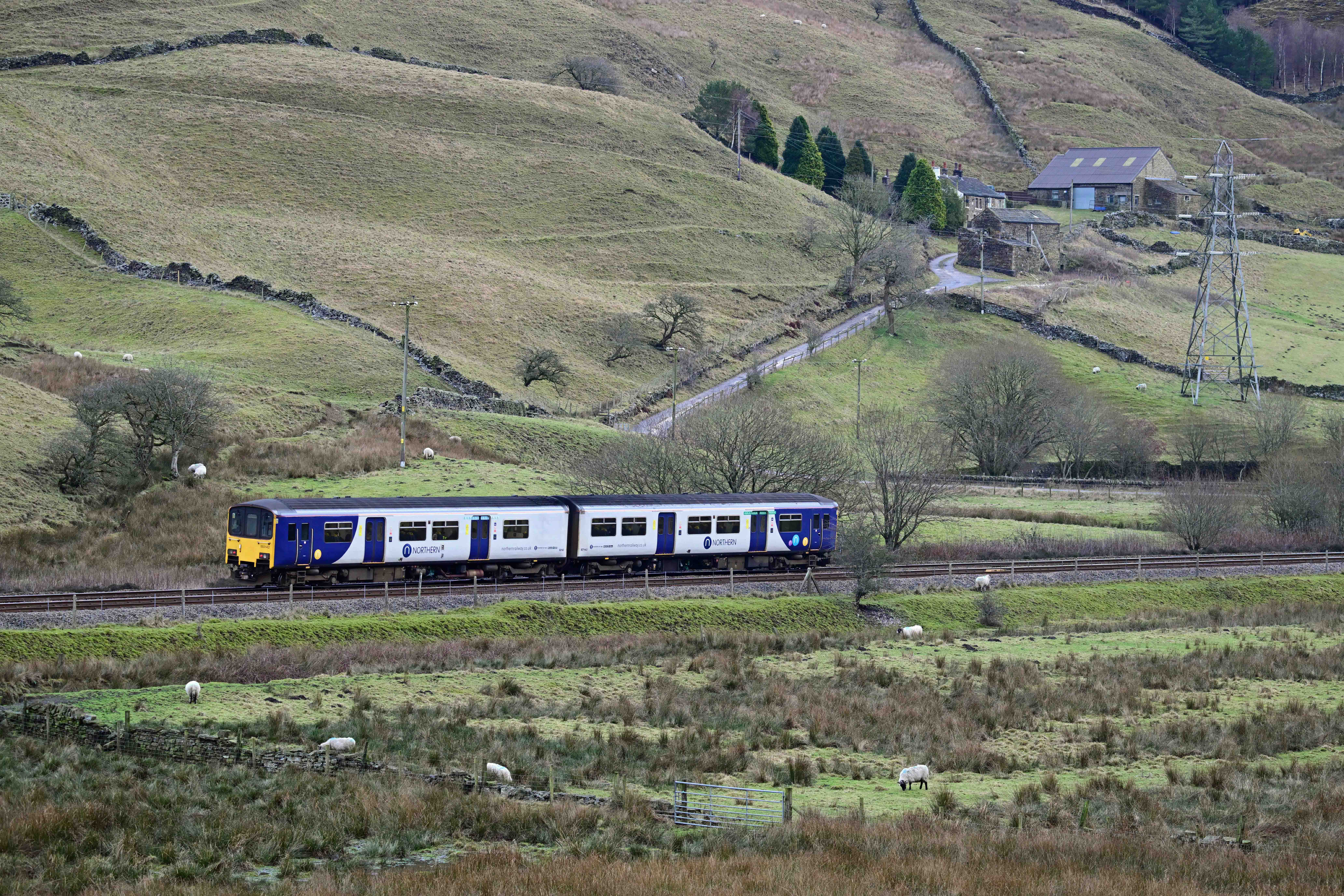
BR built class 150 number 150142 passes working 2K67, the 11:19 Blackburn to Headbolt Lane (Merseyside). The rural nature of this section of line is a marked contrast to the area the train’s heading in to.
Having managed various shots I headed back to the bridge in time to capture the train I wanted.
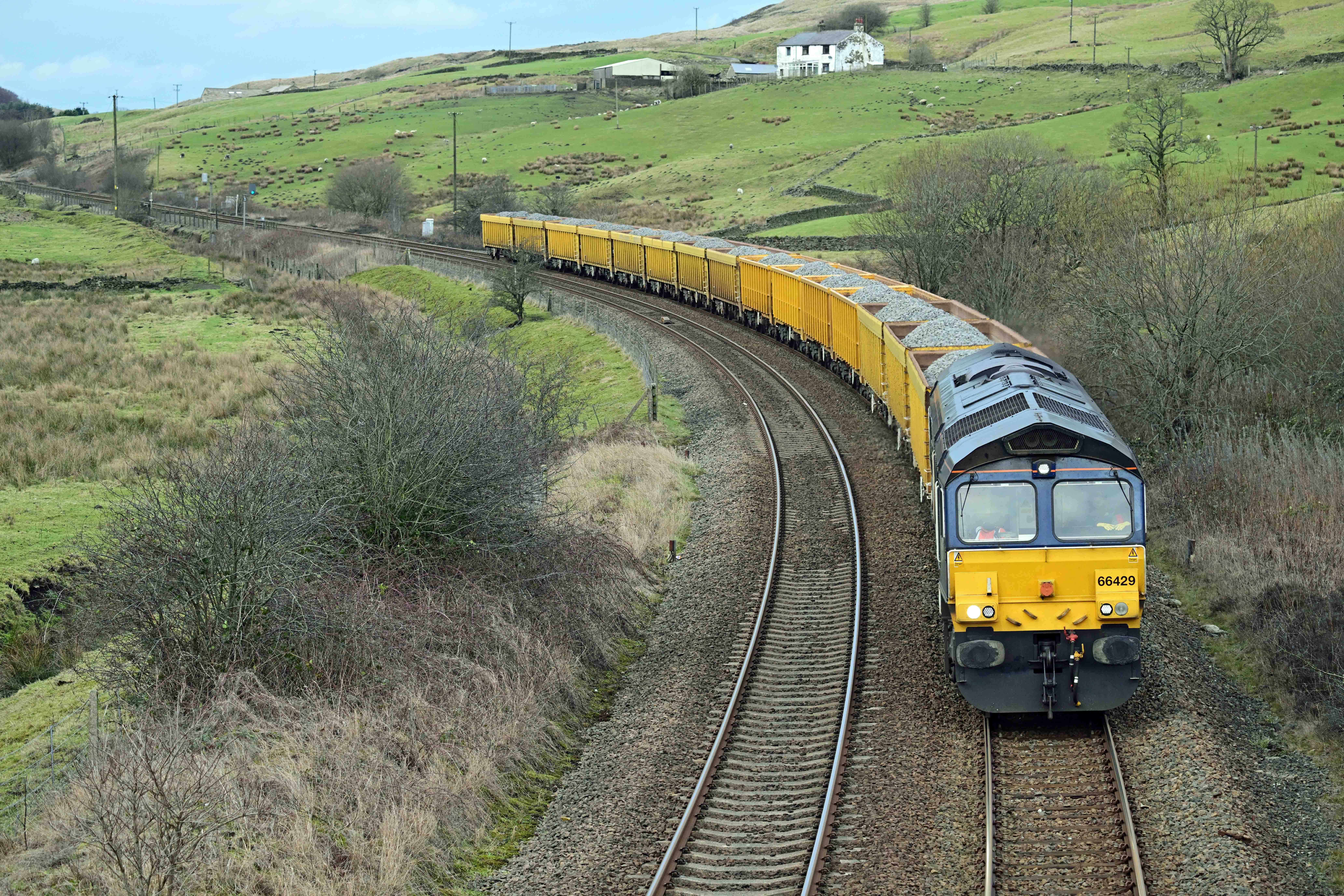
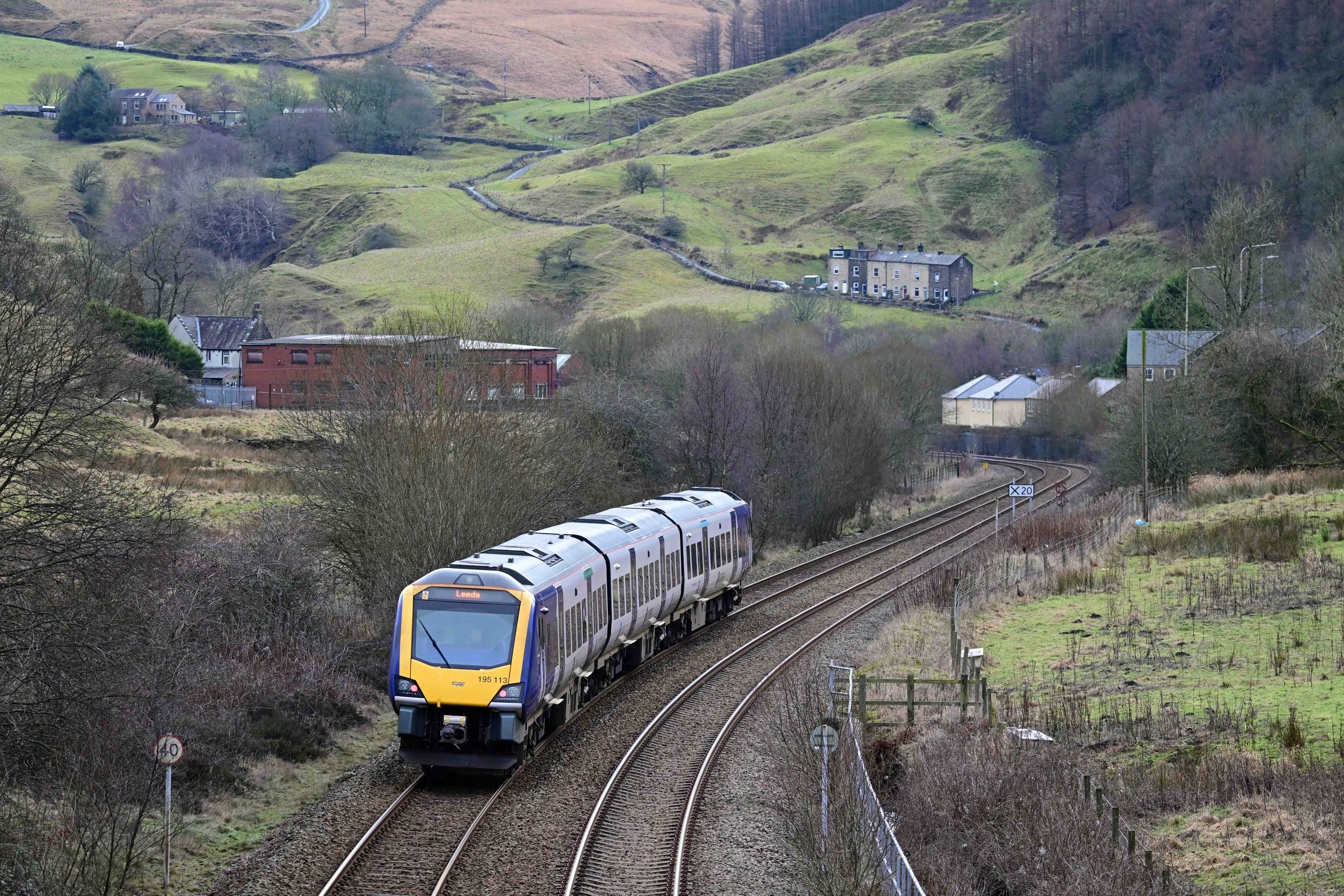
Direct Rail Services Class 66 number 66429 hauls 6E73, the 09:09 Shap Summit Quarry to Doncaster Up Decoy yard. Copy Pit was just out of shot behind the train, behind a road bridge on the Burnley Road. There used to be a loop line to the right of the train but this disappeared many years ago. Back in the 1950s-early 60s this bridge would have been shaken by the thunderous roar and clank of steam engines hauling (and banking) heavy coal trains up the hill. Looking the other way from the bridge as a Blackpool North – Leeds service passes. Where the light coloured houses are by the railway was the site of a goods yard and sidings that served Portsmouth station which was just out of sight around the curve. The station was closed in July 1958 and no traces of it remain.
Having achieved my aim I headed back into Todmorden. Remembering that I now have a bus pass (which I’d never used) I caught a bus back into town, reflecting on the fact that I’d chosen to walk all the way uphill, then get a bus back downhill. D’oh!
Back in ‘Tod’ I stopped off to get one last picture before calling it a day. I’d spotted this view the other day but wanted to wait until the weather had improved.
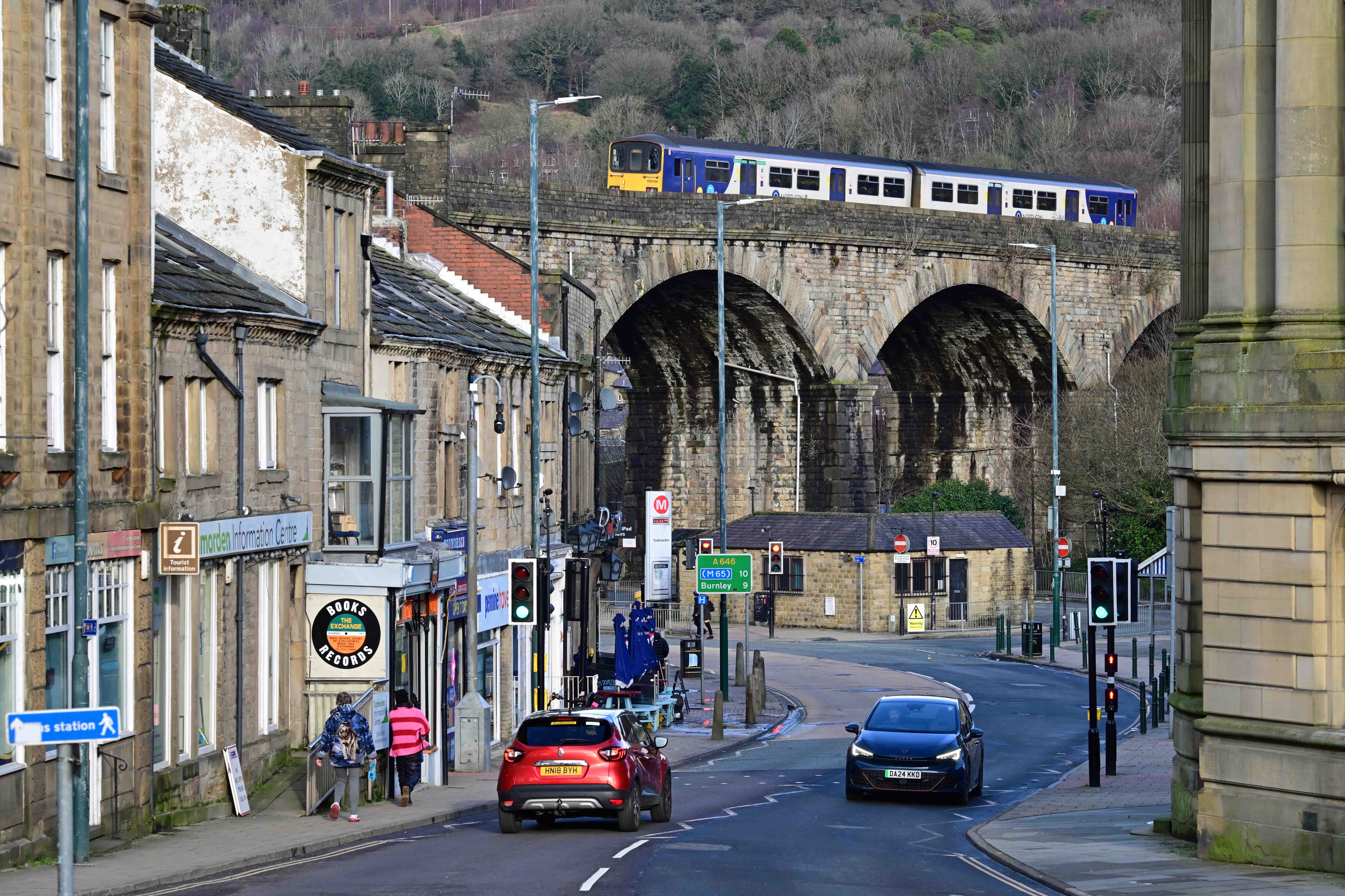
150144 crosses the wonky viaduct in the centre of Todmorden whilst working a train from from Headbolt Lane to Blackburn.
Sadly, tomorrow’s weather is due to revert to rain, so my chances of doing much are minimal. That said, Dawn’s not having to commute to Halifax, so I’m planning to take her into ‘Tod’ to explore, so there may be some pictures to be had…
I’ve a small favour to ask… If you enjoy reading this or any of the other blogs I’ve written, please click on an advert or two. You don’t have to buy anything you don’t want to of course – although if you did find something that tickled your fancy that would be fab! – but the revenue from them helps me to cover some of the cost of maintaining this site (which isn’t cheap and comes out of my own pocket). Remember, 99% of the pictures used in my blogs can be purchased as prints from my other website – https://paulbigland.zenfolio.com/
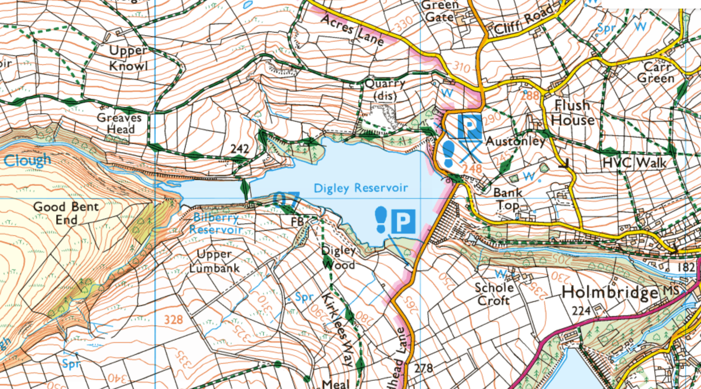
With New Year behind us and the weather remaining cold but turning sunny we felt it was time to work off some of the festive food by heading out to explore a new walk. Looking at our options I plumped for another water walk, this time around the Digley reservoir near Holmbridge in the Holme valley, near the well-known town of Holmfirth (the setting for the long-running TV series ‘last of the summer wine’).
The drive over to Digley takes about 45 minutes cross-country, which isn’t bad, although the closer we got the more ‘interesting’ the country roads became due to a mixture of shallow snow and black ice which was cunningly hidden in the shadows. Digley is actually two reservoirs, with the smaller Bilberry up above it.
Bilberry has an interesting history. It was the original of the two, and in 1852 it burst, spilling 86 million gallons of water down the River Holme, causing 81 deaths and a large amount of property damage. The disaster caused a change in the way dams were built from then on.
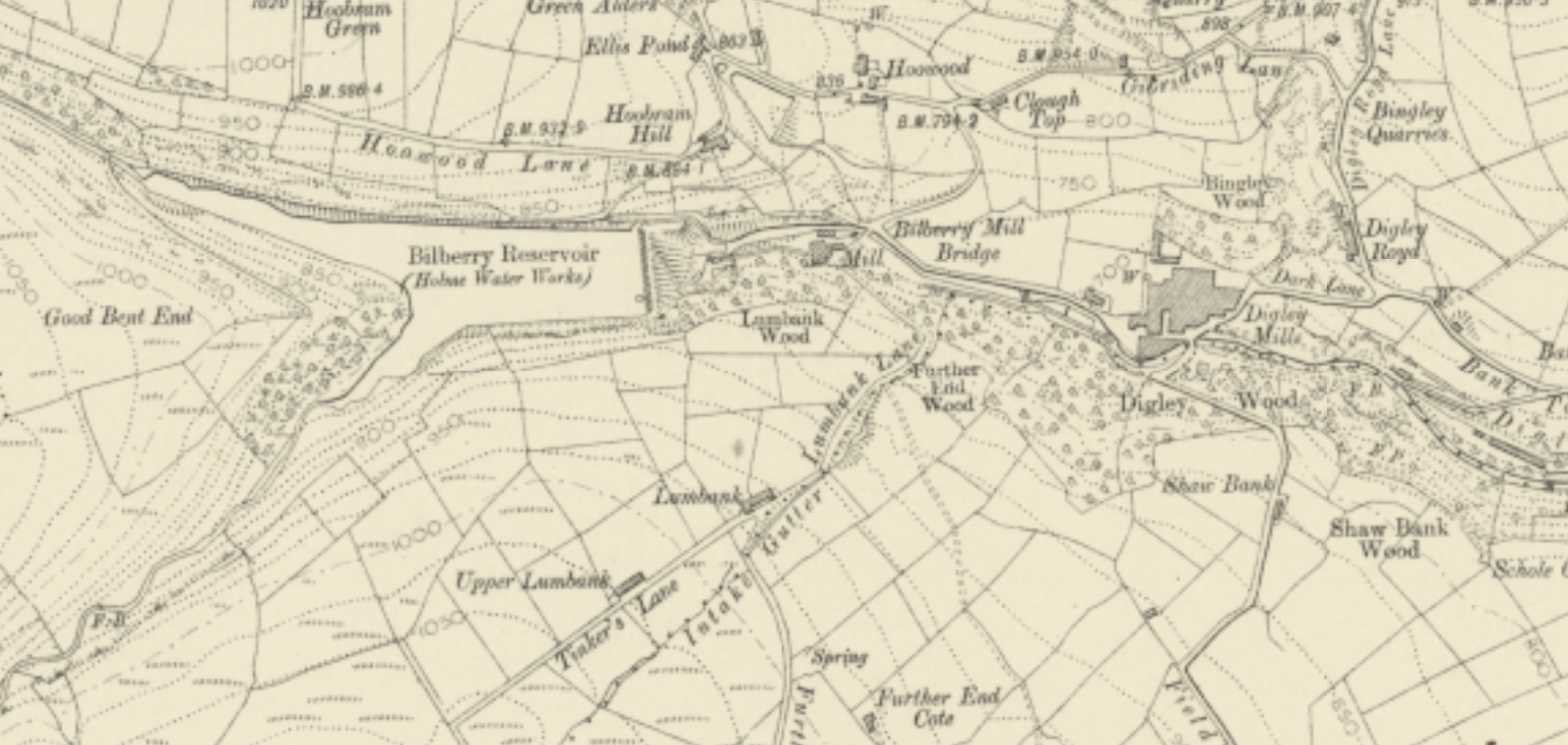
In contrast, Digley wasn’t opened until 1954, despite being planned in the 1930s. The waters now cover the site of two mills and a pub, amongst other buildings. Here’s how the area looked in 1915.
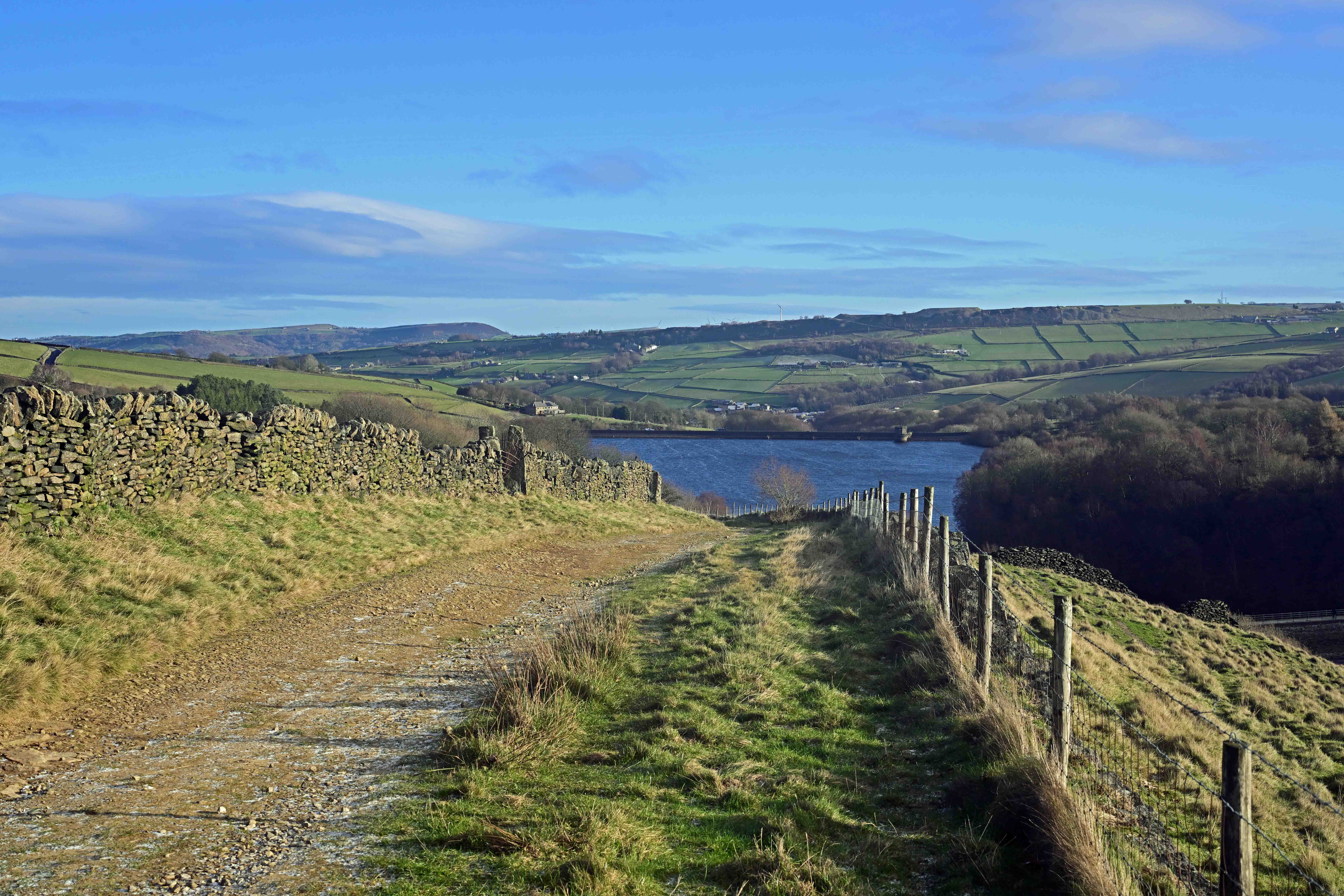
There plenty of car parking at either end of the dam. The walk’s very pleasant as it passes through woodland and also dips and climbs as the well-maintained paths don’t follow the reservoir edge too closely so you get a variety of views. Here’s a few pictures from our trip.
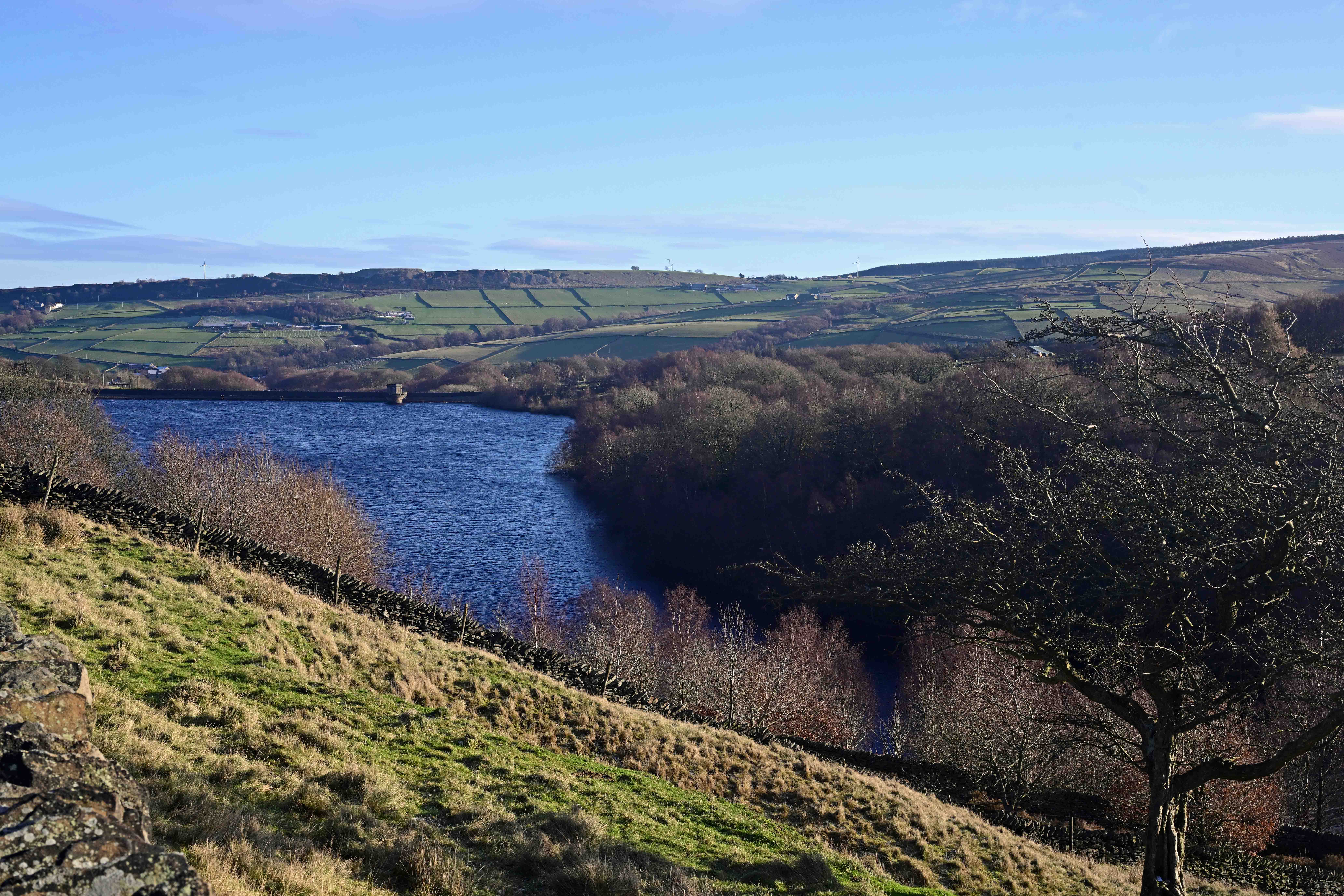
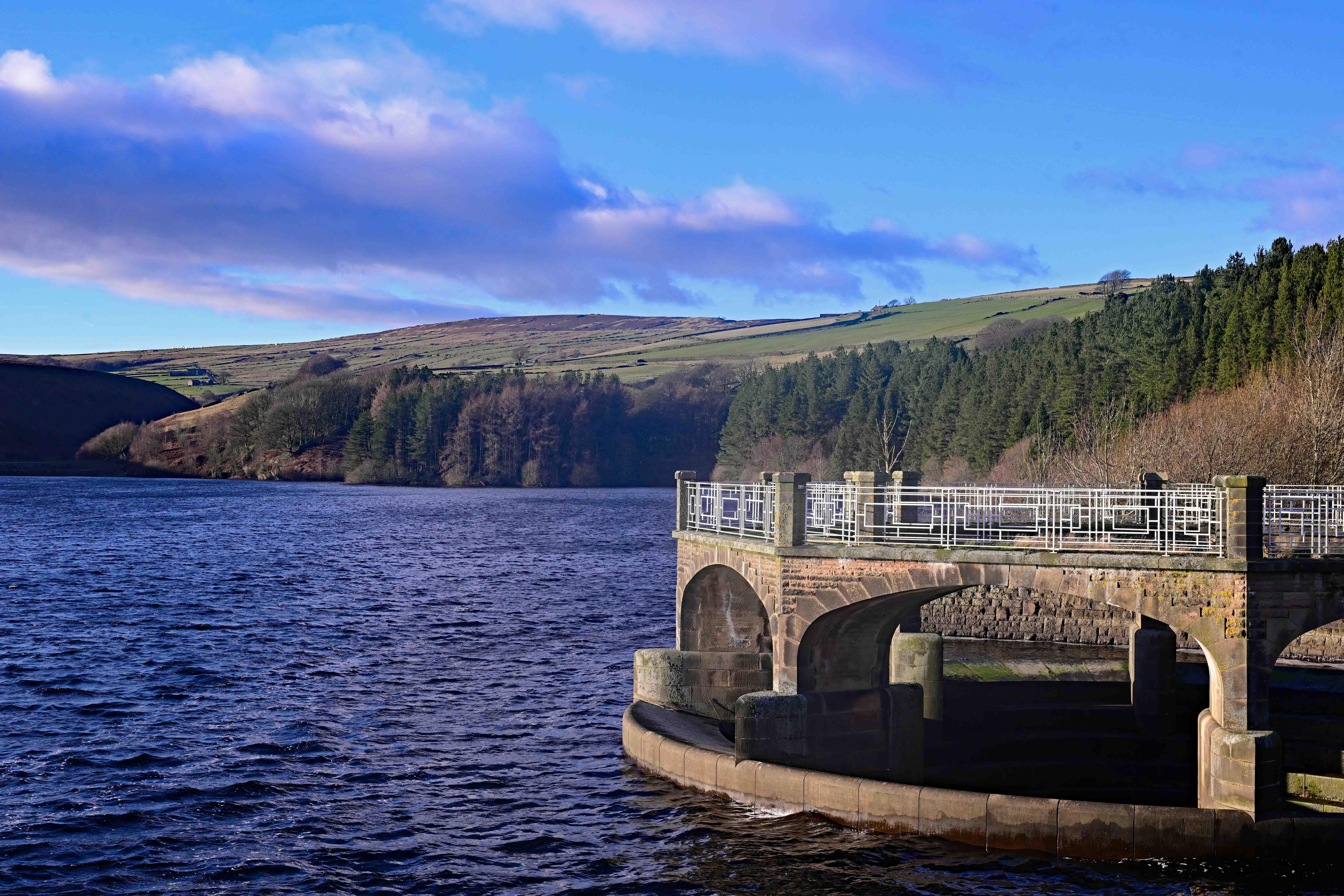
Looking down on Digley with the dam in the distance. Looking down on the Digley reservoir from Greaves Head. The edge of the Bilberry dam can be seen at the very right hand edge of the picture. As you can see, there’s some gorgeous views across the Holme valley from here. Looking back the opposite way from the dam itself, with the large and ornate dam drain in the foreground (which isn’t open to the public, for obvious reasons).
There’s nowhere to buy food or drink near the dam, so bring your own. However, the Fleece Inn in nearby Holme does food and a range of real ales and other drinks.
I’ve a small favour to ask… If you enjoy reading this or any of the other blogs I’ve written, please click on an advert or two. You don’t have to buy anything you don’t want to of course – although if you did find something that tickled your fancy that would be fab! – but the revenue from them helps me to cover some of the cost of maintaining this site (which isn’t cheap and comes out of my own pocket). Remember, 99% of the pictures used in my blogs can be purchased as prints from my other website – https://paulbigland.zenfolio.com/
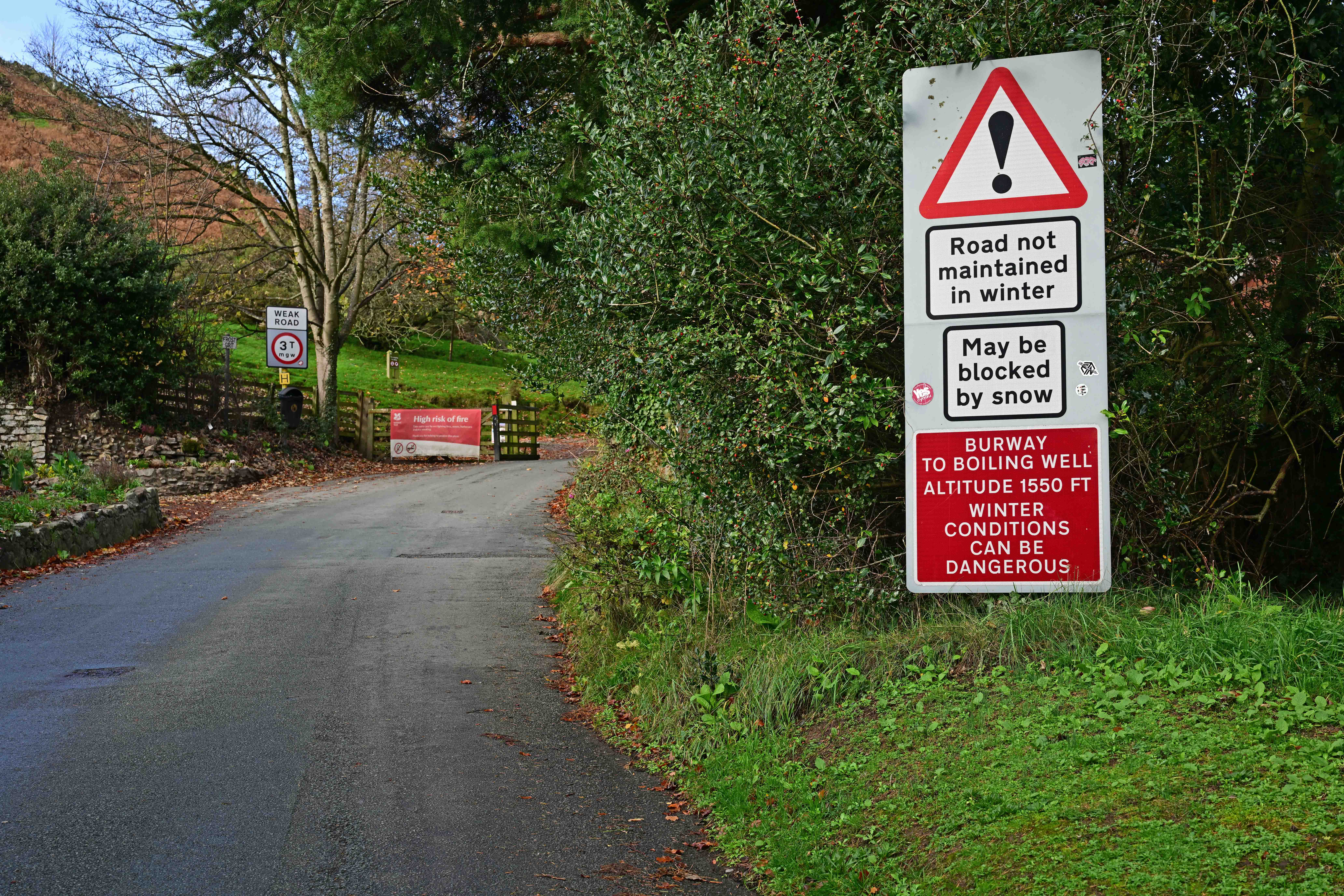
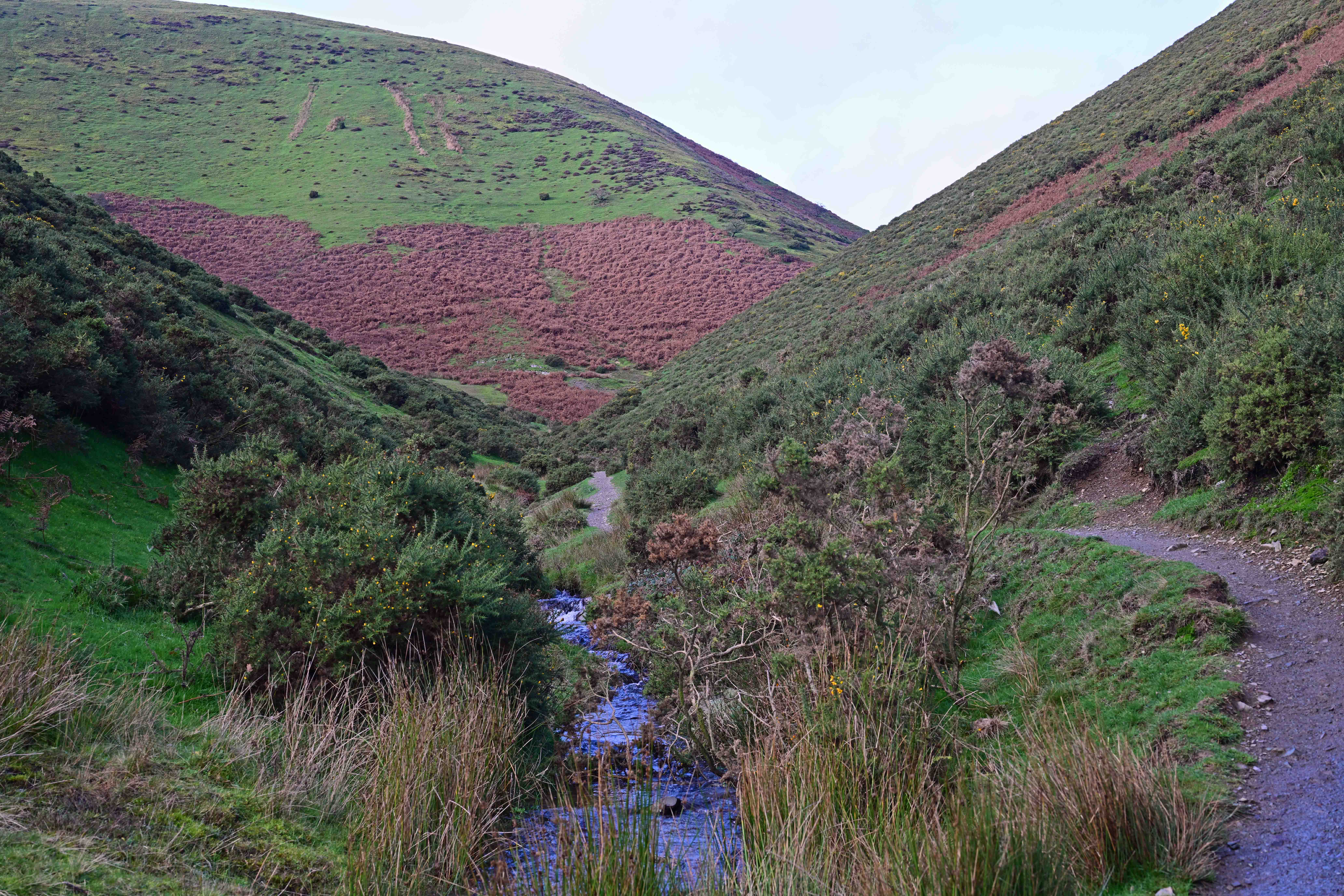
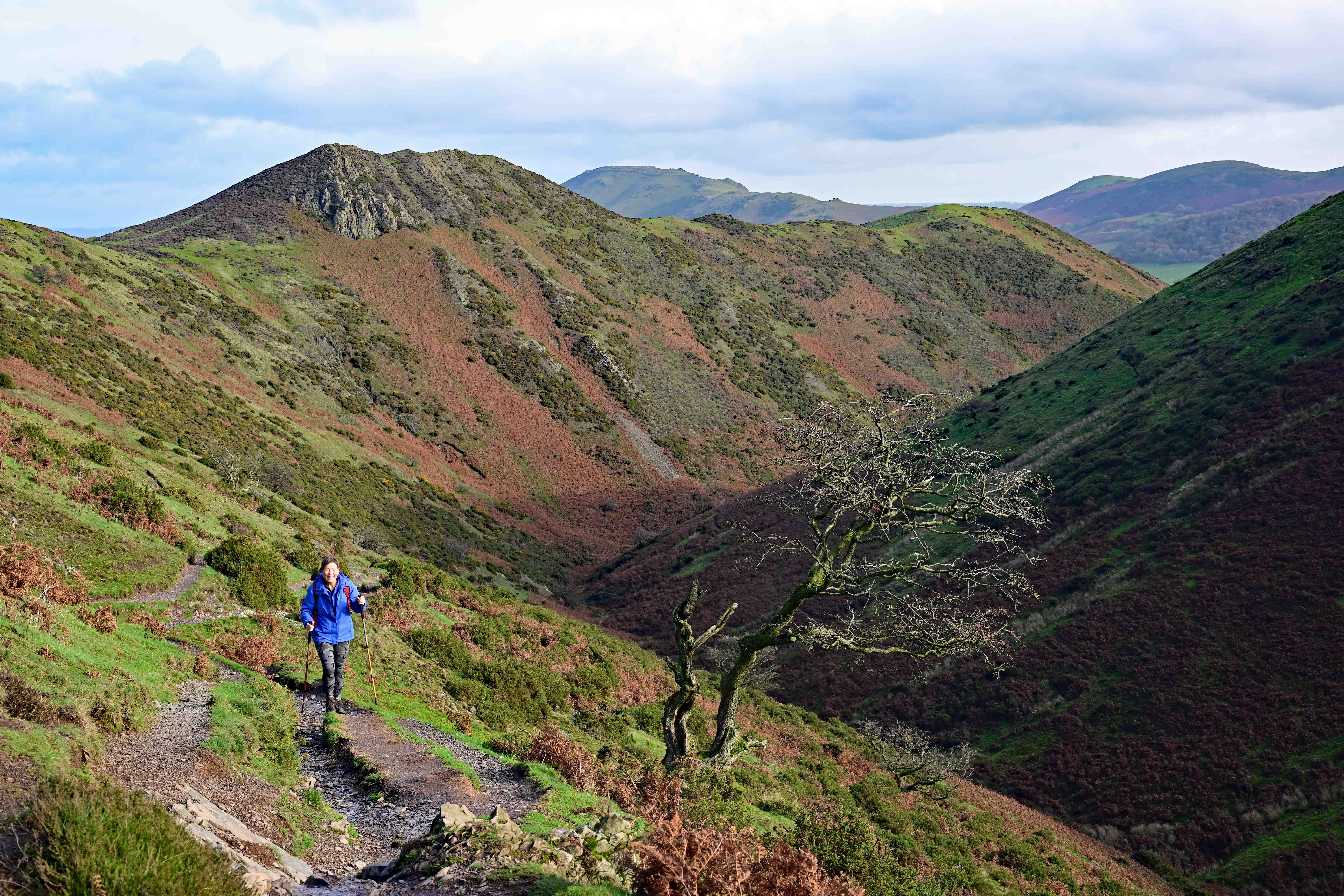
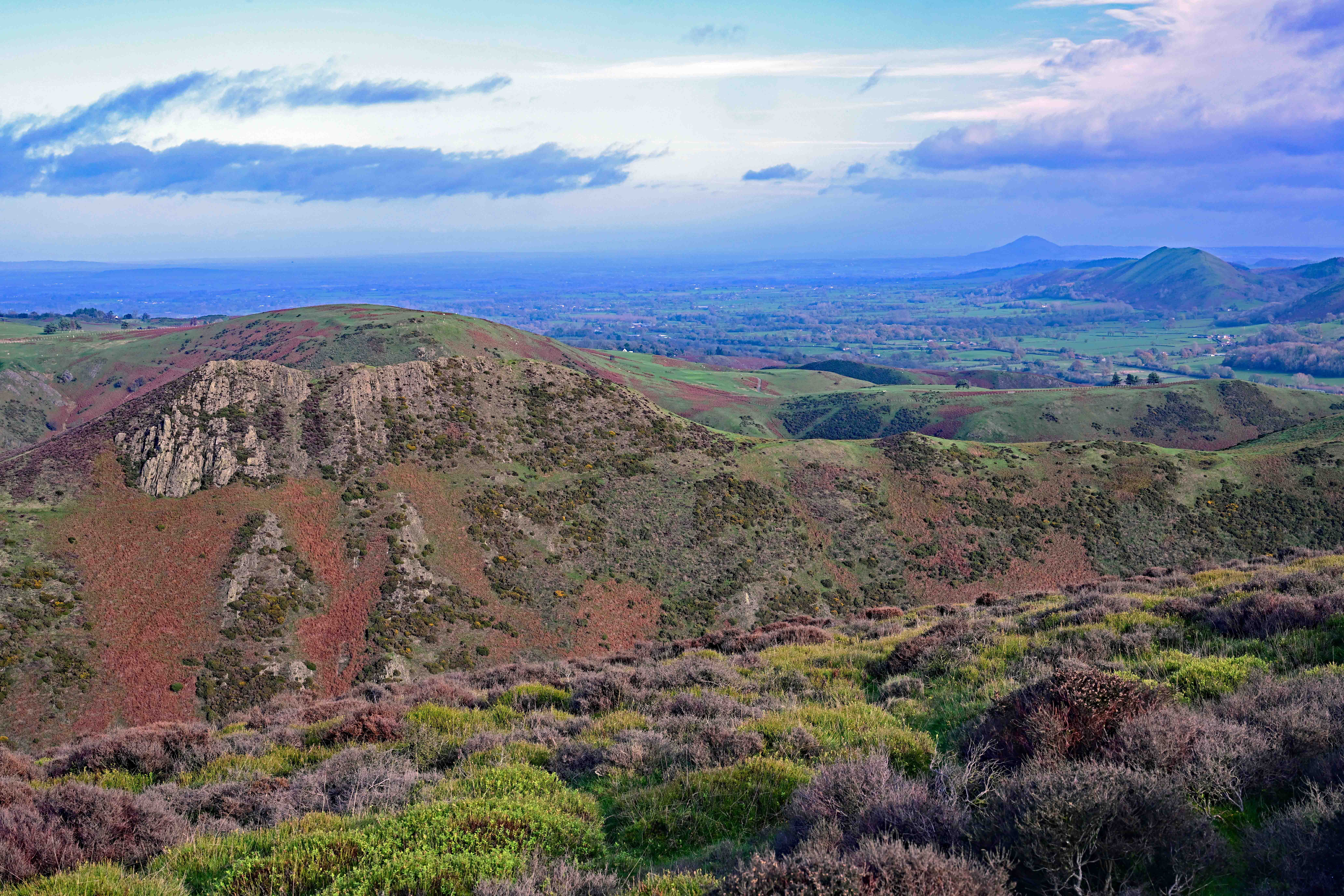
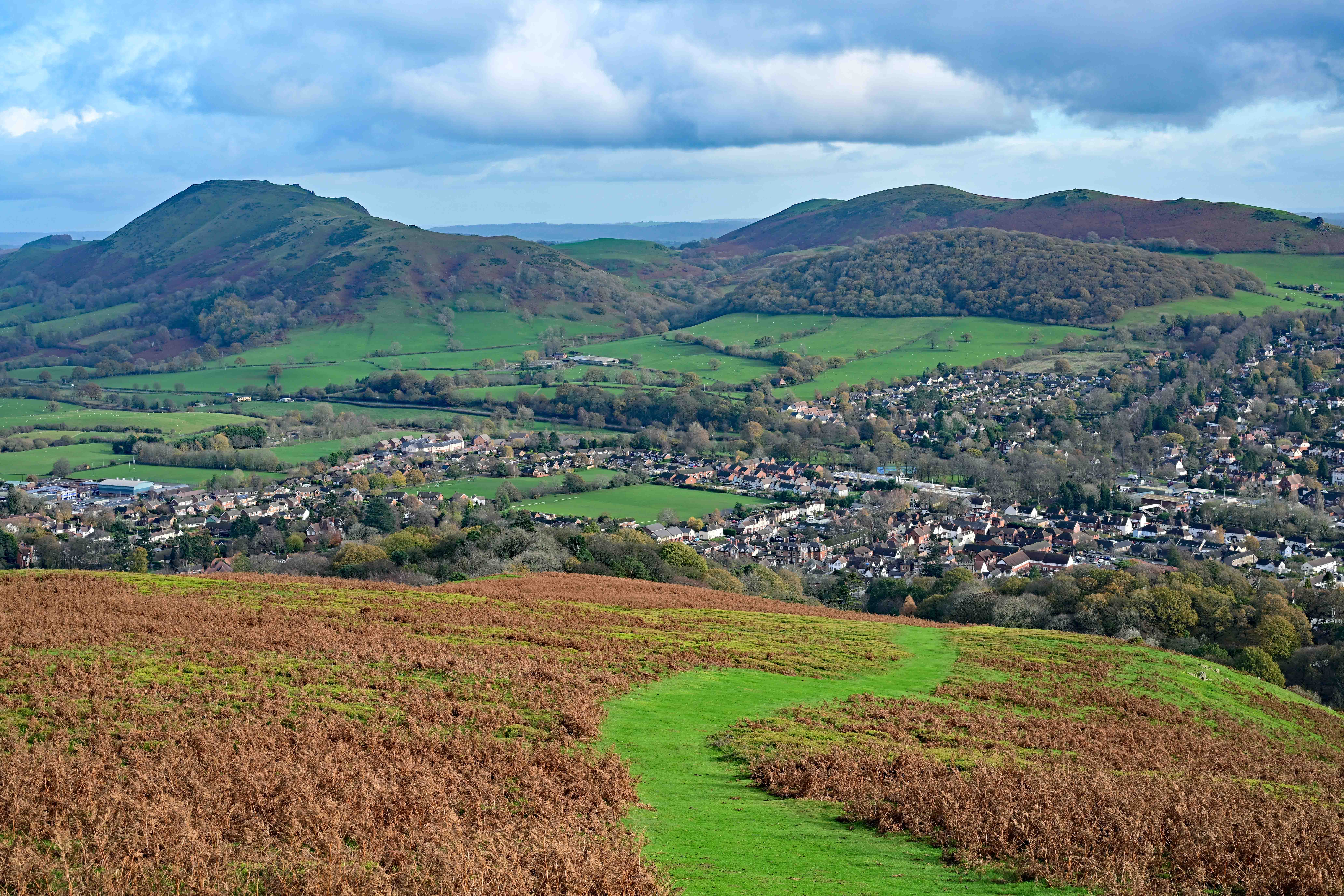
Today, the weather Gods smiled upon us! When we woke and looked out on the world (well, the Long Mynd) we saw clear blue skies and sunshine, with visibility clear for several miles. It wasn’t a day to waste, so as soon as we’d scoffed some toast washed down with coffee we donned our walking gear and headed down into Church Stretton. After a brief stop to pick up some goodies from Steele’s family bakery (their chocolate brownie is excellent, as is the fruit flapjack) we headed up to the Burway before striking off across country to follow the town brook path uphill.
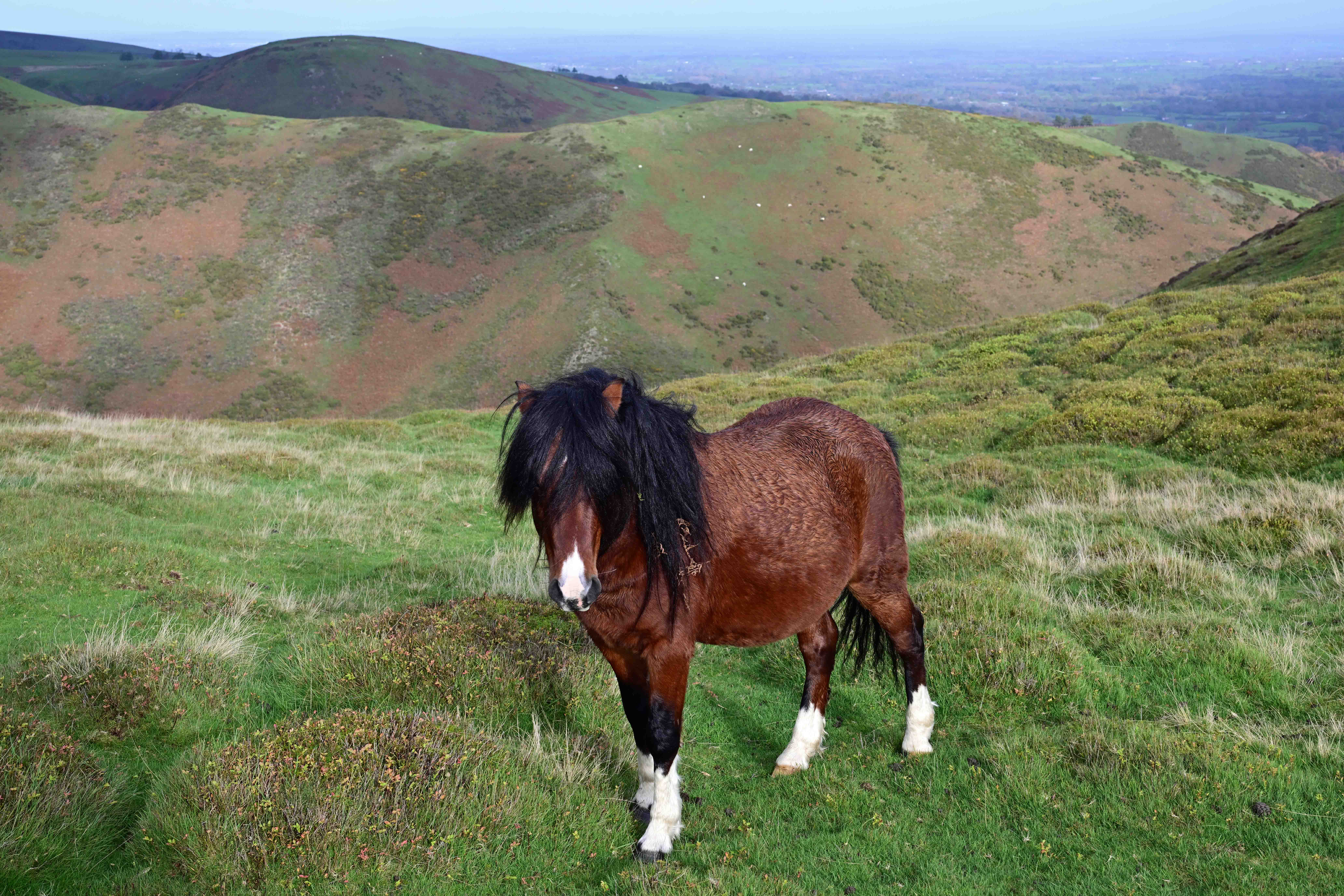
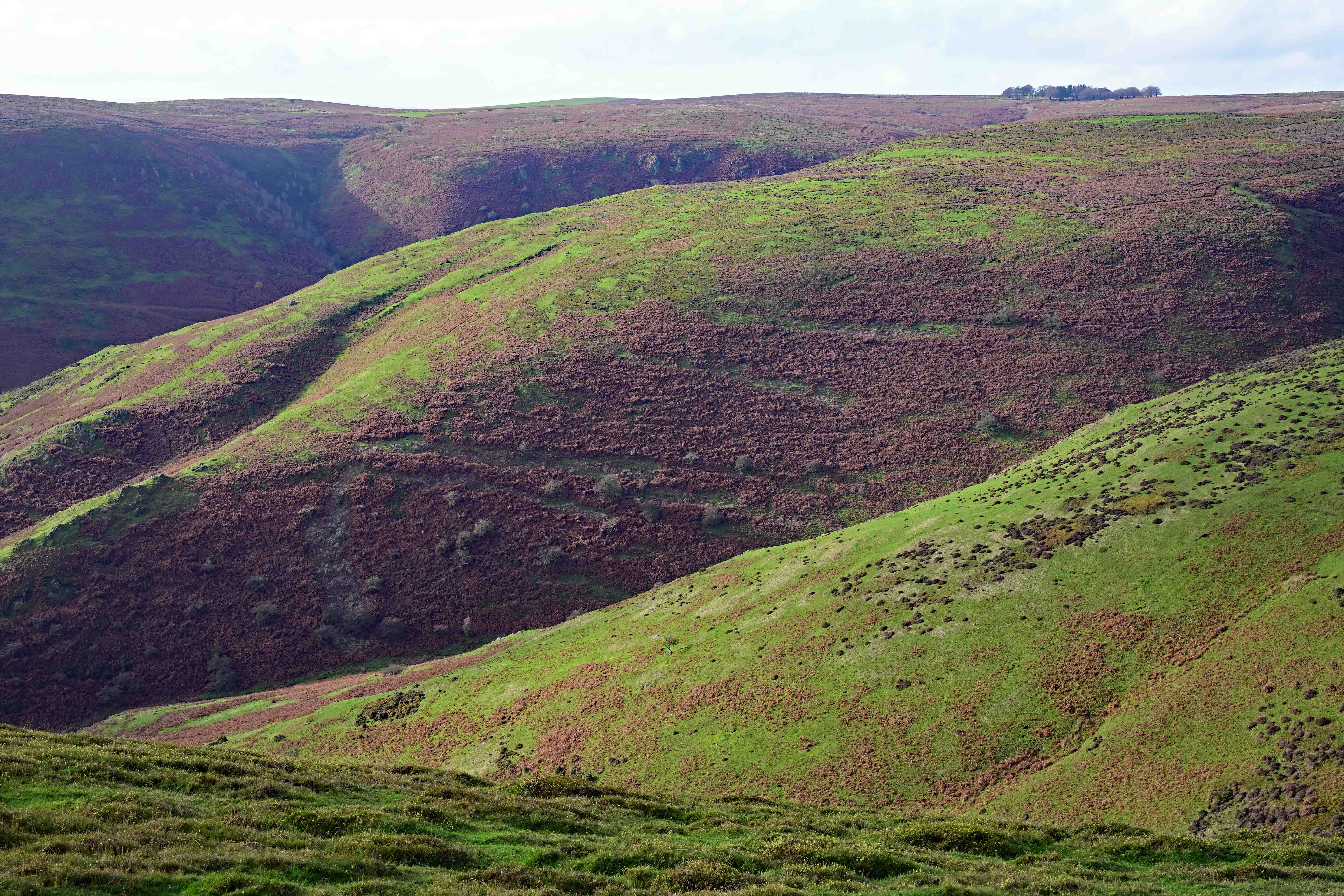
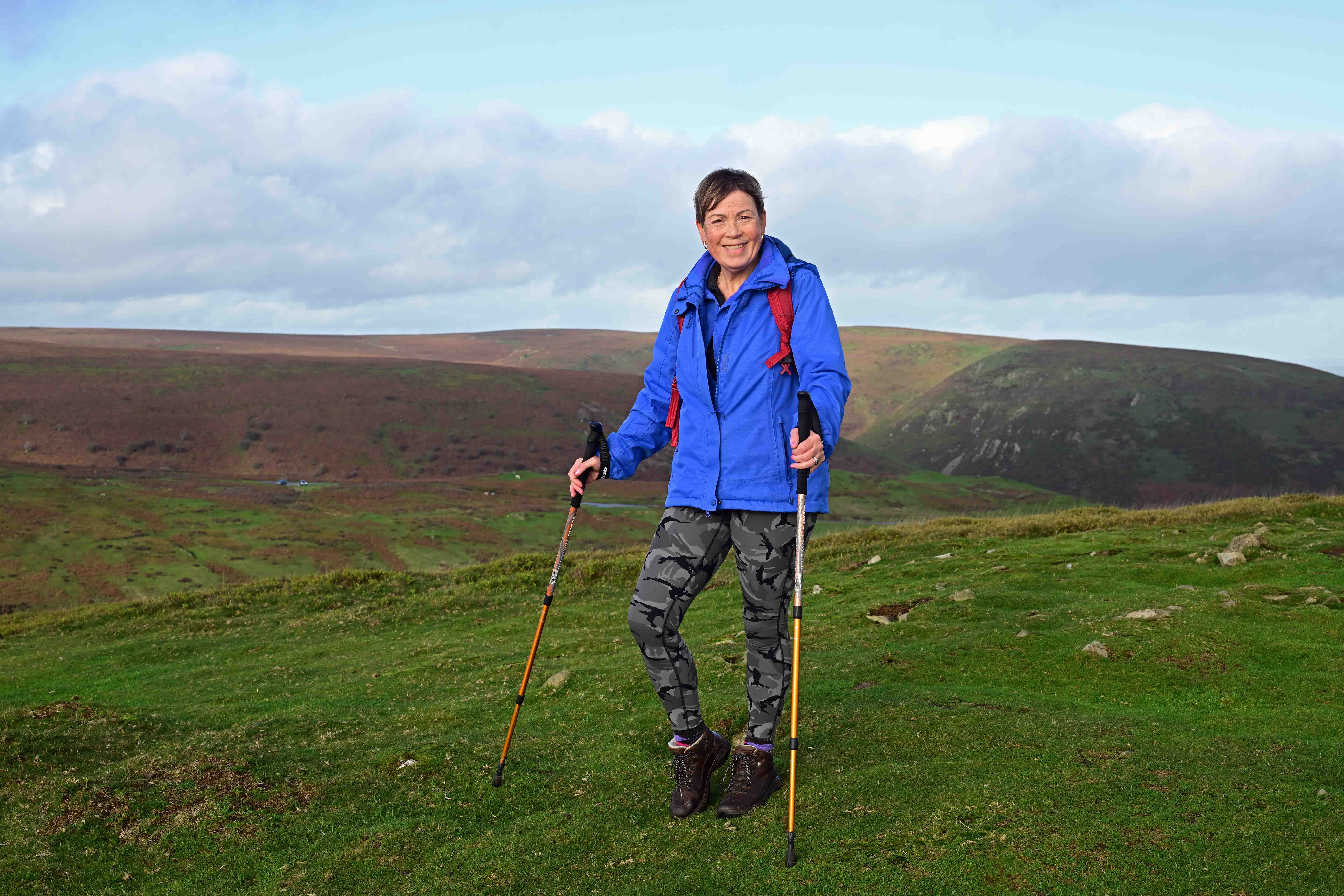
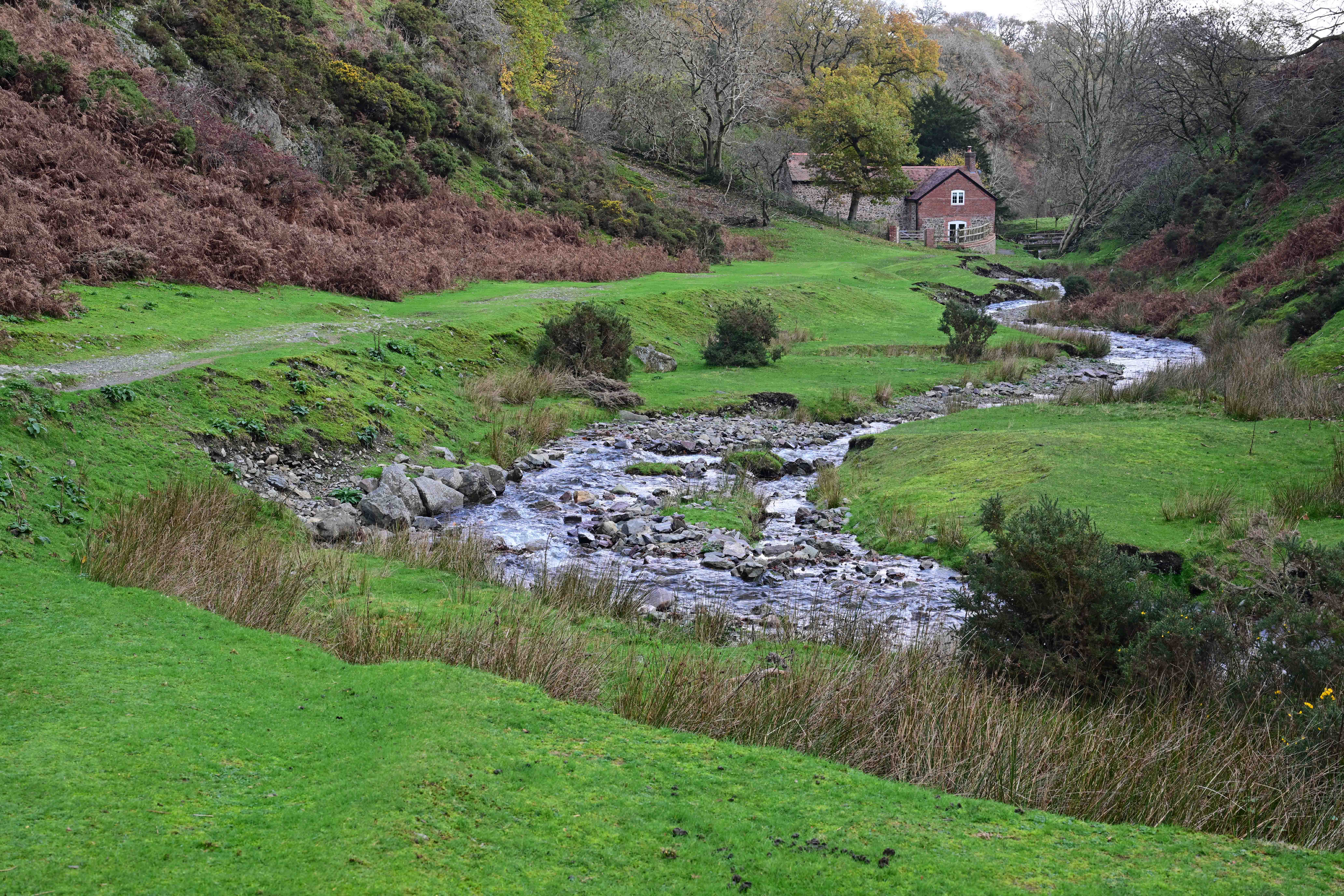
Not a place you want to get trapped on in winter.The town brook burbles adjacent to the footpath towards Long Synalds – on the lower sections anyway, after that, the footpath begins to gain height. – as this view shows! Here, we’re looking back towards Church Stretton with Caer Caradoc on the horizon and the Devil’s Mouth in the mid-distance. Having made it up to 425 meters we swung round to the South side of Townbrook valley in order to get to look back over the valley and towards the North. Looking back down over Church Stretton with Caer Caradoc to the left. One of the ‘wild’ horses that can be found wandering the Long Mynd. They’re not actually wild, but the area is common grazing land.Looking West across Yearlet towards Long Synalds. This time of year the colours are amazing as all the bracken is dying back. Dawn atop Ashlet just before we began our descent to Ashes Hollow and the footpath towards Little Stretton. What a contrast in weather, we’d have been in cloud level with zero visibility if we’d been up here over the past few days! Considering it’s nearly mid November temperatures were a balmy 12 degrees, with very little wind. Almost there! We’ve followed Ashes Hollow and the stream to the edge of Little Stretton. This house is the first sign of human habitation, but still within the area managed by the National Trust.
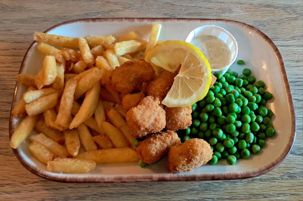
Having been walking for several hours we made a welcome pitstop at the Green Dragon pub. This friendly little pub serves a good selection of real ales and decent ‘pub grub’. I treated myself to the scampi (because it’s not something I’d cook at home) whilst Dawn plumped for the fish and chips.
Scampi, chips and peas with Tartare sauce. I felt I’d earned it!
Fed and watered, we continued our walk back into Church Stretton and home via another pitstop in our ‘local’ the Kings Arms. Now we’re back at the ranch, relaxing and wondering what tomorrow will bring. This Shropshire sojourn is coming to an end, we leave in the morning to head back to West Yorkshire, but the weather forecast is promising torrential rain for most of the journey – bar a small window in the morning that we may be able to make the most of en-route. Let’s see what happens…
I’ve a small favour to ask… If you enjoy reading this or any of the other blogs I’ve written, please click on an advert or two. You don’t have to buy anything you don’t want to of course – although if you did find something that tickled your fancy that would be fab! – but the revenue from them helps me to cover some of the cost of maintaining this site (which isn’t cheap and comes out of my own pocket). Remember, 99% of the pictures used in my blogs can be purchased as prints from my other website – https://paulbigland.zenfolio.com/


 Paul Bigland